Difference between revisions of "2009-11-23 48 9"
From Geohashing
imported>Ekorren (Been there. Report will follow.) |
imported>Ekorren (→Gallery) |
||
| Line 18: | Line 18: | ||
== Gallery == | == Gallery == | ||
| + | <gallery> | ||
| + | Image:2009-11-23_48_9_Busstop.jpg|Get off here | ||
| + | Image:2009-11-23_48_9_Road.jpg|A few hundred metres along the road, then... | ||
| + | Image:2009-11-23_48_9_Track.jpg|turn left on this way.<br>''No motorized vehicles. Open for agricultural traffic. '''Way without continuation.''' '' | ||
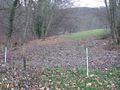
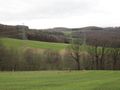
| + | Image:2009-11-23_48_9_Landscape.jpg|Arbitrary landscape impression | ||
| + | Image:2009-11-23_48_9_End_of_way.jpg|Indeed the way ended. And so did the fence only five metres to the right. | ||
| + | Image:2009-11-23_48_9_GPS.jpg|Coordinates reached | ||
| + | Image:2009-11-23_48_9_Hashmud.jpg|Wet hashpoint | ||
| + | Image:2009-11-23_48_9_View_from_hash.jpg|View at hash | ||
| + | Image:2009-11-23_48_9_Stausee.jpg|Glems reservoir | ||
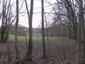
| + | Image:2009-11-23_48_9_View_back.jpg|Another landscape impression | ||
| + | </gallery> | ||
[[Category:Expeditions]] | [[Category:Expeditions]] | ||
[[Category:Expeditions with photos]] | [[Category:Expeditions with photos]] | ||
[[Category:Coordinates reached]] | [[Category:Coordinates reached]] | ||
Revision as of 18:24, 24 November 2009
| Mon 23 Nov 2009 in 48,9: 48.4980852, 9.2904900 geohashing.info google osm bing/os kml crox |
Contents
Location
Between Eningen unter Achalm and Metzingen-Glems, a muddy group of trees at the Albtrauf steep slope.
Participants
ekorren was there in the morning
Expedition
Gallery
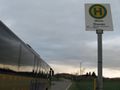
Get off here
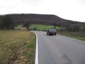
A few hundred metres along the road, then...
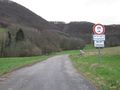
turn left on this way.
No motorized vehicles. Open for agricultural traffic. Way without continuation.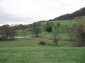
Arbitrary landscape impression
Indeed the way ended. And so did the fence only five metres to the right.
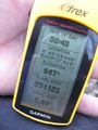
Coordinates reached
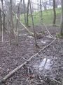
Wet hashpoint
View at hash
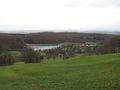
Glems reservoir
Another landscape impression


