Difference between revisions of "2010-01-25 58 -3"
imported>SuicideCraze |
m (per Renaming Proposal) |
||
| (11 intermediate revisions by 3 users not shown) | |||
| Line 14: | Line 14: | ||
__NOTOC__ | __NOTOC__ | ||
== Location == | == Location == | ||
| − | + | Broubster Forest, south of Dounreay. | |
== Participants == | == Participants == | ||
*[[User:SuicideCraze|SuicideCraze]] | *[[User:SuicideCraze|SuicideCraze]] | ||
| − | * | + | *Kat, who had no idea what we were doing. |
== Plans == | == Plans == | ||
| Line 24: | Line 24: | ||
== Expedition == | == Expedition == | ||
| + | We didn't actually leave until about 1pm after not going to bed until about 7am. The first 25 miles were easy driving, but then we came across an obstacle that Google Maps neglected to tell us about: a locked gate with a "No unauthorised vehicles beyond this point" sign. When we first spotted it we thought we'd come as far as we could, but fortunately it only applied to vehicles and not people, there was a pedestrian gate beside it. | ||
| + | So we decided we'd abandon the car and do the rest on foot. The GPS said that the hashpoint was 2 miles away as the crow flies, and Google Maps had told us that the road was 4 miles, with another half mile or so on foot at the end. We (foolishly) decided that 2 miles would surely be quicker than 4 and half. Not true. So we set off through the forest which turned out to be on quite marshy land. The going was slow and we were delighted to find some single-track road at one point which let us go about 0.2 miles on solid ground. After climbing a fence and having to pass through an area of dense trees we finally came across a clearing with a large square of wall I recognised from Google Maps. We were nearly there. | ||
| + | |||
| + | We headed west along a relatively clear path until the GPS told us the point was due south about 50 feet into some dense trees. So off through the trees again until what reached we thought was about 50 feet. The GPS obviously wasn't getting a very good signal in the trees as the distance from the point kept jumping around, but 9 times out of 10 it was registering it as less than 20 feet away so we decided that was as good as we could get. | ||
| + | |||
| + | We took some photos and had a very quick picnic because we wanted to get moving again as it would start getting dark soon. It had taken us about 2 hours to travel 2 miles in order to get there so we went for the easier route on the way back. We headed south for about half a mile and found the end of the road which we then followed for 4 miles back to the car. After that it was an easy 30 mile drive home and our adventure was over. | ||
== Tracklog == | == Tracklog == | ||
| − | + | [http://docs.google.com/leaf?id=0BylQB4n8_ZjVNTc3OGIwODUtOGE0Zi00MmY5LThkZDUtNGY4YjIzOTZkNTAw&hl=en_GB Hosted on Google Docs.] | |
== Photos == | == Photos == | ||
| + | Full gallery on [http://picasaweb.google.co.uk/SuCraze/20100125GeohashAt583# Picasa]. | ||
| − | < | + | <gallery perrow="5"> |
| − | + | Image:Geohash_2010-01-25_58_-3_-_1409.jpg | Best. Cow. Ever. | |
| − | Image: | + | Image:Geohash_2010-01-25_58_-3_-_1421.jpg | The evil gate. |
| − | Image: | + | Image:Geohash_2010-01-25_58_-3_-_1422.jpg | "Broubster Forest" |
| + | Image:Geohash_2010-01-25_58_-3_-_1451.jpg | A clearing in the forest. | ||
| + | Image:Geohash_2010-01-25_58_-3_-_1505.jpg | And then there was road. | ||
| + | Image:Geohash_2010-01-25_58_-3_-_1537.jpg | And then there was fence. | ||
| + | Image:Geohash_2010-01-25_58_-3_-_1538.jpg | And then there was more fence. | ||
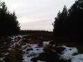
| + | Image:Geohash_2010-01-25_58_-3_-_1539.jpg | And then there was trees. | ||
| + | Image:Geohash_2010-01-25_58_-3_-_1540.jpg | The forest was pretty dense. | ||
| + | Image:Geohash_2010-01-25_58_-3_-_1604.jpg | The square wall you can see on Google Maps. | ||
| + | Image:Geohash_2010-01-25_58_-3_-_1612.jpg | GPS at the hashpoint. | ||
| + | Image:Geohash_2010-01-25_58_-3_-_1618.jpg | Picnic Time! | ||
| + | Image:Geohash_2010-01-25_58_-3_-_1619.jpg | ... with Hello Kitty plates! | ||
| + | Image:Geohash_2010-01-25_58_-3_-_Tracklog.jpg | Tracklog with the hashpoint marked. | ||
</gallery> | </gallery> | ||
| − | |||
| + | == Achievements == | ||
| + | {{Graticule unlocked | ||
| + | |||
| + | | latitude = 58 | ||
| + | | longitude = -3 | ||
| + | | date = 2010-01-25 | ||
| + | | name = SuicideCraze | ||
| + | |||
| + | }} | ||
| + | {{land geohash | ||
| + | |||
| + | | latitude = 58 | ||
| + | | longitude = -3 | ||
| + | | date = 2010-01-25 | ||
| + | | name = SuicideCraze | ||
| + | |||
| + | }} | ||
| + | {{Picnic_geohash | ||
| + | |||
| + | | latitude = 58 | ||
| + | | longitude = -3 | ||
| + | | date = 2010-01-25 | ||
| + | | name = SuicideCraze | ||
| + | |||
| + | }} | ||
| + | {{drag-along | ||
| − | + | | latitude = 58 | |
| − | + | | longitude = -3 | |
| + | | date = 2010-01-25 | ||
| + | | partner = Kat | ||
| + | | name = SuicideCraze | ||
| − | + | }} | |
| − | |||
| − | |||
| − | |||
| − | <!-- | + | <!-- Delete the next line ONLY if you have chosen the appropriate categories below. If you are unsure, don't worry. People will read your report and help you with the classification. --> |
[[Category:Expeditions]] | [[Category:Expeditions]] | ||
| − | |||
[[Category:Expeditions with photos]] | [[Category:Expeditions with photos]] | ||
| − | |||
| − | |||
| − | |||
| − | |||
| − | |||
[[Category:Coordinates reached]] | [[Category:Coordinates reached]] | ||
| − | + | {{location|GB|SCT|HLD}} | |
| − | |||
| − | |||
| − | |||
| − | |||
| − | |||
| − | |||
| − | |||
| − | |||
| − | |||
Latest revision as of 06:17, 20 March 2024
| Mon 25 Jan 2010 in 58,-3: 58.5467582, -3.7199270 geohashing.info google osm bing/os kml crox |
Location
Broubster Forest, south of Dounreay.
Participants
- SuicideCraze
- Kat, who had no idea what we were doing.
Plans
Leaving Wick in the late morning to get there around midday or so. Picnic for lunch at the hash if the weather's good and heading home after a couple of hours.
Expedition
We didn't actually leave until about 1pm after not going to bed until about 7am. The first 25 miles were easy driving, but then we came across an obstacle that Google Maps neglected to tell us about: a locked gate with a "No unauthorised vehicles beyond this point" sign. When we first spotted it we thought we'd come as far as we could, but fortunately it only applied to vehicles and not people, there was a pedestrian gate beside it.
So we decided we'd abandon the car and do the rest on foot. The GPS said that the hashpoint was 2 miles away as the crow flies, and Google Maps had told us that the road was 4 miles, with another half mile or so on foot at the end. We (foolishly) decided that 2 miles would surely be quicker than 4 and half. Not true. So we set off through the forest which turned out to be on quite marshy land. The going was slow and we were delighted to find some single-track road at one point which let us go about 0.2 miles on solid ground. After climbing a fence and having to pass through an area of dense trees we finally came across a clearing with a large square of wall I recognised from Google Maps. We were nearly there.
We headed west along a relatively clear path until the GPS told us the point was due south about 50 feet into some dense trees. So off through the trees again until what reached we thought was about 50 feet. The GPS obviously wasn't getting a very good signal in the trees as the distance from the point kept jumping around, but 9 times out of 10 it was registering it as less than 20 feet away so we decided that was as good as we could get.
We took some photos and had a very quick picnic because we wanted to get moving again as it would start getting dark soon. It had taken us about 2 hours to travel 2 miles in order to get there so we went for the easier route on the way back. We headed south for about half a mile and found the end of the road which we then followed for 4 miles back to the car. After that it was an easy 30 mile drive home and our adventure was over.
Tracklog
Photos
Full gallery on Picasa.
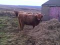
Best. Cow. Ever.
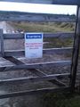
The evil gate.
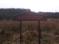
"Broubster Forest"
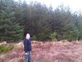
A clearing in the forest.
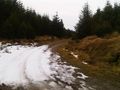
And then there was road.
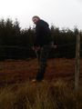
And then there was fence.
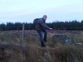
And then there was more fence.
And then there was trees.
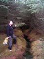
The forest was pretty dense.
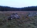
The square wall you can see on Google Maps.
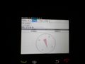
GPS at the hashpoint.
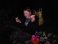
Picnic Time!
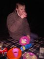
... with Hello Kitty plates!
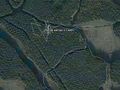
Tracklog with the hashpoint marked.


Achievements
SuicideCraze earned the Graticule Unlocked Achievement
|
SuicideCraze earned the Land geohash achievement
|
SuicideCraze earned the Picnic achievement
|
SuicideCraze earned the Drag-along achievement
|