Difference between revisions of "2010-02-07 32 -117"
From Geohashing
imported>Rs (→Plans) |
imported>FippeBot m (Location) |
||
| (9 intermediate revisions by 3 users not shown) | |||
| Line 19: | Line 19: | ||
== Participants == | == Participants == | ||
| − | Rs | + | * [[user:Rs|Richard Soderberg]] |
| + | * [http://www.erica.biz/ ericabiz] | ||
== Plans == | == Plans == | ||
| Line 26: | Line 27: | ||
== Expedition == | == Expedition == | ||
| − | + | ||
| + | Starving and exhausted from driving to the geohash, we decided to stop for the awesome life-giving nectar of In'n'Out. Then we realized that we could see the geohash out the window from our table. So we forded the concrete stream and reached the geohash point on foot. Yay! | ||
| + | |||
| + | While we were debating what to do within the circle of confusion, a couple dressed in some sort of flashy local getup peered curiously at us on their way by, seemingly immune to the standard English wave of greeting. | ||
== Tracklog == | == Tracklog == | ||
| Line 32: | Line 36: | ||
== Photos == | == Photos == | ||
| − | <!-- | + | |
| + | <!-- | ||
| + | Photos at [http://www.flickr.com/photos/rsoderberg/tags/2010020732117/ Flickr]. | ||
| + | --> | ||
| + | |||
<gallery perrow="4"> | <gallery perrow="4"> | ||
| − | Image: | + | Image:2010-02-07 32 -117 Success.jpg | A parking lot. In'n'Out just across the street! |
| − | |||
</gallery> | </gallery> | ||
| − | |||
| − | |||
| − | + | == Results == | |
| − | |||
| − | + | {{land geohash | |
| − | + | | latitude = 32 | |
| − | [[ | + | | longitude = -117 |
| − | -- | + | | date = 2010-02-07 |
| + | | name = [[User:Rs|Richard Soderberg]] | ||
| + | | image = 2010-02-07 32 -117 Success.jpg | ||
| + | }} | ||
| − | |||
[[Category:Expeditions]] | [[Category:Expeditions]] | ||
| − | |||
[[Category:Expeditions with photos]] | [[Category:Expeditions with photos]] | ||
| − | |||
| − | |||
| − | |||
| − | |||
| − | |||
[[Category:Coordinates reached]] | [[Category:Coordinates reached]] | ||
| − | + | {{location|US|CA|SD}} | |
| − | |||
| − | |||
| − | |||
| − | |||
| − | |||
| − | |||
| − | |||
| − | |||
| − | |||
Latest revision as of 00:46, 9 August 2019
| Sun 7 Feb 2010 in 32,-117: 32.7696906, -117.1443701 geohashing.info google osm bing/os kml crox |
Location
Parking lot at Mission Valley Shopping Center.
Participants
Plans
Omigod, it's a San Diego geohash on land! We'll be there around 11:45am.
Expedition
Starving and exhausted from driving to the geohash, we decided to stop for the awesome life-giving nectar of In'n'Out. Then we realized that we could see the geohash out the window from our table. So we forded the concrete stream and reached the geohash point on foot. Yay!
While we were debating what to do within the circle of confusion, a couple dressed in some sort of flashy local getup peered curiously at us on their way by, seemingly immune to the standard English wave of greeting.
Tracklog
Photos
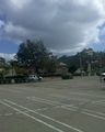
A parking lot. In'n'Out just across the street!

Results
Richard Soderberg earned the Land geohash achievement
|