Difference between revisions of "2010-02-15 45 -121"
From Geohashing
imported>Jiml (Fill in details) |
imported>Aperfectring (a live expedition message sent via geohashdroid for android.) |
||
| Line 30: | Line 30: | ||
--> | --> | ||
<gallery perrow="4"> | <gallery perrow="4"> | ||
| + | |||
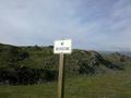
| + | Image:2010-02-15_45_-121_14-45-14-210.jpg | 100 miles, and jim and i see this... [http://www.openstreetmap.org/?lat=45.62452638333333&lon=-121.12854081666667&zoom=16&layers=B000FTF @45.6245,-121.1285] | ||
</gallery> | </gallery> | ||
Revision as of 22:48, 15 February 2010
| Mon 15 Feb 2010 in 45,-121: 45.6243272, -121.1314454 geohashing.info google osm bing/os kml crox |
Location
Near the Columbia River in The Dales, Oregon
Participants
Plans
We're planning to head there on Monday...
Expedition
Tracklog
Photos
100 miles, and jim and i see this... @45.6245,-121.1285
