Difference between revisions of "2010-02-15 45 -121"
From Geohashing
imported>Aperfectring (a live expedition message sent via geohashdroid for android.) |
imported>Aperfectring (a live expedition message sent via geohashdroid for android.) |
||
| Line 22: | Line 22: | ||
<!-- how it all turned out. your narrative goes here. --> | <!-- how it all turned out. your narrative goes here. --> | ||
| + | |||
| + | *Success! Another graticule has been visited by two intrepid geohashers! -- [[User:Aperfectring|aperfectring]] [http://www.openstreetmap.org/?lat=45.62423535&lon=-121.13139633333333&zoom=16&layers=B000FTF @45.6242,-121.1314] 23:00, 15 February 2010 (UTC) | ||
== Tracklog == | == Tracklog == | ||
<!-- if your GPS device keeps a log, you may post a link here --> | <!-- if your GPS device keeps a log, you may post a link here --> | ||
Revision as of 23:00, 15 February 2010
| Mon 15 Feb 2010 in 45,-121: 45.6243272, -121.1314454 geohashing.info google osm bing/os kml crox |
Location
Near the Columbia River in The Dales, Oregon
Participants
Plans
We're planning to head there on Monday...
Expedition
- Success! Another graticule has been visited by two intrepid geohashers! -- aperfectring @45.6242,-121.1314 23:00, 15 February 2010 (UTC)
Tracklog
Photos
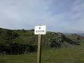
100 miles, and jim and i see this... @45.6245,-121.1285
