Difference between revisions of "2010-03-05 48 9"
From Geohashing
imported>Ekorren (Been there. Report and pictures will probably be added in a few days.) |
imported>Ekorren (gallery) |
||
| Line 21: | Line 21: | ||
<gallery> | <gallery> | ||
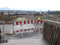
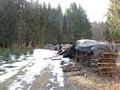
| + | File:2010-03-05_48_9_AbzweigNehren.jpg|There used to be a way here. Sadly, destroying valleys, bike trails and government finances by building just another unneeded highway is still common. | ||
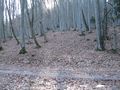
| + | File:2010-03-05_48_9_Talheim_1.jpg|Random impressions along the way up | ||
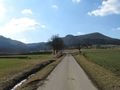
| + | File:2010-03-05_48_9_Talheim_2.jpg | ||
| + | File:2010-03-05_48_9_Cows.jpg|Moo! | ||
| + | |||
| + | File:2010-03-05_48_9_Talheim.jpg|View back on Hash village | ||
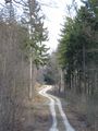
| + | File:2010-03-05_48_9_WayUp.jpg | ||
| + | File:2010-03-05_48_9_Plane.jpg|Terrain-wise, air hashing wouldn't have been so much easier as it loks, since the airfield is located even higher than the hash. | ||
| + | File:2010-03-05_48_9_Snow.jpg|There still was snow and ice. It got worse further up. | ||
| + | |||
| + | File:2010-03-05_48_9_Hashpoint.jpg|The hashpoint, surprisingly flat. The cliffs were only little away, though. | ||
| + | File:2010-03-05_48_9_GPS.jpg|Coordinates reached | ||
| + | File:2010-03-05_48_9_Way.jpg | ||
| + | File:2010-03-05_48_9_Farrenberg.jpg | ||
| + | |||
| + | File:2010-03-05_48_9_View.jpg | ||
| + | File:2010-03-05_48_9_Landslip.jpg|This is not an excavation area, but the place of an impressive landslip 27 years ago. | ||
| + | File:2010-03-05_48_9_Landslip_Sign.jpg|Explanatory sign | ||
| + | File:2010-03-05_48_9_HpGomaringen.jpg | ||
</gallery> | </gallery> | ||
Revision as of 14:22, 7 March 2010
| Fri 5 Mar 2010 in 48,9: 48.3685070, 9.0749740 geohashing.info google osm bing/os kml crox |
Contents
Location
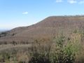
Far above Mössingen-Talheim
Participants
Expedition
Been there. Report and pictures not before sunday.
Gallery
There used to be a way here. Sadly, destroying valleys, bike trails and government finances by building just another unneeded highway is still common.
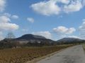
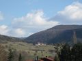
Random impressions along the way up
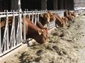
Moo!
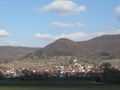
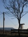
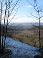
View back on Hash village
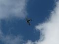
Terrain-wise, air hashing wouldn't have been so much easier as it loks, since the airfield is located even higher than the hash.
There still was snow and ice. It got worse further up.
The hashpoint, surprisingly flat. The cliffs were only little away, though.
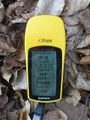
Coordinates reached
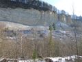
This is not an excavation area, but the place of an impressive landslip 27 years ago.
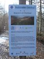
Explanatory sign