2010-03-13 -37 145
| Sat 13 Mar 2010 in -37,145: -37.8458133, 145.6716763 geohashing.info google osm bing/os kml crox |
Location
Barber Hill Track, near Three Bridges (Locality?)
Participants
- myka and possibly Fergus
- Kozz and Kozz's dog
Plans
myka will do a little shopping in town, and hopefully end up with a new pair of shoes, then head out via a stop in Nunawading to the hash in the afternoon. The drive will be out to Yarra Junction, then past Gladysdale to Three Bridges, and the hash
Expedition
Kozz
Unbeknownst to Myka, I'd packed up the dog, satnav and garmin and headed out for a bonafide Country Victoria hash even before he'd posted his plans. Otherwise we might've completed the first 'meetup' in Australia for 2010.
Twas a glorious day to be geohashing! 24 degrees celsius, clear blue skies, good times.
It took a while to get out along the highways east, and the old satnav decided that the quickest route to the hashpoint was via several gravel roads, which confused the heck out of me as I was sure that most of the way should've been paved. I eventually ignored its advice after it told me to drive through a plantation of apple trees along a muddy track, and took a different turn to head off up the hill track.
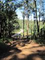
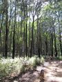
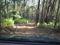
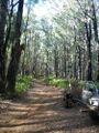
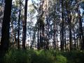
The roads through the Yarra State Forest - that's where the hash lies - are surprisingly good, so I made my way up along towards the hashpoint quite easily. Despite several steep hills and washouts on the track, I was able to work my way up the side of the hill through several tracks / roads, which switched back upon themselves and seemed to be a very roundabout way to get to the point - gaining maybe 200 metres then switching back in the opposite direction and losing 150.
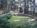
Eventually, I reached the crest of the hill, and the gravel road which lead up towards the hashpoint. Google Maps showed the hashpoint right on the edge of a marked track which ran off the top of the hilltop road, so I followed the satnav's advice until I reached a small turn-off point where a steep 4WD track lead up a hill, surrounded on all sides by mature eucalypt forestry. I accidentally drove past the turn-off, which was opposite a large pond, and had to drive on another few hundred metres until I found somewhere to turn around.
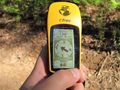
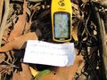
We disembarked from the car, and I headed up a steep track - absolutely *no* chance of getting my car up there - watching the Garmin zero in on the location. It jumped around a whole lot, but by general consensus I figured out the location of the hash, walking back and forwards several times until it got down to about 1.5 metres to go - well within the 8m circle of probability.
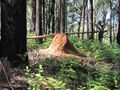
I left a hashmarker in twigs on the side of the track, photographed it - the Garmin lost satellites at this stage and shows me being 10m away from the hashpoint - then wandered back down the hill and let the dog go for a quick wade in the pond. There was some nearby geotrash, which I collected, much to the interest of the dog, who would've preferred to eat it.
I drove off down the hill, figuring that the satnav should pick up where I was, but of course it got confused and told me several times I was lost somewhere in amongst national forest. Eventually I came to the main road I'd turned off some miles back. Got back home, about to do the write-up, and saw that Myka was also heading out too.
Photos
kozz
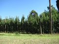
Grapevines
Apple orchard which prevented one access route
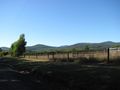
The top peak is about where the hashpoint is
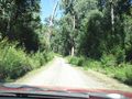
The 'road' up to the peak
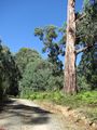
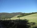
Beautiful scenery!
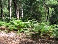
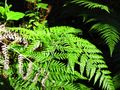
Ferns next to the road
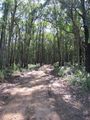
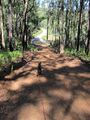
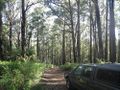
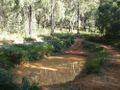
The track up to the hashpoint
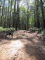
The dog finding the hashpoint
Looking back down to the road. Red = mud, grey = gravel.
Anthill!
Close to the point now
We're there!
Beautiful foliage
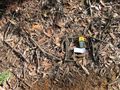
Hash marker
Proof
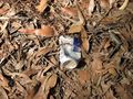
Geotrash! I took some home.
The dog, eager to get to the pond...
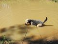
...rewarded for his patience
Heading back - early 2010 hashpoint off to the right
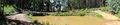
The pond
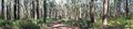
Hashpoint panorama


myka
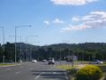
Leaving Melbourne (it's behind those hills)
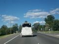
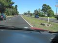
Only to get stuck behind a Horse Float!
looking down from the top of the hash-hill.
Driving back down the hill to the hash point.
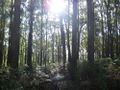
Sun through the trees.
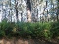
Ferny forest.
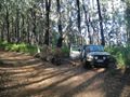
I found a perfect parking spot just off the road...
Looking back up the track towards the hilltop.

1.4m to go... proof!
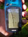
yay accuracy!...
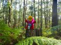
possibly Fergus celebrates accuracy while perched within 15 meters of the hash.
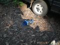
geotrash being collected.
wave goodbye to the forest
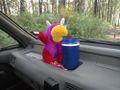
possibly Fergus guards the geosnacks.
One sees these all over the place in the aussie bush
Somewhat more full, but less appealing Water Point.

possibly Fergus liked my new shoes


