Difference between revisions of "2010-05-09 26 -80"
imported>Dtobias (Created page with '{{meetup graticule | lat=26 | lon=-80 | date=2010-05-09 | graticule_name=Palm Beach | graticule_link=Palm Beach, Florida}} == About == On the lawn outside a condominium buildin…') |
imported>Dtobias (→Photos) |
||
| Line 17: | Line 17: | ||
== Photos == | == Photos == | ||
| − | <gallery perrow=" | + | <gallery perrow="6"> |
Image:2010-05-09_26_-80_DT001.jpg | Looking out my condo door in the direction I'm going to be walking (after I get around the hedge and fence) | Image:2010-05-09_26_-80_DT001.jpg | Looking out my condo door in the direction I'm going to be walking (after I get around the hedge and fence) | ||
Image:2010-05-09_26_-80_DT002.jpg | At SW 18th and Dixie Hwy, a cop was getting information from the drivers of two cars that had apparently just been in an accident. | Image:2010-05-09_26_-80_DT002.jpg | At SW 18th and Dixie Hwy, a cop was getting information from the drivers of two cars that had apparently just been in an accident. | ||
Revision as of 01:12, 10 May 2010
| Sun 9 May 2010 in Palm Beach: 26.3330888, -80.1312620 geohashing.info google osm bing/os kml crox |
Contents
About
On the lawn outside a condominium building in Boca Raton.
Expedition Reports
Dtobias
This point was only 2.5 miles from where I live, so I saw the opportunity to get a Walk hash. I set out from home around 3 PM into the 87 degree Florida heat (the unnaturally cold winter is now long forgotten) and walked straight west on SW 18 St. to get to the hashpoint, just off that street on a side road west of Military Trail.
Photos
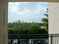
Looking out my condo door in the direction I'm going to be walking (after I get around the hedge and fence)
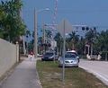
At SW 18th and Dixie Hwy, a cop was getting information from the drivers of two cars that had apparently just been in an accident.
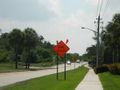
Ominous construction signs are all around promising detours and a closed bridge, but the road and bridge are actually fully open at the moment.
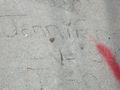
Jennifer and Josh proclaimed their love in concrete on the sidewalk here in 1987.
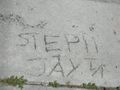
So did Steph and Jay. Wonder if these couples are still together?
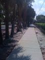
One benefit of all the construction on this street is a nice new sidewalk where there didn't used to be a complete one all the way through. They didn't replace Jen/Josh and Steph/Jay's squares, though.... yet, at least.
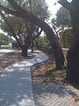
Sometimes they had to make the new sidewalk wind around to avoid trees.
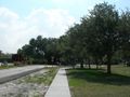
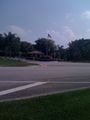
Now we're approaching the traffic circle, known in some other parts of the world as a "rotary" or "roundabout".
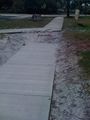
For some reason, the new construction left a sandy gap of a few feet in the sidewalk near the circle.
One of the gated communities which are all over the place here.
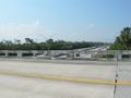
The road goes over Interstate 95.
On the other side of the Interstate, things look less urban and more suburban-sprawly.
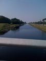
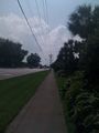
Another bridge, over one of the many canals around here.
Turning into a side road just past the canal, I can now see the building that the hashpoint is next to. I can recall getting taken into that building by a Realtor while looking for my current condo, so I must have passed very near the hashpoint for a "Deja Vu hash" (but have no proof of that).
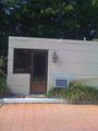
There's a guardhouse, but no guard or gate.
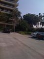
In the parking lot, you can see the lawn where the hashpoint is.
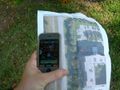
The free GPS app for my iPhone wasn't giving very accurate fixes, so it's a few digits off when I was standing in what I thought to be the right spot.
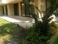
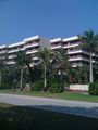
A view from the hashpoint at the first-floor patios.
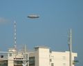
On returning home (also on foot), I see the Goodyear Blimp passing over my condo complex (or somewhere behind it, anyway).


