Difference between revisions of "2010-05-27 48 8"
From Geohashing
imported>Ekorren (template only yet, report follows) |
imported>FippeBot m (Location) |
||
| (One intermediate revision by one other user not shown) | |||
| Line 20: | Line 20: | ||
<gallery> | <gallery> | ||
| + | File:2010-05-27_48_8_Track.jpg|Still 1 km to go into a wet and mostly dark forest | ||
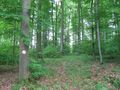
| + | File:2010-05-27_48_8_Parcours-Sign.jpg|This way to the hash? | ||
| + | File:2010-05-27_48_8_Path.jpg|Might be... | ||
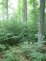
| + | File:2010-05-27_48_8_TooDense.jpg|No way. | ||
| + | File:2010-05-27_48_8_Track2.jpg|This one looks better | ||
| + | File:2010-05-27_48_8_Hash.jpg|The hashpoint | ||
| + | File:2010-05-27_48_8_GPS.jpg|Coordinates reached | ||
| + | File:2010-05-27_48_8_Tunnel.jpg|Beware of cobblestone in the dark | ||
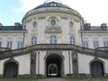
| + | File:2010-05-27_48_8_Solitude.jpg|Solitude castle | ||
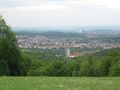
| + | File:2010-05-27_48_8_SolitudeView.jpg|View from Solitude castle | ||
</gallery> | </gallery> | ||
| Line 27: | Line 37: | ||
[[Category:Expeditions with photos]] | [[Category:Expeditions with photos]] | ||
[[Category:Coordinates reached]] | [[Category:Coordinates reached]] | ||
| + | {{location|DE|BW|BB}} | ||
Latest revision as of 02:12, 9 August 2019
| Thu 27 May 2010 in 48,8: 48.8240331, 8.9800173 geohashing.info google osm bing/os kml crox |
Contents
Location
Dense forest near Leonberg-Gebersheim
Participants
Expedition
Gallery
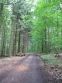
Still 1 km to go into a wet and mostly dark forest
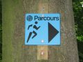
This way to the hash?
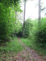
Might be...
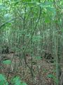
No way.
This one looks better
The hashpoint
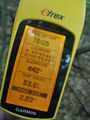
Coordinates reached
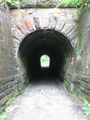
Beware of cobblestone in the dark
Solitude castle
View from Solitude castle


