Difference between revisions of "2010-07-21 60 23"
imported>Jusu m (→Expedition) |
m (per Renaming Proposal) |
||
| (24 intermediate revisions by 4 users not shown) | |||
| Line 7: | Line 7: | ||
__NOTOC__ | __NOTOC__ | ||
| − | |||
| − | |||
== Location == | == Location == | ||
| − | [http://kansalaisen.karttapaikka.fi/ | + | [http://kansalaisen.karttapaikka.fi/linkki?scale=16000&text=2010-07-21+60+23+hashpoint&srs=EPSG%3A3067&y=6670660&x=289968&lang=en Citizen's MapSite] shows that the hashpoint is in somewhat wet forest surrounded by ditches. Roads and paths lead practically all the way to the destination. It's about 11 kilometers from home, as the crow flies. |
| − | I have geocache Latokartanonkoski | + | I have geocache [http://coord.info/GCK3WH Latokartanonkoski] about 3.3 km from the hashpoint. |
== Participants == | == Participants == | ||
| − | [[User:Jusu|Jusu]] | + | * [[User:Jusu|Jusu]] |
== Plans == | == Plans == | ||
| Line 24: | Line 22: | ||
== Expedition == | == Expedition == | ||
| − | I started my cycling tour from home at 9:45 o'clock. Temperature was 22.7 C, sunny weather. Traffic was not too heavy on road 52, but some trucks and cars passed me very close. | + | I started my slow cycling tour from home at 9:45 o'clock. Temperature was 22.7 C, sunny weather. Traffic was not too heavy on road 52, but some trucks and cars passed me very close. |
| − | I passed the border of Salo and Raasepori (Raseborg in Swedish) towns. At the same moment I moved from province of Varsinais-Suomi (SWE: Egentliga Finland) to Uusimaa (Nyland). There is also a kind of language border. Just looking a map you can see that the majority of place names are Swedish on the south side of the border, and Finnish on the north side. | + | I passed the border of Salo and Raasepori (Raseborg in Swedish) towns. At the same moment I moved from province of Varsinais-Suomi (SWE: Egentliga Finland) to Uusimaa (Nyland). No passport or visa required. There is also a kind of language border. Just looking a map you can see that the majority of place names are Swedish on the south side of the border, and Finnish on the north side. |
| − | Forest road was closed by a wire, but that isn't a problem. | + | Forest road was closed by a wire, but that isn't a problem because of [http://en.wikipedia.org/wiki/Freedom_to_roam Everyman's right]. Next to road there were several low platforms for moose hunting. I left my bike to the end of the road, and started walking a small path. A moose or a deer got scared of me. I couldn't see it, but I could hear that it was some 30 meters from me. |
| − | + | I reached the hashpoint at 11:20 o'clock. Ground was quite dry, so I didn't wet my shoes. There were pine trees, small birches and spruces. Ground was covered by blueberry sprays, but I couldn't spot any berries. There were also some lingonberries, marsh tea, and hare's-tail cottongrass, for example. Normal Finnish forest. | |
| − | |||
| − | I reached the hashpoint at 11:20 o'clock. Ground was quite dry, so I didn't wet my shoes. There were pine trees, small birches and spruces. Ground was covered by blueberry sprays, but I couldn't spot any berries. There were also some lingonberries and | ||
I climbed to a small hill to the south from hashpoint. The hill is called Lökberget, Swedish for Onion Hill. There I expected to have meetup with an adder, but didn't see any. | I climbed to a small hill to the south from hashpoint. The hill is called Lökberget, Swedish for Onion Hill. There I expected to have meetup with an adder, but didn't see any. | ||
| − | I got back home at 13:10. Now temperature was 26.1 C. | + | I got back home at 13:10. Now temperature was 26.1 C; slightly cooler than previous days. Phone's GPS measured 31 km total length for the trip. |
| + | |||
| + | Next day's (2010-07-22) hash would have been close and reachable too. I noticed it at the afternoon, but felt too lazy. Besides, now temperature was over 30 C. 2010-07-23 hash was also close, but not nicely reachable, as it was in a wet place in a bog protection area. | ||
| + | |||
| + | == Tracklog == | ||
== Photos == | == Photos == | ||
| − | + | I would have a stupid grin photo too, but I'm too shy to put it here. Besides, it's too stupid. :) | |
| − | <gallery perrow=" | + | <gallery widths=300px heights=225px perrow="3"> |
| + | Image:2010-07-21 60 23 RaaseporiSign.jpg|Uusimaa | ||
| + | Image:2010-07-21 60 23 SaloSign.jpg|Varsinais-Suomi | ||
| + | Image:2010-07-21_60_23_BeginningOfForestRoadTanker.jpg|Beginning of forest road | ||
| + | Image:2010-07-21 60 23 EndOfForestRoad.jpg|End of the forest road | ||
| + | Image:2010-07-21 60 23 MooseHuntingPlatform.jpg|Platform for moose hunting | ||
| + | Image:2010-07-21 60 23 Footpath.jpg|Path to hashpoint | ||
| + | Image:2010-07-21_60_23_Hashpoint.jpg|Hashpoint | ||
| + | Image:2010-07-21 60 23 GPS.jpg|GPS | ||
| + | Image:2010-07-21 60 23 ViewDownToHaspoint.jpg|View down towards the hashpoint | ||
| + | Image:2010-07-21 60 23 Lokberget2.jpg|Lökberget, some 150 m south from the hashpoint | ||
| + | Image:2010-07-21 60 23 Lokberget1.jpg|Lökberget | ||
| + | Image:2010-07-21 60 23 Road52Traffic.jpg|Road 52, speed limit 100 km/h | ||
</gallery> | </gallery> | ||
| Line 48: | Line 60: | ||
{{land geohash | latitude = 60 | longitude = 23 | date = 2010-07-21 | name = Jusu}} | {{land geohash | latitude = 60 | longitude = 23 | date = 2010-07-21 | name = Jusu}} | ||
| − | {{ | + | {{Graticule unlocked |
| latitude = 60 | | latitude = 60 | ||
| Line 57: | Line 69: | ||
}} | }} | ||
| − | |||
[[Category:Expeditions]] | [[Category:Expeditions]] | ||
| − | |||
| − | |||
[[Category:Expeditions with photos]] | [[Category:Expeditions with photos]] | ||
| − | |||
| − | |||
[[Category:Coordinates reached]] | [[Category:Coordinates reached]] | ||
| + | {{location|FI|18}} | ||
Latest revision as of 06:10, 20 March 2024
| Wed 21 Jul 2010 in Salo: 60.1188623, 23.2195419 geohashing.info google osm bing/os kml crox |
Location
Citizen's MapSite shows that the hashpoint is in somewhat wet forest surrounded by ditches. Roads and paths lead practically all the way to the destination. It's about 11 kilometers from home, as the crow flies.
I have geocache Latokartanonkoski about 3.3 km from the hashpoint.
Participants
Plans
I've checked hashpoints every now and then already during last winter. However, I was always too lazy to walk in snow or whatever. There was a lot of snow this year.
Now I'm on summer vacation. Today's geohash coordinates looked promising. I decided to cycle there: first south on road 52, then short forest road to east. Eventually a smaller path would lead almost to the destination.
Expedition
I started my slow cycling tour from home at 9:45 o'clock. Temperature was 22.7 C, sunny weather. Traffic was not too heavy on road 52, but some trucks and cars passed me very close.
I passed the border of Salo and Raasepori (Raseborg in Swedish) towns. At the same moment I moved from province of Varsinais-Suomi (SWE: Egentliga Finland) to Uusimaa (Nyland). No passport or visa required. There is also a kind of language border. Just looking a map you can see that the majority of place names are Swedish on the south side of the border, and Finnish on the north side.
Forest road was closed by a wire, but that isn't a problem because of Everyman's right. Next to road there were several low platforms for moose hunting. I left my bike to the end of the road, and started walking a small path. A moose or a deer got scared of me. I couldn't see it, but I could hear that it was some 30 meters from me.
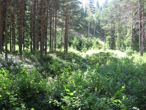
I reached the hashpoint at 11:20 o'clock. Ground was quite dry, so I didn't wet my shoes. There were pine trees, small birches and spruces. Ground was covered by blueberry sprays, but I couldn't spot any berries. There were also some lingonberries, marsh tea, and hare's-tail cottongrass, for example. Normal Finnish forest.
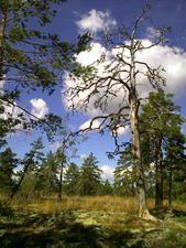
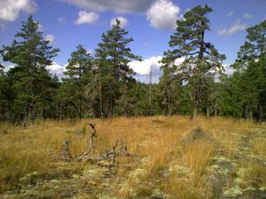
I climbed to a small hill to the south from hashpoint. The hill is called Lökberget, Swedish for Onion Hill. There I expected to have meetup with an adder, but didn't see any.
I got back home at 13:10. Now temperature was 26.1 C; slightly cooler than previous days. Phone's GPS measured 31 km total length for the trip.
Next day's (2010-07-22) hash would have been close and reachable too. I noticed it at the afternoon, but felt too lazy. Besides, now temperature was over 30 C. 2010-07-23 hash was also close, but not nicely reachable, as it was in a wet place in a bog protection area.
Tracklog
Photos
I would have a stupid grin photo too, but I'm too shy to put it here. Besides, it's too stupid. :)
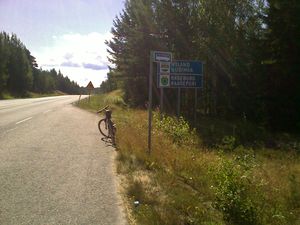
Uusimaa
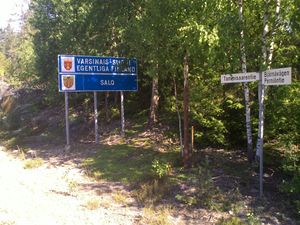
Varsinais-Suomi
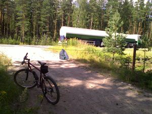
Beginning of forest road
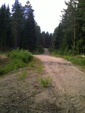
End of the forest road
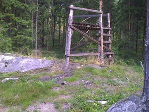
Platform for moose hunting
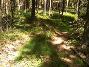
Path to hashpoint
Hashpoint
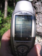
GPS
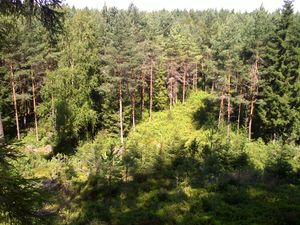
View down towards the hashpoint
Lökberget, some 150 m south from the hashpoint
Lökberget
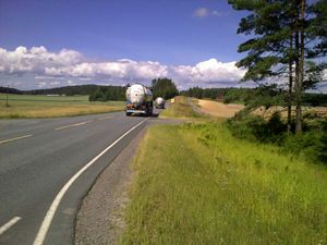
Road 52, speed limit 100 km/h


Achievements
Jusu earned the Land geohash achievement
|
Jusu earned the Graticule Unlocked Achievement
|