Difference between revisions of "2010-07-29 45 -122"
From Geohashing
imported>Jiml (First draft of Report) |
imported>FippeBot m (Location) |
||
| (2 intermediate revisions by one other user not shown) | |||
| Line 1: | Line 1: | ||
| − | + | [[Image:{{{image|2010-07-29_45_-122-area1.jpg}}}|thumb|left]] | |
| − | |||
| − | |||
| − | |||
| − | |||
| − | |||
| − | |||
| − | |||
{{meetup graticule | {{meetup graticule | ||
| lat=45 | | lat=45 | ||
| Line 17: | Line 10: | ||
__NOTOC__ | __NOTOC__ | ||
== Location == | == Location == | ||
| − | In a neighborhood south of King City, Oregon, adjacent to | + | In a neighborhood south of King City, Oregon, perhaps adjacent to a park. |
| − | a | ||
== Participants == | == Participants == | ||
| Line 27: | Line 19: | ||
== Expedition == | == Expedition == | ||
| − | Jim | + | Jim left relatively early from work after the previous night's Fiasco. |
It took a little longer to get there, but he managed to miss most of the | It took a little longer to get there, but he managed to miss most of the | ||
| Line 33: | Line 25: | ||
The hashpoint appeared to be in on private property. There was supposed | The hashpoint appeared to be in on private property. There was supposed | ||
| − | to be a | + | to be a park nearby, which is where he thought the hashpoint was actually located, but he couldn't |
| − | + | actually get | |
| + | into that park. | ||
== Photos == | == Photos == | ||
| − | + | ||
| − | |||
| − | |||
| − | |||
<gallery perrow="5"> | <gallery perrow="5"> | ||
| + | Image:2010-07-29_45_-122-area1.jpg | The neighborhood of the hashpoint | ||
| + | Image:2010-07-29_45_-122-hashview.jpg | Looking towards the hashpoint | ||
</gallery> | </gallery> | ||
| Line 59: | Line 51: | ||
[[Category:Not reached - No public access]] | [[Category:Not reached - No public access]] | ||
| + | {{location|US|OR|MU}} | ||
Latest revision as of 03:01, 9 August 2019

| Thu 29 Jul 2010 in 45,-122: 45.4739393, -122.5191685 geohashing.info google osm bing/os kml crox |
Location
In a neighborhood south of King City, Oregon, perhaps adjacent to a park.
Participants
Plans
Jim printed out a Google Map and programmed the GPS.
Expedition
Jim left relatively early from work after the previous night's Fiasco.
It took a little longer to get there, but he managed to miss most of the rush hour traffic.
The hashpoint appeared to be in on private property. There was supposed to be a park nearby, which is where he thought the hashpoint was actually located, but he couldn't actually get into that park.
Photos
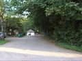
The neighborhood of the hashpoint
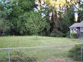
Looking towards the hashpoint

Achievements
- No Trespassing