2010-08-21 67 25
From Geohashing
Revision as of 19:36, 11 October 2010 by imported>Isopekka

| Sat 21 Aug 2010 in 67,25: 67.0014348, 25.7931139 geohashing.info google osm bing/os kml crox |
Location
About 60 km north of Rovaniemi, in wilderness. Can be almost reached by car.
Participants
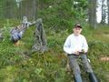
- isopekka with wife, son and dog.
Expedition
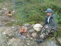
After driving about 90 km my wife and son decided to enjoy the nature in wilderness. So I had to continue driving alone still about 2 km. To the hashpoint I had to walk 800 m. At hashpoint I was at 15:00 p.m. Silence in wilderness was perfect. After hash-documentation I found my family really enjoying outdoor life.
- By car total 188 km
- Walking total 1.6 km
- Expedition took 5 hours
- Physical efforts needed(1-5): 2
Photos
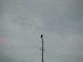
The Owl (Surnia ulula?)
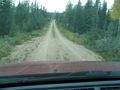
Still 2 km to drive
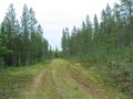
...and 800 m to walk
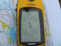
Exactly at the latitude N67
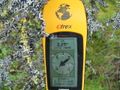
The proof
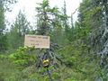
The hashpoint tree
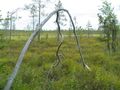
View from the hashpoint
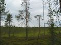
Another view from the hashpoint
Enjoying the nature
...and hunting
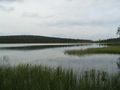
Kunettijärvi, a nice wilderness lake near the hashpoint


Achievements
- Land Geohash
isopekka achieved level 2 of the Minesweeper Geohash achievement
|