Difference between revisions of "2010-08-26 47 15"
From Geohashing
imported>Atadxart ([live picture] Well thats me [http://www.openstreetmap.org/?lat=47.27862775325775&lon=15.864960551261902&zoom=16&layers=B000FTF @47.2786,15.8650]) |
imported>Jiml m (Adjust result categories) |
||
| Line 1: | Line 1: | ||
| − | |||
<!-- If you did not specify these parameters in the template, please substitute appropriate values for IMAGE, LAT, LON, and DATE (YYYY-MM-DD format) | <!-- If you did not specify these parameters in the template, please substitute appropriate values for IMAGE, LAT, LON, and DATE (YYYY-MM-DD format) | ||
| Line 15: | Line 14: | ||
}} | }} | ||
| − | + | ||
__NOTOC__ | __NOTOC__ | ||
== Location == | == Location == | ||
| − | + | Near Weitz (?) | |
== Participants == | == Participants == | ||
| − | + | * [[User:Atadxart|Atadxart]] | |
== Plans == | == Plans == | ||
<!-- what were the original plans --> | <!-- what were the original plans --> | ||
| + | Unknown. | ||
== Expedition == | == Expedition == | ||
| Line 30: | Line 30: | ||
| − | + | Hello, | |
This is my first geohash | This is my first geohash | ||
| Line 36: | Line 36: | ||
No other hashers in sight | No other hashers in sight | ||
| − | + | I'm happy I made it -- [[User:Atadxart|Atadxart]] [http://www.openstreetmap.org/?lat=47.278536558151245&lon=15.864890813827515&zoom=16&layers=B000FTF @47.2785,15.8649] 13:40, 26 August 2010 (CEST) | |
| + | |||
== Tracklog == | == Tracklog == | ||
<!-- if your GPS device keeps a log, you may post a link here --> | <!-- if your GPS device keeps a log, you may post a link here --> | ||
| Line 60: | Line 61: | ||
{{#vardefine:ribbonwidth|800px}} | {{#vardefine:ribbonwidth|800px}} | ||
<!-- Add any achievement ribbons you earned below, or remove this section --> | <!-- Add any achievement ribbons you earned below, or remove this section --> | ||
| + | * Land Geohash | ||
| Line 66: | Line 68: | ||
[[Category:New report]] | [[Category:New report]] | ||
| − | |||
| − | |||
| − | |||
| − | |||
| − | |||
[[Category:Expeditions]] | [[Category:Expeditions]] | ||
| − | + | ||
[[Category:Expeditions with photos]] | [[Category:Expeditions with photos]] | ||
| − | |||
| − | |||
| − | |||
| − | |||
| − | |||
[[Category:Coordinates reached]] | [[Category:Coordinates reached]] | ||
| − | |||
| − | |||
| − | |||
| − | |||
| − | |||
| − | |||
| − | |||
| − | |||
| − | |||
| − | |||
Revision as of 18:54, 26 August 2010
| Thu 26 Aug 2010 in 47,15: 47.2785357, 15.8649227 geohashing.info google osm bing/os kml crox |
Location
Near Weitz (?)
Participants
Plans
Unknown.
Expedition
Hello,
This is my first geohash
No other hashers in sight
I'm happy I made it -- Atadxart @47.2785,15.8649 13:40, 26 August 2010 (CEST)
Tracklog
Photos
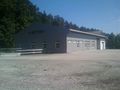
Its a car dealer but out of business - location is available for rent... @47.2785,15.8649

Well thats me @47.2786,15.8650


Achievements
- Land Geohash