Difference between revisions of "2010-10-03 -19 146"
imported>Mattyk (→Expedition) |
imported>Jiml m (Adjust - expand template to provide a decent base for the report) |
||
| Line 5: | Line 5: | ||
}} | }} | ||
| − | |||
__NOTOC__ | __NOTOC__ | ||
== Location == | == Location == | ||
| Line 16: | Line 15: | ||
== [[User:JimmyNZ|JimmyNZ]]'s Plans == | == [[User:JimmyNZ|JimmyNZ]]'s Plans == | ||
| − | I'm over here for work and | + | I'm over here for work and can't resist the chance to strike out and get my first geohash on foreign soil. Still working tomorrow, but if the work load is light I'll shoot off and achieve this. Maybe I'll take a few others with me for the ride. |
== [[User:Mattyk|mattyk]]'s Plans == | == [[User:Mattyk|mattyk]]'s Plans == | ||
| Line 35: | Line 34: | ||
== Photos == | == Photos == | ||
| − | + | ||
<gallery perrow="5"> | <gallery perrow="5"> | ||
File:2010-09-14_-36_174_Spring.jpg|Reminder of spring | File:2010-09-14_-36_174_Spring.jpg|Reminder of spring | ||
| Line 48: | Line 47: | ||
[[Category:Expedition without GPS]] | [[Category:Expedition without GPS]] | ||
[[Category:Coordinates reached]] | [[Category:Coordinates reached]] | ||
| + | --> | ||
| + | |||
| + | |||
| + | |||
| + | <!-- If you did not specify these parameters in the template, please substitute appropriate values for IMAGE, LAT, LON, and DATE (YYYY-MM-DD format) | ||
| + | |||
| + | [[Image:{{{image|IMAGE}}}|thumb|left]] | ||
| + | |||
| + | Remove this section if you don't want an image at the top (left) of your report. You should remove the "Image:" or "File:" | ||
| + | tag from your image file name, and replace the all upper-case word IMAGE in the above line. | ||
| + | |||
| + | And DON'T FORGET to add your expedition and the best photo you took to the gallery on the Main Page! We'd love to read your report, but that means we first have to discover it! | ||
| + | --> | ||
| + | {{meetup graticule | ||
| + | | lat=-19 | ||
| + | | lon=146 | ||
| + | | date=2010-10-03 | ||
| + | }} | ||
| + | |||
| + | <!-- edit as necessary --> | ||
| + | __NOTOC__ | ||
| + | == Location == | ||
| + | <!-- where you've surveyed the hash to be --> | ||
| + | |||
| + | == Participants == | ||
| + | <!-- who attended --> | ||
| + | |||
| + | == Plans == | ||
| + | <!-- what were the original plans --> | ||
| + | |||
| + | == Expedition == | ||
| + | <!-- how it all turned out. your narrative goes here. --> | ||
| + | |||
| + | == Tracklog == | ||
| + | <!-- if your GPS device keeps a log, you may post a link here --> | ||
| + | |||
| + | == Photos == | ||
| + | <!-- Insert pictures between the gallery tags using the following format: | ||
| + | Image:2010-##-## ## ## Alpha.jpg | Witty Comment | ||
| + | --> | ||
| + | <gallery perrow="5"> | ||
| + | </gallery> | ||
| + | |||
| + | == Achievements == | ||
| + | {{#vardefine:ribbonwidth|800px}} | ||
| + | <!-- Add any achievement ribbons you earned below, or remove this section --> | ||
| + | |||
| + | |||
| + | <!-- =============== USEFUL CATEGORIES FOLLOW ================ | ||
| + | Delete the next line ONLY if you have chosen the appropriate categories below. If you are unsure, don't worry. People will read your report and help you with the classification. --> | ||
| + | [[Category:New report]] | ||
| + | |||
| + | <!-- Potential categories. Please include all the ones appropriate to your expedition --> | ||
| + | <!-- If this is a planning page: | ||
| + | [[Category:Expedition planning]] | ||
| + | --> | ||
| + | |||
| + | <!-- An actual expedition: | ||
| + | [[Category:Expeditions]] | ||
| + | -- and one or more of -- | ||
| + | [[Category:Expeditions with photos]] | ||
| + | [[Category:Expeditions with videos]] | ||
| + | [[Category:Expedition without GPS]] | ||
| + | --> | ||
| + | |||
| + | <!-- if you reached your coords: | ||
| + | [[Category:Coordinates reached]] | ||
| + | --> | ||
| + | |||
| + | <!-- or if you failed :( | ||
| + | [[Category:Coordinates not reached]] | ||
| + | -- and a reason -- | ||
| + | [[Category:Not reached - Mother Nature]] when there is a natural obstacle between you and the target | ||
| + | [[Category:Not reached - No public access]] when there is a man-made obstacle between you and the target | ||
| + | [[Category:Not reached - Technology]] when you failed get your GPS, car, bike or such to work | ||
| + | [[Category:Not reached - Did not attempt]] when you went to an alternate location, or decided early on to abort the expedition. | ||
--> | --> | ||
Revision as of 04:39, 3 October 2010
| Sun 3 Oct 2010 in -19,146: -19.8362717, 146.6914929 geohashing.info google osm bing/os kml crox |
Location
Side of the road 75km out of Townsville
Participants
JimmyNZ's Plans
I'm over here for work and can't resist the chance to strike out and get my first geohash on foreign soil. Still working tomorrow, but if the work load is light I'll shoot off and achieve this. Maybe I'll take a few others with me for the ride.
mattyk's Plans
I'm planning on getting out on my first one in a long time, bringing both daughters with me. Depending on where I am with household duties, it could be any time during the day. I will create an enduring hashpoint marker in case I'm there before anyone else.
jishy's Plans
Heading out at about 3pm with my partner and Jezs. Looks easy!
mattyk's Expedition
We headed out around 11:30ish and drove and drove and drove, and just before the Haughton River we saw a car parked on a little siding, a guy running across the highway towards someone standing by a fence in a paddock, and a truck pulling out onto the road.
We chucked a U-turn and pulled over, then my non-asleep companion and I trotted over, through a closed but not locked gate, and headed towards the guys near the fence. One asked if we lived there, to which I said something inane like "geohashing," and he introduced himself as JimmyNZ. We shook hands and exchanged brief exclamations that this was the first time we'd ever actually met up with someone at a hash.
Then we snapped a photo, placed my home-made plaque, and headed back to our cars (and my still-sleeping companion who was making full use of the air conditioning.)
Tracklog
Photos
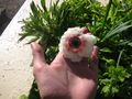
Reminder of spring

-->
Achievements
| Sun 3 Oct 2010 in -19,146: -19.8362717, 146.6914929 geohashing.info google osm bing/os kml crox |
Location
Participants
Plans
Expedition
Tracklog
Photos
Achievements