Difference between revisions of "2010-10-07 61 24"
imported>PekkaR |
imported>PekkaR |
||
| Line 46: | Line 46: | ||
--> | --> | ||
<gallery perrow="4"> | <gallery perrow="4"> | ||
| − | Image: | + | Image:2010-10-07_61-24_gps.jpg | GPSr at the hashpoint |
</gallery> | </gallery> | ||
Revision as of 17:01, 7 October 2010
| Thu 7 Oct 2010 in 61,24: 61.0117018, 24.4863319 geohashing.info google osm bing/os kml crox |
Location
In the Finnish woods close to a nature path in Idänpää (East End) part of the town Hämeenlinna, [Karttapaikka map].
Suomalaisessa metsässä ulkoilureitin lähistöllä Hämeenlinnassa Idänpään kaupunginosassa, [Karttapaikka].
Participants
Plans
I've never done geohashing before, but I've been geocacher about eight years. Today's hashpoint was quite near because I live in Hämeenlinna.
Tämä oli ensimmäinen "hassini", geokätköilijä olen ollut jo yli kahdeksan vuotta. Olen lukenut kätköilyfoorumilla aiheesta ja nyt kun piste sattui kotikaupunkiin, piti lähteä kokeilemaan.
Expedition
There was a short walk, about 200 metres, from nearest street to the hashpoint. It was about 2:15 pm when I reached the place. It was in Finnish forest - pines, spruces, but also little oaks. It was fine autumn weather, temperature about 12°.
Auto parkkiin Someronkadun varteen, siitä oli parisataa metriä päivän pisteelle. Melkein koko matka oli mukavaa ulkoilupolkua ja lopussa pieni poikkeaminen metsään. Pääsin paikalle noin 14:15. Ympäristö oli tavallista suomalaista kaupunkimetsää - mäntyjä, kuusia, mutta myös pieniä tammia. Oli kaunis syyspäivä, lämpötila n. 12 astetta.
Photos
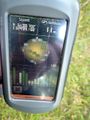
GPSr at the hashpoint

Achievements