Difference between revisions of "2010-11-05 55 13"
imported>Fasanen (Clean up) |
imported>FippeBot m (Location) |
||
| (4 intermediate revisions by one other user not shown) | |||
| Line 16: | Line 16: | ||
== Expedition == | == Expedition == | ||
| − | + | K had a day off from work and Mr.T had vacation from school. Fasanen suggested to go for a picnic in a forest which strangely enough also contained the hashpoint for that day. Coffee, lemonade and cinnamon buns were loaded into the car and off they went. The car trip ended just south of the Holmeja sawmill where work with replacing game fencing was going on and as there had been an intense rain the night before, the ground had turned into an inferno of mud. As soon as the hashing party got onto the path leading into the forest, the conditions looked a lot better. | |
| + | |||
| + | It was not long before Fasanen noticed that he had forgotten his outdoor GPS on the kitchen table at home. Fortunately he had his phone with him and hopefully the cellphone coverage would be sufficient to get the hashpoint coordinates. As the area was full of small paths and roads, he had also prepared a paper print-out of the map covering the area. | ||
| + | |||
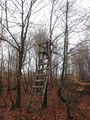
| + | Fasanen and K walked and Mr.T rode his bike and after about 2 kilometres they got to the vicinity of the hashpoint. Fasanen went off-road while the others looked for a suitable place for a picnic. A hunting tower numbered “41” became the perfect spot for that. | ||
| + | |||
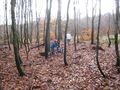
| + | Located 120 meters south of the hunting tower, the hashpoint was not that easy to find. The forest was very dense. With a maximum accuracy of 12 meters, Fasanen never seemed to be able to get closer than 6 meters from the hashpoint and finally decided a particular spot to be the hashpoint. After the traditional ceremony of documenting, Fasanen went back to the picnic team and they all had their picnic. | ||
| + | |||
| + | On their way back to the car, a tree numbered “43” was found and when the expedition was over, they could conclude that Meaning of Life (42) was not found during this expedition either. It was however a nice trip to a very nice area which they all certainly liked to revisit. | ||
== Photos == | == Photos == | ||
| − | + | <gallery perrow="4"> | |
| − | <gallery perrow=" | + | Image:551320101005 06.JPG | Getting closer |
| + | Image:551320101005 08.JPG | Yellow ribbon and direction of hash | ||
| + | Image:551320101005 02.JPG | At hash point | ||
| + | Image:551320101005 01.JPG | Low accuracy proof | ||
| + | Image:551320101005 03.JPG | Eastern view | ||
| + | Image:551320101005 04.JPG | Bewitching pond next to hash | ||
| + | Image:551320101005 07.JPG | Beets used as deer bait | ||
| + | Image:551320101005 09.JPG | We found "41" and... | ||
| + | Image:551320101005 12.JPG | ..."43" during the expedition. Unfortunately we didn't find the Meaning of Life. | ||
| + | Image:551320101005 10.JPG | Mr.T and K. | ||
| + | Image:551320101005 13.JPG | Mr.T looking for deer | ||
| + | Image:551320101005 11.JPG | Homeward bound | ||
</gallery> | </gallery> | ||
| + | ==Achievements== | ||
| + | {{land geohash | latitude=55 | longitude=13 | date=2010-11-05 | name=Fasanen }} | ||
| + | {{drag-along | latitude = 55 | longitude = 13 | date = 2010-11-05 | partner = his wife | name = Fasanen}} | ||
[[Category:Expeditions]] | [[Category:Expeditions]] | ||
| Line 29: | Line 51: | ||
[[Category:Meetup on 2010-11-05]] | [[Category:Meetup on 2010-11-05]] | ||
[[Category:Sweden]] | [[Category:Sweden]] | ||
| + | {{location|SE|M}} | ||
Latest revision as of 04:31, 9 August 2019
| Fri 5 Nov 2010 in 55,13: 55.5474503, 13.3025172 geohashing.info google osm bing/os kml crox |
Location
In the forest east of Holmeja, Skåne, Sweden
Participants
- Fasanen, K & Mr. T
Plans
Enjoy a walk and picnic in the forest when the hash point for once is not located to farmland.
Expedition
K had a day off from work and Mr.T had vacation from school. Fasanen suggested to go for a picnic in a forest which strangely enough also contained the hashpoint for that day. Coffee, lemonade and cinnamon buns were loaded into the car and off they went. The car trip ended just south of the Holmeja sawmill where work with replacing game fencing was going on and as there had been an intense rain the night before, the ground had turned into an inferno of mud. As soon as the hashing party got onto the path leading into the forest, the conditions looked a lot better.
It was not long before Fasanen noticed that he had forgotten his outdoor GPS on the kitchen table at home. Fortunately he had his phone with him and hopefully the cellphone coverage would be sufficient to get the hashpoint coordinates. As the area was full of small paths and roads, he had also prepared a paper print-out of the map covering the area.
Fasanen and K walked and Mr.T rode his bike and after about 2 kilometres they got to the vicinity of the hashpoint. Fasanen went off-road while the others looked for a suitable place for a picnic. A hunting tower numbered “41” became the perfect spot for that.
Located 120 meters south of the hunting tower, the hashpoint was not that easy to find. The forest was very dense. With a maximum accuracy of 12 meters, Fasanen never seemed to be able to get closer than 6 meters from the hashpoint and finally decided a particular spot to be the hashpoint. After the traditional ceremony of documenting, Fasanen went back to the picnic team and they all had their picnic.
On their way back to the car, a tree numbered “43” was found and when the expedition was over, they could conclude that Meaning of Life (42) was not found during this expedition either. It was however a nice trip to a very nice area which they all certainly liked to revisit.
Photos
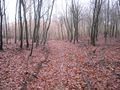
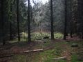
Getting closer
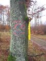
Yellow ribbon and direction of hash
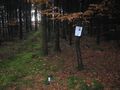
At hash point
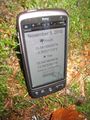
Low accuracy proof
Eastern view
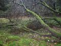
Bewitching pond next to hash
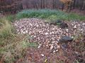
Beets used as deer bait
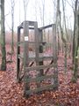
We found "41" and...
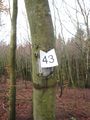
..."43" during the expedition. Unfortunately we didn't find the Meaning of Life.
Mr.T and K.
Mr.T looking for deer
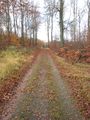
Homeward bound


Achievements
Fasanen earned the Land geohash achievement
|
Fasanen earned the Drag-along achievement
|