Difference between revisions of "2010-11-14 48 9"
From Geohashing
imported>Ekorren m (typo) |
imported>FippeBot m (Location) |
||
| (2 intermediate revisions by one other user not shown) | |||
| Line 7: | Line 7: | ||
== Location == | == Location == | ||
| − | + | A field at Mähringen, Kusterdingen municipality. | |
== Participants == | == Participants == | ||
| − | *[[User:Ekorren|Ekorren]] | + | *[[User:Ekorren|Ekorren]] was there. |
| − | |||
| − | + | == Expedition == | |
| + | Been there in the afternoon by bike. Took slight detours in both directions, to visit two minor sights: An early celtic tumulus (hill grave) and some slightly weird monument from the late 19th century. No photos of both of them, sorry. | ||
| − | + | The hash itself was at the border of a field, maybe about 2 metres into the field. I'll count that as reached. | |
| − | |||
== Gallery == | == Gallery == | ||
| − | + | <gallery> | |
| + | File:2010-11-14_48_9_FieldMarket.JPG|Modern field market? I got two bottles of apple juice from the machine at the left side. | ||
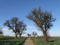
| + | File:2010-11-14_48_9_Hashpath_1.JPG|Way to hash | ||
| + | File:2010-11-14_48_9_Hashpoint_Way.JPG|The hashpoint is at the left side of the way | ||
| + | File:2010-11-14_48_9_Hashpoint_close.JPG|Closeup | ||
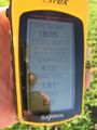
| + | File:2010-11-14_48_9_GPS.JPG| | ||
| + | File:2010-11-14_48_9_VFH.JPG|View from hash | ||
| + | File:2010-11-14_48_9_Hashpath_2.JPG|View from close to the hash | ||
| + | </gallery> | ||
| − | |||
[[Category:Expeditions]] | [[Category:Expeditions]] | ||
[[Category:Expeditions with photos]] | [[Category:Expeditions with photos]] | ||
| − | [[Category:Coordinates | + | [[Category:Coordinates reached]] |
| − | + | {{location|DE|BW|TÜ}} | |
| − | |||
Latest revision as of 04:36, 9 August 2019
| Sun 14 Nov 2010 in 48,9: 48.4891851, 9.1125707 geohashing.info google osm bing/os kml crox |
Contents
Location
A field at Mähringen, Kusterdingen municipality.
Participants
- Ekorren was there.
Expedition
Been there in the afternoon by bike. Took slight detours in both directions, to visit two minor sights: An early celtic tumulus (hill grave) and some slightly weird monument from the late 19th century. No photos of both of them, sorry.
The hash itself was at the border of a field, maybe about 2 metres into the field. I'll count that as reached.
Gallery
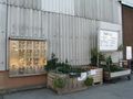
Modern field market? I got two bottles of apple juice from the machine at the left side.
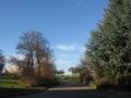
Way to hash
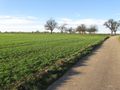
The hashpoint is at the left side of the way
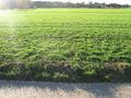
Closeup
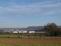
View from hash
View from close to the hash


