Difference between revisions of "2010-11-18 50 10"
imported>Mampfred (Created page with '{{subst:Expedition |lat = 50 |lon = 10 |date = 2010-11-18 }}') |
imported>FippeBot m (Location) |
||
| (6 intermediate revisions by 2 users not shown) | |||
| Line 1: | Line 1: | ||
| − | |||
| − | |||
| − | |||
| − | |||
| − | |||
| − | |||
| − | |||
| − | |||
| − | |||
| − | |||
{{meetup graticule | {{meetup graticule | ||
| lat=50 | | lat=50 | ||
| Line 15: | Line 5: | ||
}} | }} | ||
| − | |||
| − | |||
== Location == | == Location == | ||
| − | + | Next to a road about 20 miles outside of Erfurt - in the woods. | |
== Participants == | == Participants == | ||
| − | + | *[[User:Rincewind|Rincewind]] and [[User:Mampfred|Mampfred]] | |
== Plans == | == Plans == | ||
| − | + | Make it a midnight-hash. | |
== Expedition == | == Expedition == | ||
| − | + | Drove down in [[User:Rincewind|Rincewind]]'s car to the hash, a 30 min drive from Erfurt. On the way there we actually passed the hash as close as 100 meters from the Autobahn on a bridge - unfortunately it took another 10 minutes to get to the next exit and find the street below the Autobahn to get to the actual hash. | |
| + | |||
| + | Nevertheless we reached the hash at about 11:45pm the previous day and started taking the stupid grin photos before we snapped the GPS screenshots at exactly midnight. This wasn't quite as easy as usual as the weather-conditions (foggy, light drizzle) and the trees around us significantly decreased the accuracy of the GPS signals. Considering that we circled around the position for at least 10 minutes with the GPS jumping all over the place we definitely reached the coordinates ... at some point. | ||
| + | |||
| + | All in all pretty uneventful, coordinates reached though. | ||
== Tracklog == | == Tracklog == | ||
| − | + | See [http://www.everytrail.com/view_trip.php?trip_id=887851 here]. | |
== Photos == | == Photos == | ||
| − | |||
| − | |||
| − | |||
<gallery perrow="5"> | <gallery perrow="5"> | ||
| + | Image:2010-11-18_50_10_hash.jpg | Hash-Marker | ||
| + | Image:2010-11-18_50_10_mampfred.jpg | [[User:Mampfred|Mampfred]] | ||
| + | Image:2010-11-18_50_10_rincewind.jpg | [[User:Rincewind|Rincewind]] | ||
| + | Image:2010-11-18_50_10_stupid_grin.jpg | Stupid grin(tm) | ||
| + | Image:2010-11-18_50_10_art.jpg | Light-Sabers? | ||
</gallery> | </gallery> | ||
== Achievements == | == Achievements == | ||
{{#vardefine:ribbonwidth|800px}} | {{#vardefine:ribbonwidth|800px}} | ||
| − | + | {{Land geohash | |
| − | + | | latitude = 50 | |
| + | | longitude = 10 | ||
| + | | date = 2010-11-18 | ||
| + | | name = Mampfred and Rincewind | ||
| + | }} | ||
| + | {{Midnight_geohash | ||
| + | | latitude = 50 | ||
| + | | longitude = 10 | ||
| + | | date = 2010-11-18 | ||
| + | | name = Mampfred and Rincewind | ||
| + | }} | ||
| + | {{Minesweeper geohash | ||
| + | | graticule = Erfurt, Germany | ||
| + | | ranknumber = 1 | ||
| + | | w = true | ||
| + | | name = Rincewind | ||
| + | }} | ||
| − | |||
| − | |||
| − | |||
| − | |||
| − | |||
| − | |||
| − | |||
| − | |||
| − | |||
[[Category:Expeditions]] | [[Category:Expeditions]] | ||
| − | |||
[[Category:Expeditions with photos]] | [[Category:Expeditions with photos]] | ||
| − | |||
| − | |||
| − | |||
| − | |||
| − | |||
[[Category:Coordinates reached]] | [[Category:Coordinates reached]] | ||
| − | + | {{location|DE|TH|IK}} | |
| − | |||
| − | |||
| − | |||
| − | |||
| − | |||
| − | |||
| − | |||
| − | |||
| − | |||
Latest revision as of 04:39, 9 August 2019
| Thu 18 Nov 2010 in 50,10: 50.7131611, 10.9354438 geohashing.info google osm bing/os kml crox |
Location
Next to a road about 20 miles outside of Erfurt - in the woods.
Participants
Plans
Make it a midnight-hash.
Expedition
Drove down in Rincewind's car to the hash, a 30 min drive from Erfurt. On the way there we actually passed the hash as close as 100 meters from the Autobahn on a bridge - unfortunately it took another 10 minutes to get to the next exit and find the street below the Autobahn to get to the actual hash.
Nevertheless we reached the hash at about 11:45pm the previous day and started taking the stupid grin photos before we snapped the GPS screenshots at exactly midnight. This wasn't quite as easy as usual as the weather-conditions (foggy, light drizzle) and the trees around us significantly decreased the accuracy of the GPS signals. Considering that we circled around the position for at least 10 minutes with the GPS jumping all over the place we definitely reached the coordinates ... at some point.
All in all pretty uneventful, coordinates reached though.
Tracklog
See here.
Photos
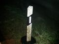
Hash-Marker
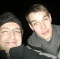
Stupid grin(tm)
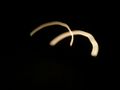
Light-Sabers?


Achievements
Mampfred and Rincewind earned the Land geohash achievement
|
Mampfred and Rincewind earned the Midnight Geohash achievement
|
Rincewind achieved level 1 of the Minesweeper Geohash achievement
|