Difference between revisions of "2010-12-21 -43 172"
imported>Mikethegirl (→Participants) |
imported>FippeBot m (Location) |
||
| (7 intermediate revisions by 3 users not shown) | |||
| Line 1: | Line 1: | ||
| − | |||
| − | |||
| − | |||
| − | |||
| − | |||
| − | |||
| − | |||
| − | |||
| − | |||
| − | |||
{{meetup graticule | {{meetup graticule | ||
| lat=-43 | | lat=-43 | ||
| Line 25: | Line 15: | ||
[[User:mikethegirl|Mikethegirl]] and one other | [[User:mikethegirl|Mikethegirl]] and one other | ||
| − | == | + | == Expedition == |
| − | + | ||
| + | Didn't get out of town until after 9pm, was get fairly dark by the time we | ||
| + | got to the end of the road near the hashpoint. | ||
| + | |||
| + | Turns out it was in the middle of a reserve/estuary/place with really long, tough grass | ||
| + | (waist height) and very wet underfoot. I'm pretty sure we would have needed a | ||
| + | hefty pair of gumboots had the tide been in. | ||
| + | |||
| + | Pulled out the trusty torch to help us find a way around the many creek-like patches of water, and eventually found the hashpoint. | ||
| − | + | Turns out there was a stick already there, so no need to mark the spot. Having looked at | |
| − | + | the other reported hashes for this graticule, I'm very confused as to why a stake | |
| + | had been placed at the exact spot, but I'll leave it to serendipity and think no more on it. | ||
| − | + | A successful first geohash! | |
| − | |||
== Photos == | == Photos == | ||
| Line 39: | Line 37: | ||
--> | --> | ||
<gallery perrow="5"> | <gallery perrow="5"> | ||
| + | Image:2010-12-21 -43 172a.PNG | Made it! | ||
</gallery> | </gallery> | ||
| Line 45: | Line 44: | ||
<!-- Add any achievement ribbons you earned below, or remove this section --> | <!-- Add any achievement ribbons you earned below, or remove this section --> | ||
| + | {{land geohash | ||
| + | | latitude = -43 | ||
| + | | longitude = 172 | ||
| + | | date = 2010-12-21 | ||
| + | }} | ||
| − | + | {{drag-along | |
| − | + | | latitude = -43 | |
| − | + | | longitude = 172 | |
| + | | date = 2010-12-21 | ||
| + | | partner = Will | ||
| + | | name = mikethegirl | ||
| + | }} | ||
| − | |||
| − | |||
| − | |||
| − | |||
| − | |||
| − | |||
[[Category:Expeditions]] | [[Category:Expeditions]] | ||
| − | |||
[[Category:Expeditions with photos]] | [[Category:Expeditions with photos]] | ||
| − | |||
| − | |||
| − | |||
| − | |||
[[Category:Coordinates reached]] | [[Category:Coordinates reached]] | ||
| − | + | {{location|NZ|CAN}} | |
| − | |||
| − | |||
| − | |||
| − | |||
| − | |||
| − | |||
| − | |||
| − | |||
| − | |||
Latest revision as of 05:00, 9 August 2019
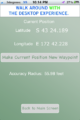
| Tue 21 Dec 2010 in -43,172: -43.4031488, 172.7037896 geohashing.info google osm bing/os kml crox |
Location
Out near Kaiapoi, really near the coast but not in the water.
Participants
Mikethegirl and one other
Expedition
Didn't get out of town until after 9pm, was get fairly dark by the time we got to the end of the road near the hashpoint.
Turns out it was in the middle of a reserve/estuary/place with really long, tough grass (waist height) and very wet underfoot. I'm pretty sure we would have needed a hefty pair of gumboots had the tide been in.
Pulled out the trusty torch to help us find a way around the many creek-like patches of water, and eventually found the hashpoint.
Turns out there was a stick already there, so no need to mark the spot. Having looked at the other reported hashes for this graticule, I'm very confused as to why a stake had been placed at the exact spot, but I'll leave it to serendipity and think no more on it.
A successful first geohash!
Photos
Made it!

Achievements
This user earned the Land geohash achievement
|
mikethegirl earned the Drag-along achievement
|