Difference between revisions of "2011-02-06 60 17"
imported>Vswe |
imported>FippeBot m (Location) |
||
| (5 intermediate revisions by 2 users not shown) | |||
| Line 6: | Line 6: | ||
== Location == | == Location == | ||
| − | Out in the woods north of Uppsala. A 30km walk | + | Out in the woods north of Uppsala. A 30km walk. |
== Participants == | == Participants == | ||
| Line 15: | Line 15: | ||
== Expedition == | == Expedition == | ||
| − | + | After packing some food to bring I left home some time before 8AM, on foot of course. I went north for hours, changing roads from time to time. I got a very unpleasant surprise after just one and a half hour(about 8.5 km), my feet had already started to feel a bit sore. Not much but just the tiniest bit. Not a good sign, I still had more than 20km left to the hashpoint and then 30 back. | |
| + | |||
| + | So why this big miscalculation? I wasn't tired from my last expedition two days ago but my body was probably | ||
| + | not in the best possible condition after the 7km walk that day. And for these kinds of walks you need | ||
| + | all energy you can get. | ||
| + | |||
| + | Anyways, I couldn't give up already just for feeling a bit tired. While I walked I ate the food I brought: | ||
| + | 2 bananas and 2 sandwiches to mention a few things (and also to mention most of the things). And so I walked. | ||
| + | After about 3 hours of walking a group of deer crossed my path some meters away. This is not the first time | ||
| + | I've met deer on geohashing expeditions. In fact, my first expedition involved meeting deer. Apart from | ||
| + | that instance not much happened and it was fun, I think that's a good thing with geohashing. | ||
| + | |||
| + | Some | ||
| + | time after meeting the deer I felt really tired in my legs and feet but continued on. Changed to the | ||
| + | last road, 6 km to go. | ||
| + | |||
| + | Later on I saw two buses in some sort of bus parking but didn't think about them but | ||
| + | rather sat down on a rock and ate my third and last sandwich while resting my legs. After a short pause | ||
| + | I continued on the road until I were 268 meters from the coordinates. The forest was deeply covered in | ||
| + | snow (of course) and the last part had been tiresome but feeling the hashpoint close I brought forth energy | ||
| + | and headed into the snow. 268 meters later I would have been there if I would have been flying but, since I wasn't | ||
| + | there was still some way left. Finally I reached the point, happy as usual. Took some pictures and headed out | ||
| + | to the road again. | ||
| + | |||
| + | Back on the road I started to feel tired again, more than ever, but started walking south. What else where | ||
| + | there to do? I pretty quickly realized that I wasn't able to walk the whole way back and aimed for a bus in | ||
| + | a village about 10km away(almost along the way back). It was now hurting when I walked. Now I started to | ||
| + | think about those two buses again, maybe they were in traffic. I realized that one of those probably was | ||
| + | bus 842 which I had seen many times during the day, as it went almost the same route I did. 5 kilometers | ||
| + | away from the hash I reached the buses and one was number 842 just as I had thought and it was just about | ||
| + | to leave. Perfect. | ||
| + | |||
| + | == Tracklog == | ||
| + | Tracklog[http://maps.google.com/maps/ms?hl=en&ie=UTF8&t=h&oe=UTF8&num=200&msa=0&msid=210402289646106509761.00049bb92b93ba20ad342&ll=59.990745,17.541046&spn=0.269928,0.617294&z=11] Remember to click "Next" to see the rest of the log. | ||
== Photos == | == Photos == | ||
| − | + | Long expedition means many pictures. | |
| − | + | ||
| − | + | ||
<gallery perrow="5"> | <gallery perrow="5"> | ||
| + | Image:2011-02-06_60_17_GPS1.jpg | GPS at start(if you look at the bottom you can see it's pointing at W2 rather than W1, so the values aren't correct). | ||
| + | Image:2011-02-06_60_17_view1.jpg | Just left my house. | ||
| + | Image:2011-02-06_60_17_view2.jpg | Let's... | ||
| + | Image:2011-02-06_60_17_view3.jpg | ...GO! | ||
| + | Image:2011-02-06_60_17_view4.jpg | According to a friend there's a geocache under that bridge. | ||
| + | <!--Image:2011-02-06_60_17_view5.jpg | ... -> | ||
| + | <!--Image:2011-02-06_60_17_view6.jpg | ... -> | ||
| + | <!--Image:2011-02-06_60_17_view7.jpg | ... -> | ||
| + | <!--Image:2011-02-06_60_17_view8.jpg | ... -> | ||
| + | <!--Image:2011-02-06_60_17_view9.jpg | ... -> | ||
| + | <!--Image:2011-02-06_60_17_view10.jpg | ... -> | ||
| + | <!--Image:2011-02-06_60_17_view11.jpg | ... -> | ||
| + | <!--Image:2011-02-06_60_17_view12.jpg | ... -> | ||
| + | Image:2011-02-06_60_17_view13.jpg | A church (Skuttunge kyrka) | ||
| + | Image:2011-02-06_60_17_view14.jpg | Well... It just continues... | ||
| + | Image:2011-02-06_60_17_deer1.jpg | All of... | ||
| + | Image:2011-02-06_60_17_deer2.jpg | ...a sudden I saw... | ||
| + | Image:2011-02-06_60_17_deer3.jpg | ...a bunch of deers. | ||
| + | Image:2011-02-06_60_17_view15.jpg | A left turn here, last road. | ||
| + | Image:2011-02-06_60_17_me1.jpg | Resting and eating. | ||
| + | Image:2011-02-06_60_17_view16.jpg | When does it end...? | ||
| + | Image:2011-02-06_60_17_view17.jpg | Where did the civilisation go? | ||
| + | Image:2011-02-06_60_17_view18.jpg | 268 meters in that direction. | ||
| + | Image:2011-02-06_60_17_GPS2.jpg | Proof. | ||
| + | Image:2011-02-06_60_17_me2.jpg | [[:Category:Grins|Stupid Grin]]<sup>tm</sup> | ||
| + | Image:2011-02-06_60_17_view19.jpg | Oh look, a tree! (view from the hashpoint) | ||
| + | Image:2011-02-06_60_17_view20.jpg | Wow, some other regular trees(view from the hashpoint) | ||
| + | |||
</gallery> | </gallery> | ||
== Achievements == | == Achievements == | ||
{{#vardefine:ribbonwidth|800px}} | {{#vardefine:ribbonwidth|800px}} | ||
| − | <!-- | + | {{Walk geohash |
| + | | latitude = 60 | ||
| + | | longitude = 17 | ||
| + | | date = 2011-02-06 | ||
| + | | name = Vswe | ||
| + | | distance = 36.21km | ||
| + | }} | ||
| + | {{land geohash | latitude = 60 | longitude = 17 | date = 2011-02-06 | name = Vswe }} | ||
| + | <!-- Maybe not this time, it but tough but maybe not enough, I mean it was a really pain in the end but I... well never mind. {{mnimb geohash | latitude = 60 | longitude = 17 | date = 2011-02-06 | name = Vswe}} --> | ||
| − | |||
| − | |||
[[Category:Expeditions]] | [[Category:Expeditions]] | ||
| − | |||
[[Category:Expeditions with photos]] | [[Category:Expeditions with photos]] | ||
| − | |||
| − | |||
| − | |||
| − | |||
| − | |||
[[Category:Coordinates reached]] | [[Category:Coordinates reached]] | ||
| + | {{location|SE|C}} | ||
Latest revision as of 05:29, 9 August 2019
| Sun 6 Feb 2011 in 60,17: 60.0878971, 17.4495572 geohashing.info google osm bing/os kml crox |
Location
Out in the woods north of Uppsala. A 30km walk.
Participants
Plans
I will try to walk there. Leave in the morning and hopefully coming back after a 12 hours and 60 km walk :D
Expedition
After packing some food to bring I left home some time before 8AM, on foot of course. I went north for hours, changing roads from time to time. I got a very unpleasant surprise after just one and a half hour(about 8.5 km), my feet had already started to feel a bit sore. Not much but just the tiniest bit. Not a good sign, I still had more than 20km left to the hashpoint and then 30 back.
So why this big miscalculation? I wasn't tired from my last expedition two days ago but my body was probably not in the best possible condition after the 7km walk that day. And for these kinds of walks you need all energy you can get.
Anyways, I couldn't give up already just for feeling a bit tired. While I walked I ate the food I brought: 2 bananas and 2 sandwiches to mention a few things (and also to mention most of the things). And so I walked. After about 3 hours of walking a group of deer crossed my path some meters away. This is not the first time I've met deer on geohashing expeditions. In fact, my first expedition involved meeting deer. Apart from that instance not much happened and it was fun, I think that's a good thing with geohashing.
Some time after meeting the deer I felt really tired in my legs and feet but continued on. Changed to the last road, 6 km to go.
Later on I saw two buses in some sort of bus parking but didn't think about them but rather sat down on a rock and ate my third and last sandwich while resting my legs. After a short pause I continued on the road until I were 268 meters from the coordinates. The forest was deeply covered in snow (of course) and the last part had been tiresome but feeling the hashpoint close I brought forth energy and headed into the snow. 268 meters later I would have been there if I would have been flying but, since I wasn't there was still some way left. Finally I reached the point, happy as usual. Took some pictures and headed out to the road again.
Back on the road I started to feel tired again, more than ever, but started walking south. What else where there to do? I pretty quickly realized that I wasn't able to walk the whole way back and aimed for a bus in a village about 10km away(almost along the way back). It was now hurting when I walked. Now I started to think about those two buses again, maybe they were in traffic. I realized that one of those probably was bus 842 which I had seen many times during the day, as it went almost the same route I did. 5 kilometers away from the hash I reached the buses and one was number 842 just as I had thought and it was just about to leave. Perfect.
Tracklog
Tracklog[1] Remember to click "Next" to see the rest of the log.
Photos
Long expedition means many pictures.
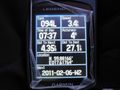
GPS at start(if you look at the bottom you can see it's pointing at W2 rather than W1, so the values aren't correct).
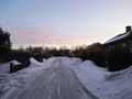
Just left my house.
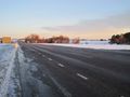
Let's...
...GO!
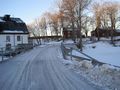
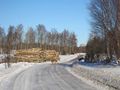
According to a friend there's a geocache under that bridge.
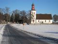
A church (Skuttunge kyrka)
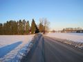
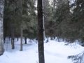
Well... It just continues...
All of...
...a sudden I saw...
...a bunch of deers.
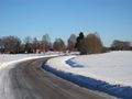
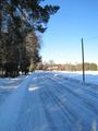
A left turn here, last road.

Resting and eating.
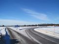
When does it end...?
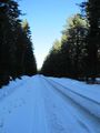
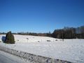
Where did the civilisation go?
268 meters in that direction.
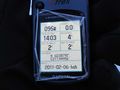
Proof.
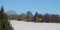
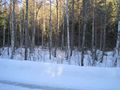
Oh look, a tree! (view from the hashpoint)
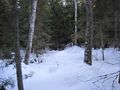
Wow, some other regular trees(view from the hashpoint)


Achievements
Vswe earned the Walk geohash Achievement
|
Vswe earned the Land geohash achievement
|