Difference between revisions of "2011-04-20 39 -104"
From Geohashing
imported>AkiTensai (Page spawn) |
imported>FippeBot m (Location) |
||
| (One intermediate revision by one other user not shown) | |||
| Line 1: | Line 1: | ||
| − | |||
<!-- If you did not specify these parameters in the template, please substitute appropriate values for IMAGE, LAT, LON, and DATE (YYYY-MM-DD format) | <!-- If you did not specify these parameters in the template, please substitute appropriate values for IMAGE, LAT, LON, and DATE (YYYY-MM-DD format) | ||
| Line 18: | Line 17: | ||
__NOTOC__ | __NOTOC__ | ||
== Location == | == Location == | ||
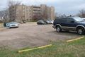
| − | + | An employee parking lot of Sunny Acres, about 104th and York. | |
== Participants == | == Participants == | ||
| − | + | *[[user:AkiTensai|AkiTensai]] | |
| − | |||
| − | |||
| − | |||
== Expedition == | == Expedition == | ||
| − | + | A short drive and a simple distance away, this Geohash was easy to access. | |
| − | |||
| − | |||
| − | |||
== Photos == | == Photos == | ||
| − | |||
| − | |||
| − | |||
<gallery perrow="5"> | <gallery perrow="5"> | ||
| + | Image:2011-04-20_39_-104_Aki_GPS.jpg | Aki's GPS (doubled up to show To gps and date) | ||
| + | Image:2011-04-20_39_-104_Arizona_Tea_Geohash.jpg |Not only marking the spot in thirst, also marking the Geohash. | ||
</gallery> | </gallery> | ||
== Achievements == | == Achievements == | ||
{{#vardefine:ribbonwidth|800px}} | {{#vardefine:ribbonwidth|800px}} | ||
| − | + | {{land geohash | latitude = 39| longitude = -104 | date = 2011-04-20 | name = AkiTensai | image = 2011-04-20_39_-104_Arizona_Tea_Geohash.jpg }} | |
| − | |||
| − | |||
| − | |||
| − | |||
| − | |||
| − | |||
| − | |||
| − | |||
| − | |||
| − | |||
| − | |||
[[Category:Expeditions]] | [[Category:Expeditions]] | ||
| − | |||
[[Category:Expeditions with photos]] | [[Category:Expeditions with photos]] | ||
| − | |||
| − | |||
| − | |||
| − | |||
| − | |||
[[Category:Coordinates reached]] | [[Category:Coordinates reached]] | ||
| − | + | {{location|US|CO|AD}} | |
| − | |||
| − | |||
| − | |||
| − | |||
| − | |||
| − | |||
| − | |||
| − | |||
| − | |||
Latest revision as of 03:58, 6 August 2019
| Wed 20 Apr 2011 in 39,-104: 39.8868560, -104.9555198 geohashing.info google osm bing/os kml crox |
Location
An employee parking lot of Sunny Acres, about 104th and York.
Participants
Expedition
A short drive and a simple distance away, this Geohash was easy to access.
Photos
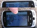
Aki's GPS (doubled up to show To gps and date)
Not only marking the spot in thirst, also marking the Geohash.


Achievements
AkiTensai earned the Land geohash achievement
|