Difference between revisions of "2011-04-24 50 -1"
imported>Mahahahaneapneap (Added details) |
imported>FippeBot m (Location) |
||
| (One intermediate revision by one other user not shown) | |||
| Line 22: | Line 22: | ||
== Photos == | == Photos == | ||
<gallery perrow="5"> | <gallery perrow="5"> | ||
| + | Image:2011-04-24 50 -1 01.jpg | Mahahahaneapneap pointing at something. | ||
| + | Image:2011-04-24 50 -1 02.jpg | A view of the heath. | ||
| + | Image:2011-04-24 50 -1 03.jpg | More heath. | ||
| + | Image:2011-04-24 50 -1 04.jpg | Corwin in front of a pyre. | ||
| + | Image:2011-04-24 50 -1 05.jpg | Co-ordinates. | ||
| + | Image:2011-04-24 50 -1 06.jpg | Almost there. | ||
| + | Image:2011-04-24 50 -1 07.jpg | The three of us at the geohash. | ||
| + | Image:2011-04-24 50 -1 08.jpg | A nice field we found on the way back. | ||
| + | Image:2011-04-24 50 -1 09.jpg | I think the airport is behind those trees. | ||
</gallery> | </gallery> | ||
| Line 27: | Line 36: | ||
[[Category:Expeditions with photos]] | [[Category:Expeditions with photos]] | ||
[[Category:Coordinates reached]] | [[Category:Coordinates reached]] | ||
| + | {{location|GB|ENG|BCP}} | ||
Latest revision as of 06:16, 9 August 2019
| Sun 24 Apr 2011 in 50,-1: 50.7891061, -1.8277996 geohashing.info google osm bing/os kml crox |
Location
The geohash was in a wooded area very close to Bournemouth Airport. We were concerned that it may lie just inside the boundary to the airport.
Participants
Plans
Not much planning went into this. On the morning of the expedition, Corwin suggested it to Mahahahaneapneap, who then invited Blue Rise. Mahahahaneapneap wrote the co-ordinates on a piece of paper, and off we went.
Expedition
Corwin picked us both up and we drove a few miles to the geohash. We parked in the car park on Matchams Lane and completed the journey on foot. It was a very warm day, but the only people around were a couple of dog walkers. We found the co-ordinates fairly easily, and posed for photos using Blue Rise's new camera. The spot turned out not to be within the airport boundary, but it was fairly close.
Photos
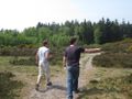
Mahahahaneapneap pointing at something.
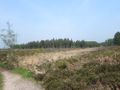
A view of the heath.
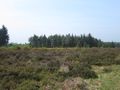
More heath.
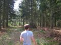
Corwin in front of a pyre.
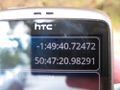
Co-ordinates.
Almost there.
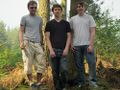
The three of us at the geohash.
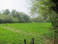
A nice field we found on the way back.
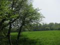
I think the airport is behind those trees.


