Difference between revisions of "2011-04-30 50 -2"
imported>Mahahahaneapneap (Created page) |
imported>Mahahahaneapneap (Added details) |
||
| Line 1: | Line 1: | ||
| − | |||
<!-- If you did not specify these parameters in the template, please substitute appropriate values for IMAGE, LAT, LON, and DATE (YYYY-MM-DD format) | <!-- If you did not specify these parameters in the template, please substitute appropriate values for IMAGE, LAT, LON, and DATE (YYYY-MM-DD format) | ||
| Line 15: | Line 14: | ||
}} | }} | ||
| − | |||
__NOTOC__ | __NOTOC__ | ||
== Location == | == Location == | ||
| − | + | The geohash was about 3 miles outside Wareham, just off a country road. | |
== Participants == | == Participants == | ||
| − | + | *[[User:04housemat|04housemat]] | |
| + | *[[User:Corwin|Corwin]] | ||
| + | *[[User:Mahahahaneapneap|Mahahahaneapneap]] | ||
| + | *[[User:Owenrowland|Owenrowland]] | ||
== Plans == | == Plans == | ||
| − | + | The four of us had planned to meet up at a pub in Poole in the evening. We knew that the geohash was reachable, but didn't consider going until Mahahahaneapneap suggested it to 04housemat at about 5pm. We phoned Corwin and Owenrowland, and they were free, so we decided to go for it. | |
== Expedition == | == Expedition == | ||
| − | + | Corwin picked up Mahahahaneapneap and 04housemat in Poole, and we drove to Owenrowland's house in Wareham. We stayed there for a bit, then decided to get going before it started to get dark. We parked the car [http://maps.google.com/maps?ll=50.670915,-2.078428&spn=0.001741,0.005284&t=h&z=18 here] and immediately made our way west, in completely the wrong direction. We got about 100 metres before we realised, then we made our way back. The location was easy to find after that. It was a few metres off a well trodden path in some trees, but we had no problems with GPS signal. We stayed for a few minutes to take photos, then made our way to the pub in Poole. | |
| − | |||
| − | == | ||
| − | |||
== Photos == | == Photos == | ||
| − | |||
| − | |||
| − | |||
<gallery perrow="5"> | <gallery perrow="5"> | ||
| + | Image:2011-04-30 50 -2 Sign.jpg | A nice sign next to the road where we parked | ||
</gallery> | </gallery> | ||
| − | |||
| − | |||
| − | |||
| − | |||
| − | |||
| − | |||
| − | |||
| − | |||
| − | |||
| − | |||
| − | |||
| − | |||
| − | |||
| − | |||
| − | |||
[[Category:Expeditions]] | [[Category:Expeditions]] | ||
| − | |||
[[Category:Expeditions with photos]] | [[Category:Expeditions with photos]] | ||
| − | + | ||
| − | |||
| − | |||
| − | |||
| − | |||
[[Category:Coordinates reached]] | [[Category:Coordinates reached]] | ||
| − | |||
| − | |||
| − | |||
| − | |||
| − | |||
| − | |||
| − | |||
| − | |||
| − | |||
| − | |||
Revision as of 00:49, 2 May 2011
| Sat 30 Apr 2011 in 50,-2: 50.6712943, -2.0772488 geohashing.info google osm bing/os kml crox |
Location
The geohash was about 3 miles outside Wareham, just off a country road.
Participants
Plans
The four of us had planned to meet up at a pub in Poole in the evening. We knew that the geohash was reachable, but didn't consider going until Mahahahaneapneap suggested it to 04housemat at about 5pm. We phoned Corwin and Owenrowland, and they were free, so we decided to go for it.
Expedition
Corwin picked up Mahahahaneapneap and 04housemat in Poole, and we drove to Owenrowland's house in Wareham. We stayed there for a bit, then decided to get going before it started to get dark. We parked the car here and immediately made our way west, in completely the wrong direction. We got about 100 metres before we realised, then we made our way back. The location was easy to find after that. It was a few metres off a well trodden path in some trees, but we had no problems with GPS signal. We stayed for a few minutes to take photos, then made our way to the pub in Poole.
Photos
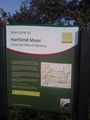
A nice sign next to the road where we parked
