Difference between revisions of "2011-05-10 53 10"
imported>Bierhefe (→Photos) |
imported>Bierhefe |
||
| Line 1: | Line 1: | ||
| − | |||
<!-- If you did not specify these parameters in the template, please substitute appropriate values for IMAGE, LAT, LON, and DATE (YYYY-MM-DD format) | <!-- If you did not specify these parameters in the template, please substitute appropriate values for IMAGE, LAT, LON, and DATE (YYYY-MM-DD format) | ||
| Line 41: | Line 40: | ||
== Photos == | == Photos == | ||
| − | |||
| − | |||
| − | |||
<gallery perrow="5"> | <gallery perrow="5"> | ||
| − | + | Image:53_10_2011-05-10_01.JPG|200px|thumb|left|The way to the hashpoint | |
| − | + | Image:53_10_2011-05-10_02.JPG|200px|thumb|left|A sign | |
| − | + | Image:53_10_2011-05-10_03.JPG|200px|thumb|left|Marker, Hashcots, Mobile, GPS | |
| − | + | Image:53_10_2011-05-10_04.JPG|200px|thumb|left|GPS, now readable | |
| − | + | Image:53_10_2011-05-10_05.JPG|200px|thumb|left|Stupid Grin<sup>tm</sup> | |
| − | + | Image:53_10_2011-05-10_06.JPG|200px|thumb|left|Sticks and no stones | |
| − | + | Image:2011-05-10-07.JPG|200px|thumb|left|Cut down trees | |
| − | + | Image:53_10_2011-05-10_08.JPG|200px|thumb|left|Place of the geocache | |
| − | + | Image:53_10_2011-05-10_09.JPG|200px|thumb|left|Picnic | |
| − | + | Image:53_10_2011-05-10_11.JPG|200px|thumb|left|The forester's house of Bornberg | |
| − | + | Image:53_10_2011-05-10_13.JPG|200px|thumb|left|There's a stone, but no stick | |
</gallery> | </gallery> | ||
Revision as of 18:46, 10 May 2011
| Tue 10 May 2011 in 53,10: 53.4957903, 10.3347794 geohashing.info google osm bing/os kml crox |
Location
In a forest between Kröppelshagen-Fahrendorf and Dassendorf.
Participants
User:Bierhefe, together with his wife
Plans
Bierhefe tries to reach this hash after work. Either by bike or by public transportation, depends on wether his wife joins him or not.
Expedition
When I got home from work I asked my wife if she liked to go to todays geohash and she said yes. Since public transportation is very limited in the suburbs of Hamburg and my wifes bike needs some serious repairing we decided to take the car to the hash. The hashpoint is very easy to reach by car, so we made an exception to our "rule" of not going by car to a hashpoint. Also, it was a good chance to finally get into the Sachsenwald (Saxony Forest).
After some packing we got going. After a very uneventful car ride (the only exciting thing was when we missed a turn and had to turn around) we reached the forest. Some 400 meters later we got close to the hash point.
On our way here we saw a sing which said "stay on the paths!". But since we only had to go a few meters into the forest we decided to go there. The connection of the GPS was surprisingly good and I think we got VERY close to the actual hash point. At first I thought to leave my paper marker here, but since the aformentioned sign also said "No littering!" we made our own XKCD sign out of some sticks.
After we got out of the forest, we went to a nearby geocache (but it wasn't close enough to claim the Hash collision achievement). Then we had a small picinc on some cut down trees. We originally planned to have the picnic at the hash point, but since it was located in the forest we decided the cut down trees where close enough to the point to claim the achievement. ;)
Tracklog
Tracklog will follow. I forgot to turn on the tracking on part of the way to the hash, so it's a bit incomplete.
Photos
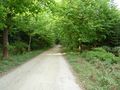
The way to the hashpoint
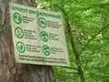
A sign
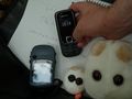
Marker, Hashcots, Mobile, GPS
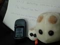
GPS, now readable
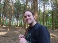
Stupid Grintm
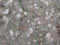
Sticks and no stones
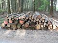
Cut down trees
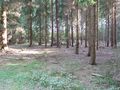
Place of the geocache
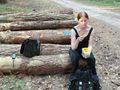
Picnic
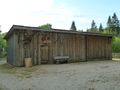
The forester's house of Bornberg
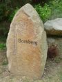
There's a stone, but no stick


Achievements
Bierhefe and his wife earned the Land geohash achievement
|
Bierhefe and his wife earned the Picnic achievement
|