Difference between revisions of "2011-05-21 50 -119"
imported>Juventas (more) |
imported>Juventas (all done) |
||
| Line 14: | Line 14: | ||
== Plans == | == Plans == | ||
| − | I was pouting because I had no achievable coordinates for [[Geohashing Day]]. Late in the day I decided it would be better to go as far as I could. | + | I was pouting because I had no easily achievable coordinates for [[Geohashing Day]]. Late in the day I decided it would be better to go as far as I could. |
== Expedition == | == Expedition == | ||
| − | + | I had [[2008-08-16_50_-119|been in the area]] back when I was new to geohashing. I got really close but decided to let nature win. I would totally be up for a rematch now, except being May instead of August I was sure it would be locked in with snow. If I hadn't slept in I could of attempted a long snowshoe. | |
| + | |||
| + | When I had been on this road three years ago, I remember thinking how rough and treacherous it was. Either they upgraded the road (unlikely) or all this geohashing had altered my perception of what was a good road. | ||
| + | |||
| + | As I gained altitude, I began driving through patches of snow, but at around 1200m it changed completely. There was only one set of tire tracks, and amusingly, they went a few meters meters ahead before reversing. I didn't have snow tires or chains, so I enjoyed some of the brisk air, then headed back. | ||
| + | |||
| + | Once back to civilization I did a little sight-seeing and took a few shots. Overall, much better than staying at home. I believe that's the point of all of this. | ||
== Tracklog == | == Tracklog == | ||
| Line 23: | Line 29: | ||
== Photos == | == Photos == | ||
| − | + | {{Gallery | |
| − | + | |File:2011-05-21_end.jpg| | |
| − | -- | + | |File:2011-05-21_blackbirds.jpg| |
| − | + | |File:2011-05-21_houseboats.jpg| | |
| − | + | }} | |
== Achievements == | == Achievements == | ||
Revision as of 03:17, 7 July 2011
| Sat 21 May 2011 in 50,-119: 50.3363335, -119.6496377 geohashing.info google osm bing/os kml crox |
Location
North of Bouleau Lake, west of Westside Road.
Participants
Plans
I was pouting because I had no easily achievable coordinates for Geohashing Day. Late in the day I decided it would be better to go as far as I could.
Expedition
I had been in the area back when I was new to geohashing. I got really close but decided to let nature win. I would totally be up for a rematch now, except being May instead of August I was sure it would be locked in with snow. If I hadn't slept in I could of attempted a long snowshoe.
When I had been on this road three years ago, I remember thinking how rough and treacherous it was. Either they upgraded the road (unlikely) or all this geohashing had altered my perception of what was a good road.
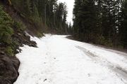
As I gained altitude, I began driving through patches of snow, but at around 1200m it changed completely. There was only one set of tire tracks, and amusingly, they went a few meters meters ahead before reversing. I didn't have snow tires or chains, so I enjoyed some of the brisk air, then headed back.
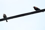
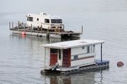
Once back to civilization I did a little sight-seeing and took a few shots. Overall, much better than staying at home. I believe that's the point of all of this.


