Difference between revisions of "2011-06-02 48 9"
From Geohashing
imported>Ekorren (template only by now, more to be added later) |
imported>Ekorren (gallery) |
||
| Line 17: | Line 17: | ||
<gallery> | <gallery> | ||
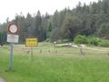
| + | File:2011-06-02_48_9_Lochenpass_Hst.JPG|They say, on Ascension Day, someone was taken up into the clouds. | ||
| + | File:2011-06-02_48_9_Lochen_Clouds.JPG|More clouds... | ||
| + | File:2011-06-02_48_9_Squirrel.JPG|Hello, brother? | ||
| + | File:2011-06-02_48_9_Battlesheep.JPG|Beware of the European Battlesheep Forces! | ||
| + | File:2011-06-02_48_9_Panzerueberrollbahn.JPG|Do I even want to know what a ''tank rolling over track'' is? | ||
| + | File:2011-06-02_48_9_Trueb_directions.JPG|I don't think I really want to follow ''any'' of these directions. | ||
| + | File:2011-06-02_48_9_Dreitrittenkapelle.JPG|An chapel which was, surprisingly enough. not broken down by the military. | ||
| + | File:2011-06-02_48_9_EMS_90deg.JPG|90 degree time - even marked. But shouldn't the marker say "XKCD" instead of "EMS"? | ||
| + | File:2011-06-02_48_9_Hashpoint.JPG|The hashpoint. Booring forest. | ||
| + | File:2011-06-02_48_9_GPS.JPG|yes yes, it's here | ||
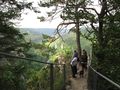
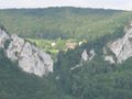
| + | File:2011-06-02_48_9_Muehlefels_1.JPG|View from the Mühlefels into the Donau valley, close to the hashpoint | ||
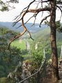
| + | File:2011-06-02_48_9_Muehlefels_2.JPG | ||
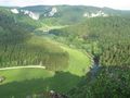
| + | File:2011-06-02_48_9_Knopfmacher_1.JPG|More famous views from the ''Button maker rock'' | ||
| + | File:2011-06-02_48_9_Knopfmacher_6.JPG | ||
| + | File:2011-06-02_48_9_Knopfmacher_2.JPG | ||
| + | File:2011-06-02_48_9_Knopfmacher_3.JPG | ||
| + | File:2011-06-02_48_9_Knopfmacher_4.JPG | ||
| + | File:2011-06-02_48_9_Knopfmacher_5.JPG|Before humans changed that, the Donau didn't have ''any'' water in summer. | ||
| + | |||
</gallery> | </gallery> | ||
Revision as of 09:22, 3 June 2011
| Thu 2 Jun 2011 in 48,9: 48.1066523, 9.0645868 geohashing.info google osm bing/os kml crox |
Contents
Location
A forest at Stetten am kalten Markt, high above the Donau valley
Participants
- Ekorren went there.
Expedition
Gallery
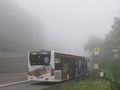
They say, on Ascension Day, someone was taken up into the clouds.
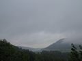
More clouds...
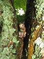
Hello, brother?
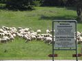
Beware of the European Battlesheep Forces!
Do I even want to know what a tank rolling over track is?
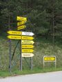
I don't think I really want to follow any of these directions.
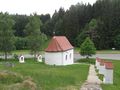
An chapel which was, surprisingly enough. not broken down by the military.
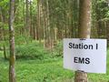
90 degree time - even marked. But shouldn't the marker say "XKCD" instead of "EMS"?
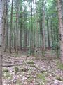
The hashpoint. Booring forest.
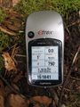
yes yes, it's here
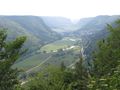
View from the Mühlefels into the Donau valley, close to the hashpoint
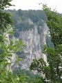
More famous views from the Button maker rock
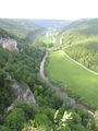
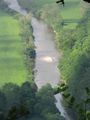
Before humans changed that, the Donau didn't have any water in summer.


