Difference between revisions of "2011-08-28 60 23"
From Geohashing
imported>Jusu |
imported>Jusu |
||
| Line 40: | Line 40: | ||
--> | --> | ||
<gallery widths=300px heights=225px perrow="3"> | <gallery widths=300px heights=225px perrow="3"> | ||
| − | + | Image:2011-08-28 60 23 Suokulmatie.jpg | Road Suokulmantie near the hash | |
| + | Image:2011-08-28 60 23 hash.jpg | Hash | ||
| + | Image:2011-08-28 60 23 GPS.jpg | GPS. Forgot to change the coordinate format. | ||
| + | Image:2011-08-28 60 23 Ervelantie.jpg | Also forgot to take pictures of scenic views, so here's just a random place along Erveläntie. | ||
</gallery> | </gallery> | ||
| Line 70: | Line 73: | ||
[[Category:Expeditions]] | [[Category:Expeditions]] | ||
| − | + | [[Category:Expeditions with photos]] | |
[[Category:Coordinates reached]] | [[Category:Coordinates reached]] | ||
Revision as of 14:16, 16 September 2011
| Sun 28 Aug 2011 in Salo, Finland: 60.2265003, 23.1970353 geohashing.info google osm bing/os kml crox |
Location
In forest about 50 m from road Suokulmantie in Ervelä, Salo. Topo map
Participants
Plans
About 5 km from home. Planning to cycle there. Tron achievement should be possible.
Expedition
Reached the spot by bike. More text etc. some day...
Tracklog
Photos
Coming...
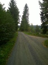
Road Suokulmantie near the hash
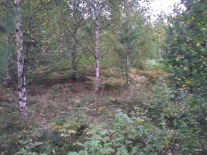
Hash
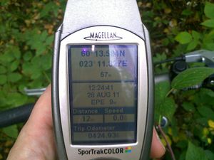
GPS. Forgot to change the coordinate format.
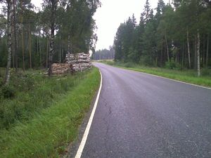
Also forgot to take pictures of scenic views, so here's just a random place along Erveläntie.


Achievements
Jusu earned the Tron achievement
|
Jusu earned the Bicycle geohash achievement
|