Difference between revisions of "2011-08-28 60 23"
From Geohashing
imported>Jusu |
imported>FippeBot m (Location) |
||
| (7 intermediate revisions by one other user not shown) | |||
| Line 1: | Line 1: | ||
| − | { { | + | <!-- If you did not specify these parameters in the template, please substitute appropriate values for IMAGE, LAT, LON, and DATE (YYYY-MM-DD format) |
| + | |||
| + | [[Image:{{{image|IMAGE}}}|thumb|left]] | ||
| + | |||
| + | Remove this section if you don't want an image at the top (left) of your report. You should remove the "Image:" or "File:" | ||
| + | tag from your image file name, and replace the all upper-case word IMAGE in the above line. | ||
| + | |||
| + | And DON'T FORGET to add your expedition and the best photo you took to the gallery on the Main Page! We'd love to read your report, but that means we first have to discover it! | ||
| + | --> | ||
| + | {{meetup graticule | ||
| + | | lat=60 | ||
| + | | lon=23 | ||
| + | | date=2011-08-28 | ||
| + | | graticule_name=Salo, Finland | ||
| + | | graticule_link=Salo, Finland | ||
| + | }} | ||
| + | |||
| + | <!-- edit as necessary --> | ||
| + | __NOTOC__ | ||
| + | == Location == | ||
| + | In forest about 50 m from road Suokulmantie in Ervelä, Salo. [http://bit.ly/quLx23 Topo map] | ||
| + | |||
| + | == Participants == | ||
| + | * [[User:Jusu|Jusu]] | ||
| + | |||
| + | == Plans == | ||
| + | About 5 km from home. Planning to cycle there. Tron achievement should be possible. | ||
| + | |||
| + | == Expedition == | ||
| + | Reached the spot by bike. Cloudy but rather warm weather. Light drizzle after reaching the hashpoint. | ||
| + | |||
| + | More text some day, I hope... | ||
| + | |||
| + | == Tracklog == | ||
| + | |||
| + | [http://www.wikiloc.com/wikiloc/view.do?&id=2012105 Tracklog] | ||
| + | |||
| + | == Photos == | ||
| + | <gallery widths=300px heights=225px perrow="3"> | ||
| + | Image:2011-08-28 60 23 Suokulmatie.jpg | Road Suokulmantie near the hash | ||
| + | Image:2011-08-28 60 23 hash.jpg | Hash | ||
| + | Image:2011-08-28 60 23 GPS.jpg | GPS. Forgot to change the coordinate format. | ||
| + | Image:2011-08-28 60 23 Ervelantie.jpg | Also forgot to take pictures of scenic views, so here's just a random place along Erveläntie. | ||
| + | </gallery> | ||
| + | |||
| + | == Achievements == | ||
| + | {{#vardefine:ribbonwidth|800px}} | ||
| + | <!-- Add any achievement ribbons you earned below, or remove this section --> | ||
| + | |||
| + | {{Tron | ||
| + | |||
| + | | latitude = 60 | ||
| + | | longitude = 23 | ||
| + | | date = 2011-08-28 | ||
| + | | tracklog = http://www.wikiloc.com/wikiloc/view.do?&id=2012105 | ||
| + | | possessive = his | ||
| + | | name = Jusu | ||
| + | <!-- | image = image name (optional) --> | ||
| + | |||
| + | }} | ||
| + | |||
| + | {{Bicycle geohash | ||
| + | | latitude = 60 | ||
| + | | longitude = 23 | ||
| + | | date = 2011-08-28 | ||
| + | | name = Jusu | ||
| + | | distance = 16.5 km | ||
| + | <!-- | image = image name (optional) --> | ||
| + | |||
| + | }} | ||
| + | |||
| + | [[Category:Expeditions]] | ||
| + | [[Category:Expeditions with photos]] | ||
| + | [[Category:Coordinates reached]] | ||
| + | {{location|FI|19}} | ||
Latest revision as of 00:41, 13 August 2019
| Sun 28 Aug 2011 in Salo, Finland: 60.2265003, 23.1970353 geohashing.info google osm bing/os kml crox |
Location
In forest about 50 m from road Suokulmantie in Ervelä, Salo. Topo map
Participants
Plans
About 5 km from home. Planning to cycle there. Tron achievement should be possible.
Expedition
Reached the spot by bike. Cloudy but rather warm weather. Light drizzle after reaching the hashpoint.
More text some day, I hope...
Tracklog
Photos
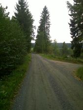
Road Suokulmantie near the hash
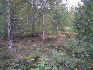
Hash
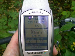
GPS. Forgot to change the coordinate format.
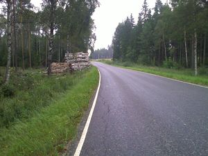
Also forgot to take pictures of scenic views, so here's just a random place along Erveläntie.


Achievements
Jusu earned the Tron achievement
|
Jusu earned the Bicycle geohash achievement
|