Difference between revisions of "2011-09-22 45 -121"
From Geohashing
imported>Kydlt (Created page with "{{meetup graticule | lat=45 | lon=-121 | date=2011-09-22 }} __NOTOC__ == Location == Cascade Locks == Participants == * Kydlt == Plans == I have a hike plane...") |
imported>Kydlt |
||
| Line 1: | Line 1: | ||
| − | {{meetup graticule | + | {{{meetup graticule |
| lat=45 | | lat=45 | ||
| lon=-121 | | lon=-121 | ||
| date=2011-09-22 | | date=2011-09-22 | ||
}} | }} | ||
| + | |||
| + | [[Image:2011-09-22 45 -121 flag in bushes text.jpg|thumb|left|300 px|I'm making these flags from crepe paper. That biodegrades faster than survey flagging.]] | ||
__NOTOC__ | __NOTOC__ | ||
| Line 19: | Line 21: | ||
== Expedition == | == Expedition == | ||
| − | A quick | + | A quick jump into the bushes by the tracks. It wasn't really the empty looking spot that was on the DOQQ. But it was only 20 ft in. I went at about 10 AM & left the marker, but I left the camera in the car. So I stopped on the way back through after a lovely hike up Eagle Creek to Loowit Falls. |
== Tracklog == | == Tracklog == | ||
<!-- if your GPS device keeps a log, you may post a link here --> | <!-- if your GPS device keeps a log, you may post a link here --> | ||
| + | [[File:2011-09-22 45-121csv track.txt|A shot in the dark at leaving a tracklog, as a csv-txt file.]]That didn't work. What form should the link here take ? | ||
| + | |||
== Photos == | == Photos == | ||
<gallery perrow="5"> | <gallery perrow="5"> | ||
| − | + | Image:2011-09-22 45 -121 flag.jpg |I was here. | |
| + | Image:2011-09-22 45 -121 gps face.jpg |What a terrible photo. It was glarey & I couldn't see what I was doing. | ||
| + | Image:2011-09-22 45 -121 Capture of track.jpg |This is a screen capture of my track displayed on the laptop. | ||
</gallery> | </gallery> | ||
Revision as of 03:41, 23 September 2011
{
| Thu 22 Sep 2011 in 45,-121: 45.6807443, -121.8521663 geohashing.info google osm bing/os kml crox |

Location
Cascade Locks
Participants
Plans
I have a hike planed on the Oregon side today, but the Hash looks to be right in Cascade Locks. I think that I'll go on the way.
Expedition
A quick jump into the bushes by the tracks. It wasn't really the empty looking spot that was on the DOQQ. But it was only 20 ft in. I went at about 10 AM & left the marker, but I left the camera in the car. So I stopped on the way back through after a lovely hike up Eagle Creek to Loowit Falls.
Tracklog
A shot in the dark at leaving a tracklog, as a csv-txt file.That didn't work. What form should the link here take ?
Photos
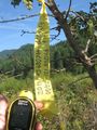
I was here.
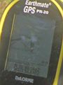
What a terrible photo. It was glarey & I couldn't see what I was doing.
- 2011-09-22 45 -121 Capture of track.jpg
This is a screen capture of my track displayed on the laptop.

