Difference between revisions of "2011-09-25 48 8"
From Geohashing
imported>Ekorren (creating page) |
imported>FippeBot m (Location) |
||
| (One intermediate revision by one other user not shown) | |||
| Line 18: | Line 18: | ||
== Gallery == | == Gallery == | ||
<gallery> | <gallery> | ||
| + | File:2011-09-25_48_8_Sky.JPG|Random sky impression | ||
| + | File:2011-09-25_48_8_HashForestFromAbove.JPG|Hash forest from above | ||
| + | File:2011-09-25_48_8_Breitenholz_1.JPG|View on hash village | ||
| + | File:2011-09-25_48_8_Breitenholz_2.JPG|Another view on hash village | ||
| + | File:2011-09-25_48_8_HashForest.JPG|Hash forest from below | ||
| + | File:2011-09-25_48_8_VFnH.JPG|View near hash | ||
| + | File:2011-09-25_48_8_GPS.JPG|Coordinates reached | ||
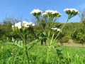
| + | File:2011-09-25_48_8_Flora_1.JPG|Flora near hash | ||
| + | File:2011-09-25_48_8_Flora_2.JPG| | ||
| + | File:2011-09-25_48_8_Road.JPG|Random road impression | ||
</gallery> | </gallery> | ||
| Line 24: | Line 34: | ||
[[Category:Expeditions with photos]] | [[Category:Expeditions with photos]] | ||
[[Category:Coordinates reached]] | [[Category:Coordinates reached]] | ||
| + | {{location|DE|BW|TÜ}} | ||
Latest revision as of 01:00, 13 August 2019
| Sun 25 Sep 2011 in 48,8: 48.5772031, 8.9483148 geohashing.info google osm bing/os kml crox |
Contents
Location
Ammerbuch-Breitenholz, a piece of forest just at the limits of the large Schönbuch forest.
Participants
Ekorren went there by bike
Expedition
Gallery
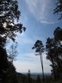
Random sky impression
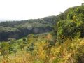
Hash forest from above
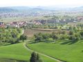
View on hash village
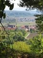
Another view on hash village
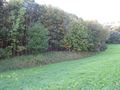
Hash forest from below
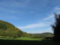
View near hash
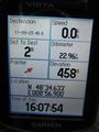
Coordinates reached
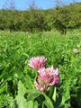
Flora near hash
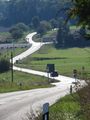
Random road impression


