Difference between revisions of "2011-12-14 30 -85"
From Geohashing
imported>Railey ([live picture] Gotta run! [http://www.openstreetmap.org/?lat=30.44401683&lon=-85.25206977&zoom=16&layers=B000FTF @30.4440,-85.2521]) |
imported>FippeBot m (Location) |
||
| (3 intermediate revisions by 3 users not shown) | |||
| Line 1: | Line 1: | ||
| − | |||
| − | |||
| − | |||
| − | |||
| − | |||
| − | |||
| − | |||
| − | |||
| − | |||
| − | |||
{{meetup graticule | {{meetup graticule | ||
| lat=30 | | lat=30 | ||
| Line 15: | Line 5: | ||
}} | }} | ||
| − | |||
__NOTOC__ | __NOTOC__ | ||
== Location == | == Location == | ||
| − | + | Near a tree in Florida | |
== Participants == | == Participants == | ||
| − | + | ||
| + | * [[User:Railey|Railey]] | ||
== Plans == | == Plans == | ||
| − | + | ||
| + | Unknown | ||
== Expedition == | == Expedition == | ||
| − | |||
| − | + | I guess someone went, fell over and took a picture of the hashpoint, and ran away. :-) | |
| − | |||
== Photos == | == Photos == | ||
| − | |||
| − | |||
| − | |||
<gallery perrow="5"> | <gallery perrow="5"> | ||
| Line 43: | Line 29: | ||
== Achievements == | == Achievements == | ||
{{#vardefine:ribbonwidth|800px}} | {{#vardefine:ribbonwidth|800px}} | ||
| − | |||
| − | |||
| − | + | * Land Geohash | |
| − | |||
| − | |||
| − | |||
| − | |||
| − | |||
| − | |||
| − | |||
[[Category:Expeditions]] | [[Category:Expeditions]] | ||
| − | |||
[[Category:Expeditions with photos]] | [[Category:Expeditions with photos]] | ||
| − | |||
| − | |||
| − | |||
| − | |||
| − | |||
[[Category:Coordinates reached]] | [[Category:Coordinates reached]] | ||
| − | + | {{location|US|FL|CA}} | |
| − | |||
| − | |||
| − | |||
| − | |||
| − | |||
| − | |||
| − | |||
| − | |||
| − | |||
Latest revision as of 04:24, 6 August 2019
| Wed 14 Dec 2011 in 30,-85: 30.4440275, -85.2520691 geohashing.info google osm bing/os kml crox |
Location
Near a tree in Florida
Participants
Plans
Unknown
Expedition
I guess someone went, fell over and took a picture of the hashpoint, and ran away. :-)
Photos
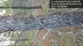
Gotta run! @30.4440,-85.2521

Achievements
- Land Geohash