Difference between revisions of "2011-12-14 34 -119"
From Geohashing
imported>S0meb0dy m (→Achievements) |
imported>GeorgDerReisende |
||
| Line 1: | Line 1: | ||
| − | |||
| − | |||
| − | |||
| − | |||
| − | |||
| − | |||
| − | |||
| − | |||
| − | |||
| − | |||
{{meetup graticule | {{meetup graticule | ||
| lat=34 | | lat=34 | ||
| Line 49: | Line 39: | ||
<!-- Add any achievement ribbons you earned below, or remove this section --> | <!-- Add any achievement ribbons you earned below, or remove this section --> | ||
| − | |||
| − | |||
[[Category:Expeditions]] | [[Category:Expeditions]] | ||
[[Category:Expeditions with photos]] | [[Category:Expeditions with photos]] | ||
[[Category:Coordinates reached]] | [[Category:Coordinates reached]] | ||
Revision as of 20:43, 14 November 2014
| Wed 14 Dec 2011 in 34,-119: 34.4440275, -119.2520691 geohashing.info google osm bing/os kml crox |
Location
Right on the Ojai Valley Trail, next to the parking lot of a church in Ojai.
Participants
Plans
I planned to get here much earlier than I did. s0meb0dy
Expedition
I literally drove into the parking lot closest to the hash point, climbed between the railing to stand on the trail and I was there. It would only have been easier if I hadn't had to drive there.
Tracklog
Photos
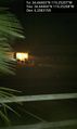
Nighttime Hash, my first. Woohoo! @34.4440,-119.2521
