Difference between revisions of "2012-01-13 58 17"
imported>Cjk ([live picture] Stuff bought [http://www.openstreetmap.org/?lat=59.18071849&lon=18.16100523&zoom=16&layers=B000FTF @59.1807,18.1610]) |
m (Eliminating redlinks) |
||
| (28 intermediate revisions by 4 users not shown) | |||
| Line 1: | Line 1: | ||
| + | [[Image:{{{image|2012-01-13_58_17_11-56-48-444.jpg}}}|thumb|left]] | ||
| − | |||
| − | |||
| − | |||
| − | |||
| − | |||
| − | |||
| − | |||
| − | |||
| − | |||
{{meetup graticule | {{meetup graticule | ||
| lat=58 | | lat=58 | ||
| Line 19: | Line 11: | ||
== Location == | == Location == | ||
<!-- where you've surveyed the hash to be --> | <!-- where you've surveyed the hash to be --> | ||
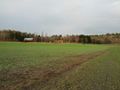
| + | In a frozen field of planted short grass. | ||
== Participants == | == Participants == | ||
<!-- who attended --> | <!-- who attended --> | ||
| − | + | [[User:Cjk|Carl-Johan]] | |
== Plans == | == Plans == | ||
<!-- what were the original plans --> | <!-- what were the original plans --> | ||
| + | The plan was to do a multihash, of the 6 closest graticules to Stockholm, Sweden. For once the Nynäshamn geohash was not in the Baltic ocean and the Norrköping one was close to Stockholm, and while I already was driving might as well do one more west, then go north and try to do 3 on the way back, Fagersta, Sala and east of Arlanda airport. | ||
| + | |||
| + | I reached these 4 of my planned graticules. | ||
| + | |||
| + | *[[2012-01-13 58 17]] | ||
| + | *[[2012-01-13 58 16]] | ||
| + | *[[2012-01-13 58 15]] | ||
| + | *[[2012-01-13 59 15]] | ||
| + | |||
| + | And didn't have time to do these: | ||
| + | *{{egl|2012-01-13|59|16}} | ||
| + | *{{egl|2012-01-13|59|17}} | ||
== Expedition == | == Expedition == | ||
<!-- how it all turned out. your narrative goes here. --> | <!-- how it all turned out. your narrative goes here. --> | ||
| + | You can check my route [https://maps.google.com/maps?saddr=Flottbrov%C3%A4gen+27,+112+64+Stockholm,+Stockholms+l%C3%A4n,+Sweden&daddr=59.30517,18.00996+to:59.306448,18.017306+to:59.2994893,18.0287815+to:59.18088,18.16046+to:58.9300977,17.8396551+to:58.91866,16.82562+to:58.92249,16.82876+to:58.9187053,15.8502461+to:59.926403,15.835663+to:Lindhagensgatan,+Stockholm,+Sverige&hl=en&ie=UTF8&ll=59.464617,17.424316&spn=2.112859,4.42749&sll=59.179095,18.153963&sspn=0.03329,0.06918&geocode=FQ8yiQMdv4ASASmN4_OKOnZfRjHIQueI5iEGhQ%3BFdLsiAMdaM8SASkz0DcCtHdfRjGVPZ2KwZoY0A%3BFdDxiAMdGuwSASm5mKcEt3dfRjF6ADN0NziS2A%3BFaHWiAMd7RgTASnNsih7vHdfRjEqR0h5AFAijA%3BFVAHhwMdTBsVASk1DqXHeXxfRjGKOjEk7XarYg%3BFbEzgwMdJzYQASl1ipGC31xfRjFAirUY8_4AEw%3BFQQHgwMdFL0AASkL4Dy5_NdeRjFgLFgX8_4AEw%3BFfoVgwMdWMkAASlvdxZb_NdeRjFgKVgX8_4AEw%3BFTEHgwMdBtvxACl3yWqfnq1eRjGBLMYY8_4AEw%3BFYNnkgMdD6LxAClv5NsdcsNdRjFg3ccX8_4AEw%3BFb9hiQMdc94SASlFBJC0gJ1fRjEisAkQ_1jHqw&oq=lindha&vpsrc=6&mra=dpe&mrsp=4&sz=14&via=1,2,3,4,5,6,7,8,9&t=m&z=8 here]. | ||
| + | |||
| + | Got into the car and drove south. Stopped for gas first since the plan was to do more than 600 km. Then south on the 73 towards Nynäshamn. I stopped at Biltema to get a car lighter splitter and a usb outlet for 12V so I could have the phone plugged in and on all the time. Also got a flashlight. | ||
| + | |||
| + | Onwards towards Nynäshamn and then take a right at the correct exit. Found the field, which was frozen and very featureless took some pictures but I had nothing to mark with. Should have bought some paint or something. | ||
| + | |||
| + | Then onto the next geohash! [[2012-01-13 58 16]] | ||
| − | |||
| − | |||
== Photos == | == Photos == | ||
| Line 42: | Line 52: | ||
Image:2012-01-13_58_17_10-37-25-934.jpg | Gas [http://www.openstreetmap.org/?lat=59.30554594&lon=18.00965798&zoom=16&layers=B000FTF @59.3055,18.0097] | Image:2012-01-13_58_17_10-37-25-934.jpg | Gas [http://www.openstreetmap.org/?lat=59.30554594&lon=18.00965798&zoom=16&layers=B000FTF @59.3055,18.0097] | ||
| − | Image:2012-01-13_58_17_11-02-19-729.jpg | | + | Image:2012-01-13_58_17_11-02-19-729.jpg | Biltema [http://www.openstreetmap.org/?lat=59.18028133&lon=18.16101101&zoom=16&layers=B000FTF @59.1803,18.1610] |
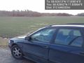
Image:2012-01-13_58_17_11-12-04-824.jpg | Stuff bought [http://www.openstreetmap.org/?lat=59.18071849&lon=18.16100523&zoom=16&layers=B000FTF @59.1807,18.1610] | Image:2012-01-13_58_17_11-12-04-824.jpg | Stuff bought [http://www.openstreetmap.org/?lat=59.18071849&lon=18.16100523&zoom=16&layers=B000FTF @59.1807,18.1610] | ||
| + | |||
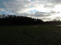
| + | Image:2012-01-13_58_17_11-47-06-712.jpg | Field [http://www.openstreetmap.org/?lat=58.92892205&lon=17.83863740&zoom=16&layers=B000FTF @58.9289,17.8386] | ||
| + | |||
| + | Image:2012-01-13_58_17_11-56-48-444.jpg | Me with grin, [http://deathfromabove1979.com/ Death from Above 1979] [http://www.openstreetmap.org/?lat=58.92646318&lon=17.83794288&zoom=16&layers=B000FTF @58.9265,17.8379] | ||
| + | |||
| + | Image:2012-01-13_58_17_22-48-23-105.jpg | On the 73 going South | ||
| + | |||
| + | Image:2012-01-13_58_17_22-49-20-963.jpg | Farm | ||
| + | |||
| + | Image:2012-01-13_58_17_22-49-56-358.jpg | Towards car | ||
| + | |||
| + | Image:2012-01-13_58_17_22-51-02-846.jpg | Sun is low on horizon in winter. | ||
| + | |||
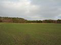
| + | Image:2012-01-13_58_17_22-52-07-422.jpg | Panorama 1 | ||
| + | |||
| + | Image:2012-01-13_58_17_22-53-55-517.jpg | Panorama 2 | ||
</gallery> | </gallery> | ||
| Line 50: | Line 76: | ||
{{#vardefine:ribbonwidth|800px}} | {{#vardefine:ribbonwidth|800px}} | ||
<!-- Add any achievement ribbons you earned below, or remove this section --> | <!-- Add any achievement ribbons you earned below, or remove this section --> | ||
| + | {{land geohash | latitude = 58 | longitude = 17 | date = 2012-01-13 | name = Carl-Johan | image = 2012-01-13_58_17_11-56-48-444.jpg }} | ||
| + | {{Frozen Geohash | latitude = 58 | longitude = 17 | date = 2012-01-13 | | name = Carl-Johan | image = 2012-01-13_58_16_22-56-46-467.jpg }} | ||
| + | {{Minesweeper geohash | graticule = Norrköping, Sweden | ranknumber = 4 | w = true | ne = true | e = true | nw = true| name = Carl-Johan }} | ||
| + | {{Multihash2 | count = 4 | date = 2012-01-13 | name = Carl-Johan | }} | ||
| + | {{police geohash | latitude = 58 | longitude = 16 | date = 2012-01-13 | encounter = riding behind cop car on freeway | name = Carl-Johan | image = 2012-01-13_58_16_02-56-13-803.jpg }} | ||
| − | |||
| − | |||
| − | |||
| − | |||
| − | |||
| − | |||
| − | |||
| − | |||
| − | |||
| − | |||
| − | |||
[[Category:Expeditions]] | [[Category:Expeditions]] | ||
| − | |||
[[Category:Expeditions with photos]] | [[Category:Expeditions with photos]] | ||
| − | |||
| − | |||
| − | |||
| − | |||
| − | |||
[[Category:Coordinates reached]] | [[Category:Coordinates reached]] | ||
| − | + | {{location|SE|AB}} | |
| − | |||
| − | |||
| − | |||
| − | |||
| − | |||
| − | |||
| − | |||
| − | |||
| − | |||
Latest revision as of 13:36, 21 March 2020

| Fri 13 Jan 2012 in 58,17: 58.9261262, 17.8381610 geohashing.info google osm bing/os kml crox |
Location
In a frozen field of planted short grass.
Participants
Plans
The plan was to do a multihash, of the 6 closest graticules to Stockholm, Sweden. For once the Nynäshamn geohash was not in the Baltic ocean and the Norrköping one was close to Stockholm, and while I already was driving might as well do one more west, then go north and try to do 3 on the way back, Fagersta, Sala and east of Arlanda airport.
I reached these 4 of my planned graticules.
And didn't have time to do these:
Expedition
You can check my route here.
Got into the car and drove south. Stopped for gas first since the plan was to do more than 600 km. Then south on the 73 towards Nynäshamn. I stopped at Biltema to get a car lighter splitter and a usb outlet for 12V so I could have the phone plugged in and on all the time. Also got a flashlight.
Onwards towards Nynäshamn and then take a right at the correct exit. Found the field, which was frozen and very featureless took some pictures but I had nothing to mark with. Should have bought some paint or something.
Then onto the next geohash! 2012-01-13 58 16
Photos
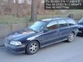
Start of drive @59.3230,17.9896
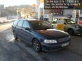
Gas @59.3055,18.0097
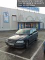
Biltema @59.1803,18.1610
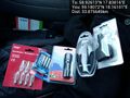
Stuff bought @59.1807,18.1610
Field @58.9289,17.8386

Me with grin, Death from Above 1979 @58.9265,17.8379
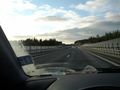
On the 73 going South
Farm
Towards car
Sun is low on horizon in winter.
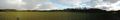
Panorama 1
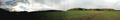
Panorama 2


Achievements
Carl-Johan earned the Land geohash achievement
|

Carl-Johan achieved level 4 of the Minesweeper Geohash achievement
|
Carl-Johan earned the Multihash Achievement
|
Carl-Johan earned the Police Geohash Achievement
|