Difference between revisions of "2012-01-17 60 17"
imported>Cjk ([live picture] Old barn) |
imported>FippeBot m (Location) |
||
| (18 intermediate revisions by 2 users not shown) | |||
| Line 1: | Line 1: | ||
| + | [[Image:{{{image|2012-01-17 60 17 13-48-14-331.jpg}}}|thumb|left]] | ||
| − | |||
| − | |||
| − | |||
| − | |||
| − | |||
| − | |||
| − | |||
| − | |||
| − | |||
{{meetup graticule | {{meetup graticule | ||
| lat=60 | | lat=60 | ||
| Line 19: | Line 11: | ||
== Location == | == Location == | ||
<!-- where you've surveyed the hash to be --> | <!-- where you've surveyed the hash to be --> | ||
| + | In the woods north of a field in the middle of nowhere NE of Uppsala, towards Östhammar. | ||
== Participants == | == Participants == | ||
<!-- who attended --> | <!-- who attended --> | ||
| + | [[User:Cjk|Carl-Johan]] | ||
== Plans == | == Plans == | ||
<!-- what were the original plans --> | <!-- what were the original plans --> | ||
| + | To do this one after [[2012-01-17 60 18]], and maybe try [[2012-01-17 60 17]] as well. | ||
== Expedition == | == Expedition == | ||
<!-- how it all turned out. your narrative goes here. --> | <!-- how it all turned out. your narrative goes here. --> | ||
| + | It was a bit twisty to get from the [[Östhammar, Sweden]] graticule to this one, but eventually I got on the Uppsala road and I could make good progress. Then as usual, the shortest route isn't always a very good road, so as I turned off the Uppsala road I found myself on ice and slush on a gravel road that only was wide enough for one car. Scandinavian flicks in the corners to get the car around them was fun though. | ||
| + | Eventually I got back onto a 90 km/h road that got me close to where to turn into the forest. Last 5 km, now going east towards the hash was like a Rally Special Stage. All snow and slush on gravel and twisting and undulating. More practice for my Scandinavian flicks and handbrake turns. At last I came to the tiny gravel path leading south to some form of house I had scouted on google maps. I parked a bit from the house not to disturb anyone. But they weren't home anyway. No tracks in the snow. I hiked into the field that I thought would lead to the hash, but I was a tiny bit too much south, should have gone for the top NW corner of the field instead of straight W. Through some trees and onto a clear cut. A lot of the land was very marshy but it was all frozen underneath the slush. | ||
| − | *In the woods -- [[User:Cjk| | + | Into some pines on the far side of the clear cut and I was meters away. Found the right pine that was the hash point. Took some pictures and a panorama. Made an xkcd marker with some sticks, scrambled a Rubik's cube, and solved it. Made a tiny snow man of the slushy snow to get a snowman achievement. And headed back. Say lots of tracks both to and from the point, some of them very fresh. |
| − | + | ||
| − | + | Got in the car and drove to the E4 and headed back. Too tired for trying another graticule. East-west roads are just to bad. | |
| + | Saw some more Rozzers on the way back to Stockholm. Another Police Achivement. | ||
| + | |||
| + | *In the woods -- [[User:Cjk|Carl-Johan]] [http://www.openstreetmap.org/?lat=60.07219650&lon=17.81424397&zoom=16&layers=B000FTF @60.0722,17.8142] 07:40, 17 January 2012 (EST) | ||
== Photos == | == Photos == | ||
| Line 40: | Line 40: | ||
<gallery perrow="5"> | <gallery perrow="5"> | ||
| − | Image:2012-01-17_60_17_13-47-34-661.jpg | Sloshy and I [http://www.openstreetmap.org/?lat=60.07195091&lon=17.81387583&zoom=16&layers=B000FTF @60.0720,17.8139] | + | Image:2012-01-17_60_17_13-47-34-661.jpg | [http://hrwiki.org/wiki/sloshy Sloshy] and I [http://www.openstreetmap.org/?lat=60.07195091&lon=17.81387583&zoom=16&layers=B000FTF @60.0720,17.8139] |
Image:2012-01-17_60_17_13-48-14-331.jpg | At the spot [http://www.openstreetmap.org/?lat=60.07207928&lon=17.81399938&zoom=16&layers=B000FTF @60.0721,17.8140] | Image:2012-01-17_60_17_13-48-14-331.jpg | At the spot [http://www.openstreetmap.org/?lat=60.07207928&lon=17.81399938&zoom=16&layers=B000FTF @60.0721,17.8140] | ||
| Line 71: | Line 71: | ||
Image:2012-01-17_60_17_22-36-13-314.jpg | Old barn | Image:2012-01-17_60_17_22-36-13-314.jpg | Old barn | ||
| + | |||
| + | Image:2012-01-17_60_17_22-36-42-759.jpg | Another old house | ||
| + | |||
| + | Image:2012-01-17_60_17_22-37-35-365.jpg | Find my way back again | ||
| + | |||
| + | Image:2012-01-17_60_17_22-38-24-651.jpg | Snow | ||
| + | |||
| + | Image:2012-01-17_60_17_22-38-56-886.jpg | Clearcut | ||
| + | |||
| + | Image:2012-01-17_60_17_22-39-35-255.jpg | Human tracks? | ||
| + | |||
| + | Image:2012-01-17_60_17_22-39-58-301.jpg | Animal tracks | ||
| + | |||
| + | Image:2012-01-17_60_17_22-40-26-032.jpg | Tipped tree | ||
| + | |||
| + | Image:2012-01-17_60_17_22-40-47-997.jpg | Tight fit | ||
| + | |||
| + | Image:2012-01-17_60_17_22-41-26-572.jpg | Coming out of woods | ||
| + | |||
| + | Image:2012-01-17_60_17_22-42-00-622.jpg | Field with old farm in background | ||
| + | |||
| + | Image:2012-01-17_60_17_22-42-28-161.jpg | Deer tracks | ||
| + | |||
| + | Image:2012-01-17_60_17_22-42-57-744.jpg | Ditch | ||
| + | |||
| + | Image:2012-01-17_60_17_22-43-32-958.jpg | Old barn again | ||
| + | |||
| + | Image:2012-01-17_60_17_22-44-02-920.jpg | Rozzers | ||
</gallery> | </gallery> | ||
| Line 76: | Line 104: | ||
{{#vardefine:ribbonwidth|800px}} | {{#vardefine:ribbonwidth|800px}} | ||
<!-- Add any achievement ribbons you earned below, or remove this section --> | <!-- Add any achievement ribbons you earned below, or remove this section --> | ||
| + | {{land geohash | latitude = 60 | longitude = 17 | date = 2012-01-17 | name = Carl-Johan }} | ||
| + | {{Minesweeper geohash | graticule = Uppsala, Sweden | ranknumber = 5 | n = true | ne = true | e = true | s = true | sw = true| name = Carl-Johan }} | ||
| + | {{Multihash | latitude1 = 60 | longitude1 = 18 | latitude2 = 60 | longitude2 = 17 | date = 2012-01-17 | name = Carl-Johan }} | ||
| + | {{police geohash | latitude = 60 | longitude = 17 | date = 2012-01-17 | name = Carl-Johan | image = 2012-01-17_60_17_22-44-02-920.jpg }} | ||
| + | {{snowman geohash | latitude = 60 | longitude = 17 | date = 2012-01-17 | name = Carl-Johan | image = 2012-01-17_60_17_13-55-30-676.jpg }} | ||
| + | [[Category:Expeditions]] | ||
| − | + | [[Category:Expeditions with photos]] | |
| − | |||
| − | [[Category: | ||
| − | |||
| − | |||
| − | |||
| − | |||
| − | |||
| − | |||
| − | |||
| − | |||
| − | |||
| − | |||
| − | |||
| − | |||
| − | |||
| − | |||
[[Category:Coordinates reached]] | [[Category:Coordinates reached]] | ||
| − | + | {{location|SE|C}} | |
| − | |||
| − | |||
| − | |||
| − | |||
| − | |||
| − | |||
| − | |||
| − | |||
| − | |||
Latest revision as of 02:06, 13 August 2019

| Tue 17 Jan 2012 in 60,17: 60.0720090, 17.8140328 geohashing.info google osm bing/os kml crox |
Location
In the woods north of a field in the middle of nowhere NE of Uppsala, towards Östhammar.
Participants
Plans
To do this one after 2012-01-17 60 18, and maybe try 2012-01-17 60 17 as well.
Expedition
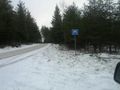
It was a bit twisty to get from the Östhammar, Sweden graticule to this one, but eventually I got on the Uppsala road and I could make good progress. Then as usual, the shortest route isn't always a very good road, so as I turned off the Uppsala road I found myself on ice and slush on a gravel road that only was wide enough for one car. Scandinavian flicks in the corners to get the car around them was fun though.
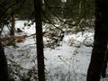
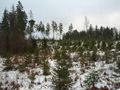
Eventually I got back onto a 90 km/h road that got me close to where to turn into the forest. Last 5 km, now going east towards the hash was like a Rally Special Stage. All snow and slush on gravel and twisting and undulating. More practice for my Scandinavian flicks and handbrake turns. At last I came to the tiny gravel path leading south to some form of house I had scouted on google maps. I parked a bit from the house not to disturb anyone. But they weren't home anyway. No tracks in the snow. I hiked into the field that I thought would lead to the hash, but I was a tiny bit too much south, should have gone for the top NW corner of the field instead of straight W. Through some trees and onto a clear cut. A lot of the land was very marshy but it was all frozen underneath the slush.
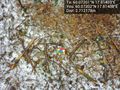
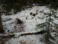
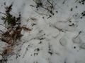
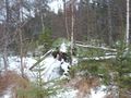
Into some pines on the far side of the clear cut and I was meters away. Found the right pine that was the hash point. Took some pictures and a panorama. Made an xkcd marker with some sticks, scrambled a Rubik's cube, and solved it. Made a tiny snow man of the slushy snow to get a snowman achievement. And headed back. Say lots of tracks both to and from the point, some of them very fresh.
Got in the car and drove to the E4 and headed back. Too tired for trying another graticule. East-west roads are just to bad. Saw some more Rozzers on the way back to Stockholm. Another Police Achivement.
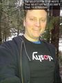
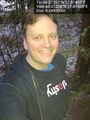
- In the woods -- Carl-Johan @60.0722,17.8142 07:40, 17 January 2012 (EST)
Photos
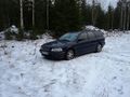
Sloshy and I @60.0720,17.8139
At the spot @60.0721,17.8140
Panorama 1 @60.0720,17.8141
Panorama 2 @60.0720,17.8139
Rubik's unsolved @60.0720,17.8141
Rubik's solved @60.0720,17.8139
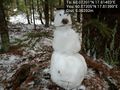
Dodgy snowman @60.0720,17.8140
Slushy roads
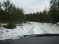
Last km
Park then walk
Snowy
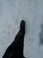
Snow under feet
Walking
Where's my cottage?
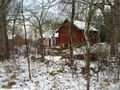
Old barn
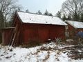
Another old house
Find my way back again
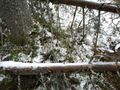
Snow
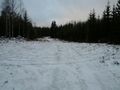
Clearcut
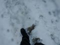
Human tracks?
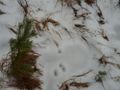
Animal tracks
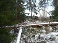
Tipped tree
Tight fit
Coming out of woods
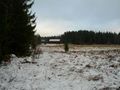
Field with old farm in background
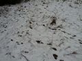
Deer tracks
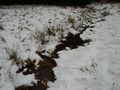
Ditch
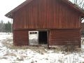
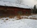
Old barn again
Rozzers


Achievements
Carl-Johan earned the Land geohash achievement
|
Carl-Johan achieved level 5 of the Minesweeper Geohash achievement
|
Carl-Johan earned the Multihash Achievement
|
Carl-Johan earned the Police Geohash Achievement
|
Carl-Johan earned the Snowman Geohash Achievement
|