Difference between revisions of "2012-01-17 60 18"
imported>Cjk ([live picture] Panorama 2 [http://www.openstreetmap.org/?lat=60.07204177&lon=18.81423075&zoom=16&layers=B000FTF @60.0720,18.8142]) |
m (per Renaming Proposal) |
||
| (17 intermediate revisions by 3 users not shown) | |||
| Line 1: | Line 1: | ||
| + | [[Image:{{{image|2012-01-17 60 18 12-12-22-682.jpg}}}|thumb|left]] | ||
| − | |||
| − | |||
| − | |||
| − | |||
| − | |||
| − | |||
| − | |||
| − | |||
{{meetup graticule | {{meetup graticule | ||
| lat=60 | | lat=60 | ||
| Line 19: | Line 12: | ||
== Location == | == Location == | ||
<!-- where you've surveyed the hash to be --> | <!-- where you've surveyed the hash to be --> | ||
| + | Behind a summer house in a weirdo summer village near the coast. | ||
== Participants == | == Participants == | ||
<!-- who attended --> | <!-- who attended --> | ||
| + | [[User:Cjk|Carl-Johan]] | ||
== Plans == | == Plans == | ||
<!-- what were the original plans --> | <!-- what were the original plans --> | ||
| + | To got to this and [[2012-01-17 60 17]] by car. And of course deflower this [[Virgin Graticule]] | ||
== Expedition == | == Expedition == | ||
<!-- how it all turned out. your narrative goes here. --> | <!-- how it all turned out. your narrative goes here. --> | ||
| + | The weather was really gray, but since the latitude was really low today it was possible to reach the hash in [[Östhammar, Sweden]] so it was worth it. Got to the car and started driving to the E18 and then towards Norrtälje. I rolled up behind the Rozzers as the Britons say so this makes it a Police Achivement. I needed to get some food at Mickey D anyway so I just did that. | ||
| + | |||
| + | Went through Norrtälje and onto the 76 that turned into the 283. After the turn off the 283 the road was just all slush. It was +2 or +3 C all day though and no wind so no Frozen Geohash and pretty comfy. Then a sharp left onto what felt like the craziest narrow raised road in the middle of the forrest. And it was dead straight for a lot of the time. Google Maps lead me on a wild goose chase into the wrong vacation village but I soon found the right one. Parked the car and walked though the abandoned backyard of one of the cabins. | ||
| − | + | Found the spot at the edge of the forest and took some pictures and saw a birdhouse. | |
| − | + | ||
| + | Then onto the next one! [[2012-01-17 60 17]] | ||
| + | |||
| + | *Nice vacation village here. -- [[User:Cjk|Carl-Johan]] [http://www.openstreetmap.org/?lat=60.07212480&lon=18.81393411&zoom=16&layers=B000FTF @60.0721,18.8139] 06:15, 17 January 2012 (EST) | ||
== Photos == | == Photos == | ||
| Line 38: | Line 40: | ||
<gallery perrow="5"> | <gallery perrow="5"> | ||
| − | Image:2012-01-17_60_18_12-12-22-682.jpg | Me and QOTSA [http://www.openstreetmap.org/?lat=60.07191420&lon=18.81406898&zoom=16&layers=B000FTF @60.0719,18.8141] | + | Image:2012-01-17_60_18_12-12-22-682.jpg | Me and [http://www.qotsa.com/ QOTSA] [http://www.openstreetmap.org/?lat=60.07191420&lon=18.81406898&zoom=16&layers=B000FTF @60.0719,18.8141] |
Image:2012-01-17_60_18_12-13-03-631.jpg | Village [http://www.openstreetmap.org/?lat=60.07207878&lon=18.81419982&zoom=16&layers=B000FTF @60.0721,18.8142] | Image:2012-01-17_60_18_12-13-03-631.jpg | Village [http://www.openstreetmap.org/?lat=60.07207878&lon=18.81419982&zoom=16&layers=B000FTF @60.0721,18.8142] | ||
| Line 49: | Line 51: | ||
Image:2012-01-17_60_18_12-15-04-593.jpg | Panorama 2 [http://www.openstreetmap.org/?lat=60.07204177&lon=18.81423075&zoom=16&layers=B000FTF @60.0720,18.8142] | Image:2012-01-17_60_18_12-15-04-593.jpg | Panorama 2 [http://www.openstreetmap.org/?lat=60.07204177&lon=18.81423075&zoom=16&layers=B000FTF @60.0720,18.8142] | ||
| + | |||
| + | Image:2012-01-17_60_18_22-15-23-418.jpg | Start of drive | ||
| + | |||
| + | Image:2012-01-17_60_18_22-16-38-718.jpg | Farbror blå, uncle blue | ||
| + | |||
| + | Image:2012-01-17_60_18_22-17-20-776.jpg | Slushy roads | ||
| + | |||
| + | Image:2012-01-17_60_18_22-17-51-515.jpg | Wrong village | ||
| + | |||
| + | Image:2012-01-17_60_18_22-18-26-945.jpg | Parked | ||
| + | |||
| + | Image:2012-01-17_60_18_22-19-04-779.jpg | Outhouse? | ||
| + | |||
| + | Image:2012-01-17_60_18_22-19-31-511.jpg | Cottage | ||
| + | |||
| + | Image:2012-01-17_60_18_22-20-00-785.jpg | At the hash | ||
</gallery> | </gallery> | ||
| Line 54: | Line 72: | ||
{{#vardefine:ribbonwidth|800px}} | {{#vardefine:ribbonwidth|800px}} | ||
<!-- Add any achievement ribbons you earned below, or remove this section --> | <!-- Add any achievement ribbons you earned below, or remove this section --> | ||
| + | {{land geohash | latitude = 60 | longitude = 18 | date = 2012-01-17 | name = Carl-Johan }} | ||
| + | {{Graticule unlocked| latitude = 60 | longitude = 18 | date = 2012-01-17 | name = Carl-Johan | image = 2012-01-17 60 18 12-12-22-682.jpg }} | ||
| + | {{Minesweeper geohash | graticule = Uppsala, Sweden | ranknumber = 5 | n = true | ne = true | e = true | s = true | sw = true| name = Carl-Johan }} | ||
| + | {{Multihash | latitude1 = 60 | longitude1 = 18 | latitude2 = 60 | longitude2 = 17 | date = 2012-01-17 | name = Carl-Johan }} | ||
| + | {{police geohash | latitude = 60 | longitude = 18 | date = 2012-01-17 | name = Carl-Johan }} | ||
| + | [[Category:Expeditions]] | ||
| − | + | [[Category:Expeditions with photos]] | |
| − | |||
| − | [[Category: | ||
| − | |||
| − | |||
| − | |||
| − | |||
| − | |||
| − | |||
| − | |||
| − | |||
| − | |||
| − | |||
| − | |||
| − | |||
| − | |||
| − | |||
[[Category:Coordinates reached]] | [[Category:Coordinates reached]] | ||
| − | + | {{location|SE|AB}} | |
| − | |||
| − | |||
| − | |||
| − | |||
| − | |||
| − | |||
| − | |||
| − | |||
| − | |||
Latest revision as of 05:47, 20 March 2024

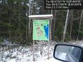
| Tue 17 Jan 2012 in 60,18: 60.0720090, 18.8140328 geohashing.info google osm bing/os kml crox |
Location
Behind a summer house in a weirdo summer village near the coast.
Participants
Plans
To got to this and 2012-01-17 60 17 by car. And of course deflower this Virgin Graticule
Expedition
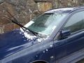
The weather was really gray, but since the latitude was really low today it was possible to reach the hash in Östhammar, Sweden so it was worth it. Got to the car and started driving to the E18 and then towards Norrtälje. I rolled up behind the Rozzers as the Britons say so this makes it a Police Achivement. I needed to get some food at Mickey D anyway so I just did that.
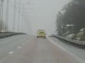
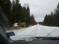
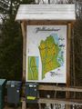
Went through Norrtälje and onto the 76 that turned into the 283. After the turn off the 283 the road was just all slush. It was +2 or +3 C all day though and no wind so no Frozen Geohash and pretty comfy. Then a sharp left onto what felt like the craziest narrow raised road in the middle of the forrest. And it was dead straight for a lot of the time. Google Maps lead me on a wild goose chase into the wrong vacation village but I soon found the right one. Parked the car and walked though the abandoned backyard of one of the cabins.
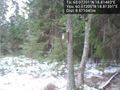
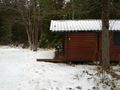
Found the spot at the edge of the forest and took some pictures and saw a birdhouse.
Then onto the next one! 2012-01-17 60 17
- Nice vacation village here. -- Carl-Johan @60.0721,18.8139 06:15, 17 January 2012 (EST)
Photos

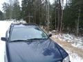
Me and QOTSA @60.0719,18.8141
Village @60.0721,18.8142
Birdhouse @60.0721,18.8139
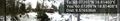
Panorama 1 @60.0721,18.8141
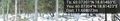
Panorama 2 @60.0720,18.8142
Start of drive
Farbror blå, uncle blue
Slushy roads
Wrong village
Parked
Outhouse?
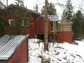
Cottage

At the hash


Achievements
Carl-Johan earned the Land geohash achievement
|
Carl-Johan earned the Graticule Unlocked Achievement
|
Carl-Johan achieved level 5 of the Minesweeper Geohash achievement
|
Carl-Johan earned the Multihash Achievement
|
Carl-Johan earned the Police Geohash Achievement
|