Difference between revisions of "2012-01-20 58 14"
imported>Cjk ([retro picture] Sun popped out.) |
m (per Renaming Proposal) |
||
| (16 intermediate revisions by 3 users not shown) | |||
| Line 1: | Line 1: | ||
| + | [[Image:{{{image|2012-01-20_58_14_14-00-22-740.jpg}}}|thumb|left]] | ||
| − | |||
| − | |||
| − | |||
| − | |||
| − | |||
| − | |||
| − | |||
| − | |||
| − | |||
{{meetup graticule | {{meetup graticule | ||
| lat=58 | | lat=58 | ||
| Line 19: | Line 11: | ||
== Location == | == Location == | ||
<!-- where you've surveyed the hash to be --> | <!-- where you've surveyed the hash to be --> | ||
| + | In the woods just off the E4, near the end of a logging road. | ||
== Participants == | == Participants == | ||
<!-- who attended --> | <!-- who attended --> | ||
| + | [[User:Cjk|Carl-Johan]] | ||
== Plans == | == Plans == | ||
<!-- what were the original plans --> | <!-- what were the original plans --> | ||
| + | Check out the driven route google maps [https://maps.google.com/maps?saddr=Unknown+road&daddr=59.212477849568,17.949532351249+to:59.2251414,17.940631+to:58.212477849568,14.949532351249+to:58.22327,14.9481+to:58.261201,14.960958+to:58.212477849568,13.949532351249+to:58.41773,13.46604+to:58.212477849568,12.949532351249+to:58.212477849568,11.949532351249+to:Gamla+Almedalsv%C3%A4gen,+G%C3%B6teborg,+Sverige&hl=en&ie=UTF8&ll=58.967004,14.72168&spn=2.764406,7.064209&sll=58.322472,13.927917&sspn=0.703866,1.766052&geocode=FaBViQMdPPYSAQ%3BFb6ChwMdXOMRAQ%3BFTW0hwMdl8ARASk_Ue4L4HBfRjGg8H0Y8_4AEw%3BFX5AeAMdnBzkAA%3BFaZqeAMdBBfkACmxoQVAyixaRjGhZ9QX8_4AEw%3BFdH-eAMdPknkACmRNKuwEdNbRjGwLtQX8_4AEw%3BFX5AeAMdXNrUAA%3BFUJiewMduHnNAClbsR387B9bRjFB3dMIeJABEw%3BFX5AeAMdHJjFAA%3BFX5AeAMd3FW2AA%3BFW08cAMd9Ri3ACmnXh_PovNPRjFVaq2VXx8y7g&vpsrc=6&mra=dvme&mrsp=7&sz=9&via=2,4,5,7&t=h&z=7 here]! | ||
| + | Since I was going down to Onsala for my mom's 65th birthday anyway this weekend, why not try to get some [[Virgin Graticule|virgin graticules]] on the way down. And what do you know, 5 of them lined up next to great roads like E4, 26, 193, 46, 47, E20 and E6. This time, going East-West was going to be easy. And three of them were virgins! Time to deflower. | ||
| + | |||
| + | *[[2012-01-20 59 17]] | ||
| + | *[[2012-01-20 58 14]] Virgin [[Tranås, Sweden]] | ||
| + | *[[2012-01-20 58 13]] Virgin [[Skövde, Sweden]] | ||
| + | *[[2012-01-20 58 12]] | ||
| + | *[[2012-01-20 58 11]] Virgin [[Uddevalla, Sweden]] | ||
| + | |||
== Expedition == | == Expedition == | ||
<!-- how it all turned out. your narrative goes here. --> | <!-- how it all turned out. your narrative goes here. --> | ||
| + | Started off from [[2012-01-20 59 17]] and got back to the E4 and headed SW. Now it turns out that the navigation in the Galaxy Nexus does not give exactly the same routes as the ones in google maps, so if you check the link above you can see a loop. That is where my phone took my on a wild ride, onto a gravel road, and the first thing that happens is that the car understeers in a corner in maybe 40 km/h and it just wants to go straight into a fence, and just touching the brakes causes the ABS to work double time. I regain control at around 20 km/h but this road is dangerous. It was humidity that had frozen over, and you couldn't even see it. The next 5 km is the most twisty, windy, hilly, narrow piece of dirt you can imagine, and when google says I'm there, it is 1 km left still. I try continuing a bit past a much better road, and I loose connectivity so I can't see where I'm supposed to go, but I realize I need to be one logging road further to the west. | ||
| + | So detour 1 km and find the right one. The weirdest part was that this logging road was named! Park at the end of line and hike into the woods. They are totally from one of Astrid Lindgrens stories. Find the spot even though the trees interfere with the GPS. It is featureless gray skies so someone could easily get lost and eaten by trolls. | ||
| + | I deflower this Graticule so I'm pleased. | ||
| + | Make it back to the car, and on the way back to the E4 I find the correct nice 70-road that the GPS should have taken me on. Don't trust the GPS blindly! | ||
| − | *Deflowered -- [[User:Cjk| | + | Onwards to [[2012-01-20 58 13]]! |
| − | + | ||
| − | + | *Deflowered -- [[User:Cjk|Carl-Johan]] [http://www.openstreetmap.org/?lat=58.21245277&lon=14.94969201&zoom=16&layers=B000FTF @58.2125,14.9497] 07:57, 20 January 2012 (EST) | |
== Photos == | == Photos == | ||
| Line 40: | Line 47: | ||
<gallery perrow="5"> | <gallery perrow="5"> | ||
| − | Image:2012-01-20_58_14_14-00-22-740.jpg | Double peace [http://www.openstreetmap.org/?lat=58.21262187&lon=14.94960702&zoom=16&layers=B000FTF @58.2126,14.9496] | + | Image:2012-01-20_58_14_20-05-44-331.jpg | Sun popped out. |
| + | |||
| + | Image:2012-01-20_58_14_14-00-22-740.jpg | Double peace, the sign of [http://www.myspace.com/beatme Electric Eel Shock] [http://www.openstreetmap.org/?lat=58.21262187&lon=14.94960702&zoom=16&layers=B000FTF @58.2126,14.9496] | ||
| + | |||
| + | Image:2012-01-20_58_14_20-07-41-086.jpg | Panorama | ||
| + | |||
| + | Image:2012-01-20_58_14_20-09-19-855.jpg | Way back | ||
| − | Image:2012-01-20_58_14_20- | + | Image:2012-01-20_58_14_20-10-12-379.jpg | Trees |
| + | |||
| + | Image:2012-01-20_58_14_20-10-38-491.jpg | Boulders | ||
| + | |||
| + | Image:2012-01-20_58_14_20-11-22-301.jpg | Trolls? | ||
| + | |||
| + | Image:2012-01-20_58_14_20-12-32-653.jpg | Hobbits? | ||
| + | |||
| + | Image:2012-01-20_58_14_20-13-41-416.jpg | Deer shit | ||
| + | |||
| + | Image:2012-01-20_58_14_20-14-28-490.jpg | Found my way back | ||
</gallery> | </gallery> | ||
| Line 48: | Line 71: | ||
{{#vardefine:ribbonwidth|800px}} | {{#vardefine:ribbonwidth|800px}} | ||
<!-- Add any achievement ribbons you earned below, or remove this section --> | <!-- Add any achievement ribbons you earned below, or remove this section --> | ||
| + | {{land geohash | latitude = 58 | longitude = 14 | date = 2012-01-20 | name = [[User:Cjk|Carl-Johan]] }} | ||
| + | {{Police geohash | latitude = 58 | longitude = 14 | date = 2012-01-20 | name = [[User:Cjk|Carl-Johan]] | image = 2012-01-20_59_17_19-55-25-831.jpg }} | ||
| + | {{Multihash2 | count = 5 | date = 2012-01-20 | name = [[User:Cjk|Carl-Johan]] }} | ||
| + | {{Graticule unlocked | latitude = 58 | longitude = 14 | date = 2012-01-20 | name = [[User:Cjk|Carl-Johan]] | image = 2012-01-20_58_14_14-00-22-740.jpg }} | ||
| − | + | [[Category:Expeditions]] | |
| − | |||
| − | [[Category: | ||
| − | |||
| − | |||
| − | |||
| − | |||
| − | |||
| − | |||
| − | |||
| − | |||
[[Category:Expeditions with photos]] | [[Category:Expeditions with photos]] | ||
| − | |||
| − | |||
| − | |||
| − | |||
[[Category:Coordinates reached]] | [[Category:Coordinates reached]] | ||
| − | + | {{location|SE|E}} | |
| − | |||
| − | |||
| − | |||
| − | |||
| − | |||
| − | |||
| − | |||
| − | |||
| − | |||
Latest revision as of 05:46, 20 March 2024

| Fri 20 Jan 2012 in 58,14: 58.2124778, 14.9495324 geohashing.info google osm bing/os kml crox |
Location
In the woods just off the E4, near the end of a logging road.
Participants
Plans
Check out the driven route google maps here!
Since I was going down to Onsala for my mom's 65th birthday anyway this weekend, why not try to get some virgin graticules on the way down. And what do you know, 5 of them lined up next to great roads like E4, 26, 193, 46, 47, E20 and E6. This time, going East-West was going to be easy. And three of them were virgins! Time to deflower.
- 2012-01-20 59 17
- 2012-01-20 58 14 Virgin Tranås, Sweden
- 2012-01-20 58 13 Virgin Skövde, Sweden
- 2012-01-20 58 12
- 2012-01-20 58 11 Virgin Uddevalla, Sweden
Expedition
Started off from 2012-01-20 59 17 and got back to the E4 and headed SW. Now it turns out that the navigation in the Galaxy Nexus does not give exactly the same routes as the ones in google maps, so if you check the link above you can see a loop. That is where my phone took my on a wild ride, onto a gravel road, and the first thing that happens is that the car understeers in a corner in maybe 40 km/h and it just wants to go straight into a fence, and just touching the brakes causes the ABS to work double time. I regain control at around 20 km/h but this road is dangerous. It was humidity that had frozen over, and you couldn't even see it. The next 5 km is the most twisty, windy, hilly, narrow piece of dirt you can imagine, and when google says I'm there, it is 1 km left still. I try continuing a bit past a much better road, and I loose connectivity so I can't see where I'm supposed to go, but I realize I need to be one logging road further to the west.
So detour 1 km and find the right one. The weirdest part was that this logging road was named! Park at the end of line and hike into the woods. They are totally from one of Astrid Lindgrens stories. Find the spot even though the trees interfere with the GPS. It is featureless gray skies so someone could easily get lost and eaten by trolls. I deflower this Graticule so I'm pleased. Make it back to the car, and on the way back to the E4 I find the correct nice 70-road that the GPS should have taken me on. Don't trust the GPS blindly!
Onwards to 2012-01-20 58 13!
- Deflowered -- Carl-Johan @58.2125,14.9497 07:57, 20 January 2012 (EST)
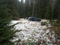
Photos
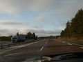
Sun popped out.

Double peace, the sign of Electric Eel Shock @58.2126,14.9496
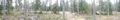
Panorama
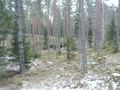
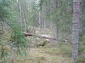
Way back
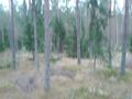
Trees
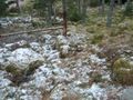
Boulders
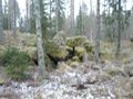
Trolls?
Hobbits?
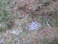
Deer shit
Found my way back


Achievements
Carl-Johan earned the Land geohash achievement
|
Carl-Johan earned the Police Geohash Achievement
|
Carl-Johan earned the Multihash Achievement
|
Carl-Johan earned the Graticule Unlocked Achievement
|