Difference between revisions of "2012-01-29 60 16"
From Geohashing
imported>Cjk |
imported>Cjk |
||
| Line 1: | Line 1: | ||
| − | + | [[Image:{{{image|2012-01-29_60_16_12-36-18-693.jpg}}}|thumb|left]] | |
| − | |||
| − | [[Image:{{{image| | ||
| − | |||
| − | |||
| − | |||
| − | |||
| − | |||
| − | |||
{{meetup graticule | {{meetup graticule | ||
| lat=60 | | lat=60 | ||
| Line 18: | Line 10: | ||
== Location == | == Location == | ||
<!-- where you've surveyed the hash to be --> | <!-- where you've surveyed the hash to be --> | ||
| + | Between a private road and the lake Storljusen near Sala. | ||
== Participants == | == Participants == | ||
<!-- who attended --> | <!-- who attended --> | ||
| + | *[[User:Cjk|Carl-Johan]] | ||
== Plans == | == Plans == | ||
<!-- what were the original plans --> | <!-- what were the original plans --> | ||
| + | Since todays latitude was really low, that meant that [[Sandviken, Sweden]] and [[Falun, Sweden]] was reachable to fill up my minesweeper achievement. So the plan was to drive like [https://maps.google.com/maps?saddr=Unknown+road&daddr=59.3322502,18.0190163+to:59.3568681,17.8759693+to:STORLJUSEN+109,+733+99+M%C3%B6klinta,+Sweden+to:60.11199,16.04703+to:59.99535,15.80814+to:Unknown+road+to:Stora+Essingen,+Sweden&hl=en&ie=UTF8&ll=59.949509,16.787109&spn=2.082477,4.42749&sll=60.006539,15.746155&sspn=0.129922,0.276718&geocode=FWJViQMd7_YSAQ%3BFZpWiQMdyPISASl1Wgm6KnZfRjHR_5MjxFC_yw%3BFcS2iQMdAcQQASmFApFDKp5fRjFQjsAY8_4AEw%3BFfi4kwMdAff6ACk9Lm6DBwxeRjGJy_shGyNLhQ%3BFXY8lQMdttv0ACmrDfEpn-VdRjFwDMAY8_4AEw%3BFdZ0kwMdjDbxACmvBy03DsJdRjGQhdIY8_4AEw%3BFSerkwMd0p_rAA%3BFVIqiQMdzn0SASlJL6EROnZfRjEprsNwAWPNsg&oq=stora+&mra=dpe&mrsp=5&sz=12&via=1,2,4,5&t=m&z=8 this]. | ||
| + | |||
| + | *[[2012-01-29 60 16]] | ||
| + | *[[2012-01-29 60 15]] | ||
| + | |||
| + | == Video == | ||
| + | A short video of me having fun on the frozen lake just north of the hash: [http://www.youtube.com/watch?v=-d8P_LOWSMI youtube] | ||
== Expedition == | == Expedition == | ||
Revision as of 22:15, 29 January 2012

| Sun 29 Jan 2012 in 60,16: 60.0125897, 16.4476091 geohashing.info google osm bing/os kml crox |
Location
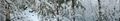
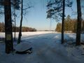
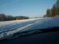
Between a private road and the lake Storljusen near Sala.
Participants
Plans
Since todays latitude was really low, that meant that Sandviken, Sweden and Falun, Sweden was reachable to fill up my minesweeper achievement. So the plan was to drive like this.
Video
A short video of me having fun on the frozen lake just north of the hash: youtube
Expedition
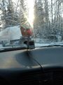
- -3C, sun, powdered snow -- Cjk @60.0125,16.4476 06:31, 29 January 2012 (EST)
Tracklog
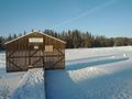
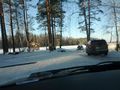
Photos
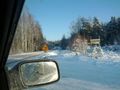
Moose hunt in progress
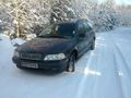
Good place to park
In there somewhere

DFA1979 @60.0126,16.4476

Nice day for a hash @60.0126,16.4476
Panorama 1 @60.0126,16.4477
Panorama 2 @60.0126,16.4477
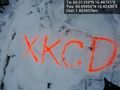
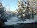
Marked @59.9995,16.4243
The spot
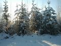
Back at the car
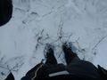
Can you drive out on the lake?
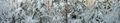
Storljusen boat society, it really is a lake.
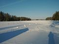
Seems like you can drive on it.
People coming from the ice
It is holding
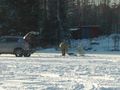
Local beaver protector
Local snow scooter guys


Achievements