Difference between revisions of "2012-02-03 32 -116"
imported>Scerruti m (Creating expedition page.) |
m (per Renaming Proposal) |
||
| (15 intermediate revisions by 3 users not shown) | |||
| Line 1: | Line 1: | ||
| + | [[Image:{{{image|Geohash2012020332-116.jpg}}}|thumb|left]] | ||
| − | |||
| − | |||
| − | |||
| − | |||
| − | |||
| − | |||
| − | |||
| − | |||
| − | |||
{{meetup graticule | {{meetup graticule | ||
| − | | lat= | + | | lat=32 |
| − | | lon= | + | | lon=-116 |
| − | | date= | + | | date=2012-02-03 |
}} | }} | ||
| − | + | ||
__NOTOC__ | __NOTOC__ | ||
== Location == | == Location == | ||
| − | + | ||
| + | On the south shoulder of Interstate 8, 3/4 of a mile before exit 34, East Willows Rd. | ||
| + | |||
== Participants == | == Participants == | ||
| − | + | ||
| + | * [[user:scerruti|scerruti]], | ||
| + | * A' and | ||
| + | * D* | ||
== Plans == | == Plans == | ||
| − | + | ||
| + | The original plan was to fully document the location and then send it out to a bunch of my Indian Guides friends who are all camping nearby this weekend. Hopefully one or two would stop or even arrange to meet at as specific time. | ||
== Expedition == | == Expedition == | ||
| − | |||
| − | + | The original plans were destroyed when my laptop power cord failed leaving me in the dark with regards to electronic communication. This meant no massive gathering on the side of I-8, perhaps a good thing? In addition my packing was significantly delayed. At one point I had decided to delay my trip until the next morning. This decision was reversed and my visit to the hash point was saved when I received a call from my wife, who was celebrating what she calls "mom's weekend" with my tribe chief's wife, telling me to stop by and pick up the crank for the chief's pop up trailer before I left town. | |
| − | + | ||
| + | Leaving home later than expected without any friends in tow, A' and D*, my offspring, and I drove to the hashpoint. Normally i would have gotten out of the vehicle and taken pictures and perhaps done a jig but darkness and a busy Interstate precluded those activities. The hash point being achieved within the margin of error for my equipment we rolled on to a Star Wars themed camping weekend including pod races and rocket launching. | ||
| + | |||
== Photos == | == Photos == | ||
| − | + | ||
| − | + | ||
| − | |||
<gallery perrow="5"> | <gallery perrow="5"> | ||
| + | |||
| + | Image:2012-02-03_32_-116_19-21-57-174.jpg | Made it [http://www.openstreetmap.org/?lat=32.83844888&lon=-116.70041693&zoom=16&layers=B000FTF @32.8384,-116.7004] | ||
</gallery> | </gallery> | ||
== Achievements == | == Achievements == | ||
{{#vardefine:ribbonwidth|800px}} | {{#vardefine:ribbonwidth|800px}} | ||
| − | |||
| + | {{land geohash | ||
| + | |||
| + | | latitude = 32 | ||
| + | | longitude = -116 | ||
| + | | date = 2012-02-03 | ||
| + | | name = scerruti | ||
| + | | image = | ||
| + | |||
| + | }} | ||
| + | {{Graticule unlocked | ||
| + | |||
| + | | latitude = 32 | ||
| + | | longitude = -116 | ||
| + | | date = 2012-02-03 | ||
| + | | name = scerruti | ||
| + | | image = | ||
| + | |||
| + | }} | ||
| + | |||
| + | Does not, in my opinion, qualify for Speed Racer because a) I stopped, b) I did not have a friend take a picture of me driving and c) the hash point was on the soft shoulder about a foot over the curb. | ||
| + | |||
| + | I need to research whether my sons are geohashers or drag alongs. | ||
| − | |||
| − | |||
| − | |||
| − | |||
| − | |||
| − | |||
| − | |||
| − | |||
[[Category:Expeditions]] | [[Category:Expeditions]] | ||
| − | + | ||
[[Category:Expeditions with photos]] | [[Category:Expeditions with photos]] | ||
| − | |||
| − | |||
| − | |||
| − | |||
| − | |||
[[Category:Coordinates reached]] | [[Category:Coordinates reached]] | ||
| − | + | {{location|US|CA|SD}} | |
| − | |||
| − | |||
| − | |||
| − | |||
| − | |||
| − | |||
| − | |||
| − | |||
| − | |||
Latest revision as of 05:45, 20 March 2024

| Fri 3 Feb 2012 in 32,-116: 32.8384373, -116.7004557 geohashing.info google osm bing/os kml crox |
Location
On the south shoulder of Interstate 8, 3/4 of a mile before exit 34, East Willows Rd.
Participants
- scerruti,
- A' and
- D*
Plans
The original plan was to fully document the location and then send it out to a bunch of my Indian Guides friends who are all camping nearby this weekend. Hopefully one or two would stop or even arrange to meet at as specific time.
Expedition
The original plans were destroyed when my laptop power cord failed leaving me in the dark with regards to electronic communication. This meant no massive gathering on the side of I-8, perhaps a good thing? In addition my packing was significantly delayed. At one point I had decided to delay my trip until the next morning. This decision was reversed and my visit to the hash point was saved when I received a call from my wife, who was celebrating what she calls "mom's weekend" with my tribe chief's wife, telling me to stop by and pick up the crank for the chief's pop up trailer before I left town.
Leaving home later than expected without any friends in tow, A' and D*, my offspring, and I drove to the hashpoint. Normally i would have gotten out of the vehicle and taken pictures and perhaps done a jig but darkness and a busy Interstate precluded those activities. The hash point being achieved within the margin of error for my equipment we rolled on to a Star Wars themed camping weekend including pod races and rocket launching.
Photos
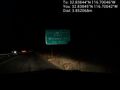
Made it @32.8384,-116.7004

Achievements
scerruti earned the Land geohash achievement
|
scerruti earned the Graticule Unlocked Achievement
|
Does not, in my opinion, qualify for Speed Racer because a) I stopped, b) I did not have a friend take a picture of me driving and c) the hash point was on the soft shoulder about a foot over the curb.
I need to research whether my sons are geohashers or drag alongs.