Difference between revisions of "2012-02-26 59 17"
imported>Cjk ([live picture] Park the car at a high spot so I can get out again. [http://www.openstreetmap.org/?lat=59.00020000&lon=17.48520000&zoom=16&layers=B000FTF @59.0002,17.4852]) |
imported>FippeBot m (Location) |
||
| (5 intermediate revisions by one other user not shown) | |||
| Line 1: | Line 1: | ||
| + | [[Image:{{{image|2012-02-26_59_17_16-32-16-557.jpg}}}|thumb|left]] | ||
| − | |||
| − | |||
| − | |||
| − | |||
| − | |||
| − | |||
| − | |||
| − | |||
| − | |||
{{meetup graticule | {{meetup graticule | ||
| lat=59 | | lat=59 | ||
| Line 19: | Line 11: | ||
== Location == | == Location == | ||
<!-- where you've surveyed the hash to be --> | <!-- where you've surveyed the hash to be --> | ||
| + | In the woods near a logging road SW of Hölö. | ||
== Participants == | == Participants == | ||
<!-- who attended --> | <!-- who attended --> | ||
| + | *[[User:Cjk|Carl-Johan]] | ||
== Plans == | == Plans == | ||
<!-- what were the original plans --> | <!-- what were the original plans --> | ||
| + | Drive there before the sun sets. | ||
== Expedition == | == Expedition == | ||
<!-- how it all turned out. your narrative goes here. --> | <!-- how it all turned out. your narrative goes here. --> | ||
| + | Drove down the E4 to Hölö and headed towards the hash. Turns out the road was very hilly and pretty much just ice and snow and more of a track than at road. I was afraid that some of the hills I was going down would be very slippery and hard to get back up again so I was planning to stop at a high point so I wouldn't get stuck. Found a nice one 100m or so from the hash. | ||
| + | |||
| + | Headed into the woods up a hill and the GPS acted up as usual with all the trees and a big rock outcrop nearby. Got as close as I could but the GPS didn't update very often and sometimes I was 10 m north of it, sometimes 10m south and the accuracy kept going from very exact to very inexact. Finally found a spot that was good enough. | ||
| + | |||
| + | *In the woods again -- [[User:Cjk|Carl-Johan]] [http://www.openstreetmap.org/?lat=58.99997151&lon=17.48364679&zoom=16&layers=B000FTF @59.0000,17.4836] 16:28, 26 February 2012 (CET) | ||
| + | Hear and saw a tiny bird singing actually below me on the hill. Marked the spot and snapped some pics before heading back to the car. | ||
| − | + | Made a 13-point turn to get the car around and headed back towards civilization and on one of the hills I was in second gear and the anti-spin was trying its best to not give power to the wheels and I stalled. Had to back up and get a good head start and in first gear I made it up the hill. I continued as fast as i dared and at one point in a corner going down hill the car understeered like crazy and all four wheels were sliding but careful braking and giving some gas and pointing the car in the right direction I made it. Back to the E4 and back to receiving the great news about [[2012-02-26_global]]! | |
== Tracklog == | == Tracklog == | ||
<!-- if your GPS device keeps a log, you may post a link here --> | <!-- if your GPS device keeps a log, you may post a link here --> | ||
| + | [http://maps.google.com/maps/ms?msa=0&msid=209560846421673743077.0004b9e72ec27017f3842 map] | ||
== Photos == | == Photos == | ||
| Line 40: | Line 42: | ||
<gallery perrow="5"> | <gallery perrow="5"> | ||
| − | Image:2012-02-26_59_17_16-32-16-557.jpg | Grin [http://www.openstreetmap.org/?lat=59.00000000&lon=17.48340000&zoom=16&layers=B000FTF @59.0000,17.4834] | + | Image:2012-02-26_59_17_18-04-23-820.jpg | Park the car at a high spot so I can get out again. [http://www.openstreetmap.org/?lat=59.00020000&lon=17.48520000&zoom=16&layers=B000FTF @59.0002,17.4852] |
| + | |||
| + | Image:2012-02-26_59_17_18-05-26-447.jpg | In there [http://www.openstreetmap.org/?lat=58.99970000&lon=17.48460000&zoom=16&layers=B000FTF @58.9997,17.4846] | ||
| + | |||
| + | Image:2012-02-26_59_17_16-32-16-557.jpg | Grin with [https://www.youtube.com/watch?v=1LLAN29W-4w&ob=av2e Battles] [http://www.openstreetmap.org/?lat=59.00000000&lon=17.48340000&zoom=16&layers=B000FTF @59.0000,17.4834] | ||
Image:2012-02-26_59_17_16-32-42-463.jpg | Marker [http://www.openstreetmap.org/?lat=59.00010000&lon=17.48360000&zoom=16&layers=B000FTF @59.0001,17.4836] | Image:2012-02-26_59_17_16-32-42-463.jpg | Marker [http://www.openstreetmap.org/?lat=59.00010000&lon=17.48360000&zoom=16&layers=B000FTF @59.0001,17.4836] | ||
| Line 48: | Line 54: | ||
Image:2012-02-26_59_17_16-33-34-609.jpg | [http://www.openstreetmap.org/?lat=59.00004573&lon=17.48365014&zoom=16&layers=B000FTF @59.0000,17.4837] | Image:2012-02-26_59_17_16-33-34-609.jpg | [http://www.openstreetmap.org/?lat=59.00004573&lon=17.48365014&zoom=16&layers=B000FTF @59.0000,17.4837] | ||
| − | Image:2012-02-26_59_17_18- | + | Image:2012-02-26_59_17_18-08-16-603.jpg | Big drop messing with GPS [http://www.openstreetmap.org/?lat=59.00010000&lon=17.48380000&zoom=16&layers=B000FTF @59.0001,17.4838] |
| + | |||
| + | Image:2012-02-26_59_17_18-09-20-932.jpg | Logging track back to the "road" [http://www.openstreetmap.org/?lat=59.00010000&lon=17.48380000&zoom=16&layers=B000FTF @59.0001,17.4838] | ||
</gallery> | </gallery> | ||
| Line 54: | Line 62: | ||
{{#vardefine:ribbonwidth|800px}} | {{#vardefine:ribbonwidth|800px}} | ||
<!-- Add any achievement ribbons you earned below, or remove this section --> | <!-- Add any achievement ribbons you earned below, or remove this section --> | ||
| − | + | {{land geohash | latitide = 59 | longitude = 18 |date = 2012-02-26 | name = [[User:Cjk|Carl-Johan]]}} | |
<!-- =============== USEFUL CATEGORIES FOLLOW ================ | <!-- =============== USEFUL CATEGORIES FOLLOW ================ | ||
Delete the next line ONLY if you have chosen the appropriate categories below. If you are unsure, don't worry. People will read your report and help you with the classification. --> | Delete the next line ONLY if you have chosen the appropriate categories below. If you are unsure, don't worry. People will read your report and help you with the classification. --> | ||
| − | |||
| − | |||
<!-- Potential categories. Please include all the ones appropriate to your expedition --> | <!-- Potential categories. Please include all the ones appropriate to your expedition --> | ||
<!-- If this is a planning page: | <!-- If this is a planning page: | ||
| Line 72: | Line 78: | ||
[[Category:Expedition without GPS]] | [[Category:Expedition without GPS]] | ||
--> | --> | ||
| − | + | [[Category:Expeditions]] | |
| + | [[Category:Expeditions with photos]] | ||
| + | [[Category:Coordinates reached]] | ||
| + | |||
<!-- if you reached your coords: | <!-- if you reached your coords: | ||
[[Category:Coordinates reached]] | [[Category:Coordinates reached]] | ||
| Line 85: | Line 94: | ||
[[Category:Not reached - Did not attempt]] when you went to an alternate location, or decided early on to abort the expedition. | [[Category:Not reached - Did not attempt]] when you went to an alternate location, or decided early on to abort the expedition. | ||
--> | --> | ||
| + | {{location|SE|AB}} | ||
Latest revision as of 02:33, 13 August 2019

| Sun 26 Feb 2012 in 59,17: 59.0000466, 17.4837187 geohashing.info google osm bing/os kml crox |
Location
In the woods near a logging road SW of Hölö.
Participants
Plans
Drive there before the sun sets.
Expedition
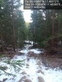
Drove down the E4 to Hölö and headed towards the hash. Turns out the road was very hilly and pretty much just ice and snow and more of a track than at road. I was afraid that some of the hills I was going down would be very slippery and hard to get back up again so I was planning to stop at a high point so I wouldn't get stuck. Found a nice one 100m or so from the hash.
Headed into the woods up a hill and the GPS acted up as usual with all the trees and a big rock outcrop nearby. Got as close as I could but the GPS didn't update very often and sometimes I was 10 m north of it, sometimes 10m south and the accuracy kept going from very exact to very inexact. Finally found a spot that was good enough.
- In the woods again -- Carl-Johan @59.0000,17.4836 16:28, 26 February 2012 (CET)
Hear and saw a tiny bird singing actually below me on the hill. Marked the spot and snapped some pics before heading back to the car.
Made a 13-point turn to get the car around and headed back towards civilization and on one of the hills I was in second gear and the anti-spin was trying its best to not give power to the wheels and I stalled. Had to back up and get a good head start and in first gear I made it up the hill. I continued as fast as i dared and at one point in a corner going down hill the car understeered like crazy and all four wheels were sliding but careful braking and giving some gas and pointing the car in the right direction I made it. Back to the E4 and back to receiving the great news about 2012-02-26_global!
Tracklog
Photos
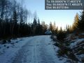
Park the car at a high spot so I can get out again. @59.0002,17.4852
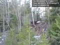
In there @58.9997,17.4846

Grin with Battles @59.0000,17.4834
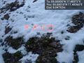
Marker @59.0001,17.4836
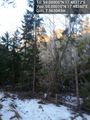
Big drop messing with GPS @59.0001,17.4838
Logging track back to the "road" @59.0001,17.4838


Achievements
Carl-Johan earned the Land geohash achievement
|