Difference between revisions of "2012-03-16 54 -3"
imported>RunawayBomber (→Expedition) |
imported>FippeBot m (Location) |
||
| (6 intermediate revisions by 3 users not shown) | |||
| Line 17: | Line 17: | ||
__NOTOC__ | __NOTOC__ | ||
== Location == | == Location == | ||
| − | Near | + | Near Fingland, England |
== Participants == | == Participants == | ||
| Line 62: | Line 62: | ||
Image:2012-03-16_54_-3_14-11-44-793.jpg | [http://www.openstreetmap.org/?lat=54.90300000&lon=-3.15318000&zoom=16&layers=B000FTF @54.9030,-3.1532] | Image:2012-03-16_54_-3_14-11-44-793.jpg | [http://www.openstreetmap.org/?lat=54.90300000&lon=-3.15318000&zoom=16&layers=B000FTF @54.9030,-3.1532] | ||
| + | |||
| + | Image:2012-03-16_54_-3_16-27-14-257.jpg | New boots! | ||
</gallery> | </gallery> | ||
== Achievements == | == Achievements == | ||
| − | |||
| − | |||
| + | None, sadly. Far too simple a hash for any of that nonsense. | ||
| − | |||
| − | |||
| − | |||
| − | |||
| − | |||
| − | |||
| − | |||
| − | |||
| − | |||
| − | |||
[[Category:Expeditions]] | [[Category:Expeditions]] | ||
| − | + | [[Category:Coordinates reached]] | |
[[Category:Expeditions with photos]] | [[Category:Expeditions with photos]] | ||
| − | + | {{location|GB|ENG|CMA}} | |
| − | |||
| − | |||
| − | |||
| − | |||
| − | |||
| − | |||
| − | |||
| − | |||
| − | |||
| − | |||
| − | |||
| − | |||
| − | |||
| − | |||
| − | |||
Latest revision as of 02:58, 13 August 2019
| Fri 16 Mar 2012 in 54,-3: 54.9029366, -3.1530995 geohashing.info google osm bing/os kml crox |
Location
Near Fingland, England
Participants
Plans
Given that it was Matingslinkys' turn to drive, the plan was to meet at RunawayBomber's flat and travel the short 7 mile journey along pretty much one road to the hash-point.
Expedition
This expedition had really very little excitement to be honest.
It was 7 miles away, and in a field, and that's about as exciting as it gets.
Matingslinkys did buy some new walking boots and used this hash to break them in a bit, and they were rather comfortable.
We saw a farmer in his blue tractor and we waved at him. He didn't see us.
It was drizzling, and a little bit breezy, but not enough to qualify for drowned rat status.
George was about 300 feet from where we parked the car, kinda in a hedge a little bit.
There was an interesting discrepancy between our GPS readings, but Matingslinkys' was wavering between 5 and 1 feet, so we called it, took the arduous walk back to the car and called it a day.
Tracklog
Google MyTracks Tracklog
Photos
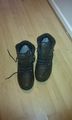
New boots!


Achievements
None, sadly. Far too simple a hash for any of that nonsense.