Difference between revisions of "2012-03-24 41 -83"
imported>Goirijo (→Photos) |
imported>FippeBot m (Location) |
||
| (7 intermediate revisions by 3 users not shown) | |||
| Line 1: | Line 1: | ||
| − | |||
| − | |||
| − | |||
| − | |||
| − | |||
| − | |||
| − | |||
| − | |||
| − | |||
| − | |||
{{meetup graticule | {{meetup graticule | ||
| lat=41 | | lat=41 | ||
| Line 15: | Line 5: | ||
}} | }} | ||
| − | |||
__NOTOC__ | __NOTOC__ | ||
== Location == | == Location == | ||
| Line 33: | Line 22: | ||
Since we were in a new place we decided to take a look around the area. We were mostly interested in a wine store [[User:nblum|nblum]] had spotted so we headed over. We were offered to taste a bunch of the wine they were selling free of cost, so we naturally accepted and tried some interesting things. We ended up buying a bottle each (sangria for me, cherry wine for her) and headed back to Ann Arbor. | Since we were in a new place we decided to take a look around the area. We were mostly interested in a wine store [[User:nblum|nblum]] had spotted so we headed over. We were offered to taste a bunch of the wine they were selling free of cost, so we naturally accepted and tried some interesting things. We ended up buying a bottle each (sangria for me, cherry wine for her) and headed back to Ann Arbor. | ||
| − | |||
| − | |||
| − | |||
== Photos == | == Photos == | ||
| − | |||
| − | |||
| − | |||
| − | |||
| − | <gallery perrow=" | + | <gallery perrow="6"> |
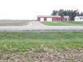
| + | Image:2012_03_24_41_-83_driving.jpg | The beginning of our adventure. | ||
| + | Image:2012_03_24_41_-83_me_hash.jpg | Me at the precise location. I really was having that much fun. | ||
| + | Image:2012_03_24_41_-83_nat_hash.jpg | Natalie blinding us with her beauty (or maybe it's just that sweatshirt). | ||
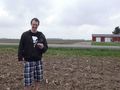
| + | Image:2012_03_24_41_-83_diego_hash.jpg | Diego confirms our location. | ||
| + | Image:2012_03_24_41_-83_hash_view.jpg | View from the location. | ||
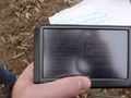
| + | Image:2012_03_24_41_-83_wine_list.jpg | Wine list of all the stuff we tried. | ||
</gallery> | </gallery> | ||
== Achievements == | == Achievements == | ||
{{#vardefine:ribbonwidth|800px}} | {{#vardefine:ribbonwidth|800px}} | ||
| − | |||
| + | {{Land_geohash | ||
| − | + | | latitude = 41 | |
| − | + | | longitude = -83 | |
| − | + | | date = 2012-03-24 | |
| + | | name = goirijo | ||
| − | + | }} | |
| − | |||
| − | |||
| − | |||
| − | |||
[[Category:Expeditions]] | [[Category:Expeditions]] | ||
| − | |||
[[Category:Expeditions with photos]] | [[Category:Expeditions with photos]] | ||
| − | |||
| − | |||
| − | |||
| − | |||
| − | |||
[[Category:Coordinates reached]] | [[Category:Coordinates reached]] | ||
| − | + | {{location|US|MI|MO}} | |
| − | |||
| − | |||
| − | |||
| − | |||
| − | |||
| − | |||
| − | |||
| − | |||
| − | |||
Latest revision as of 04:38, 6 August 2019
| Sat 24 Mar 2012 in 41,-83: 41.9558732, -83.7115310 geohashing.info google osm bing/os kml crox |
Location
The hash on a cornfield, just a few meters off a road (Petersburg Rd). Due to the time of year there was nothing growing on it, so we didn't feel to bad stepping around to be as precise as possible.
Participants
- goirijo
- My girlfriend Natalie, who should make an account for herself
Plans
We had no plans, so instead of the usual "I dunno, what do YOU feel like doing?" we decided to give this geohashing thing a try. She was visiting me in Ann Arbor for the weekend, so we were actually on graticule 42,-83. The hash on that graticule was pretty far north though, so we decided to go to the one underneath. I'd read about the official meeting time of 16:00, and after packing some cards and dice we were on our way.
Expedition
I first learned of geohashing back when the xkcd comic came out, but never really gave it any consideration. My sister however, had recently been bringing it up quite frequently in our conversations, and after hearing of her first adventure I decided it'd be a fun thing to do sometime. On March 24th I had somebody to do it with, time to do it and my ever faithful Diego (GPS) to guide me.
After getting some food, we plugged the coordinates into Diego and he promptly predicted our arrival in 30 minutes. Nothing out of the ordinary happened during the car ride, but nblum and I were both looking forward to our first geohash and excited to be travelling into the wild unknown. The unknown, it seems, is full of farmland. Eventually we arrived at Dundee, and Diego instructed us to turn onto Petersburg Rd. We drove for a while until Diego said "Arriving at coordinates, on left". At the first opportunity we parked the car (behind a green tractor) and backtracked with the GPS in hand. We walked down the road until our latitude was accurate, but the longitude was still a bit off and getting the exact hash would require stepping onto the field. After we convinced ourselves it was OK because there was nothing growing anyway and not it's not really trespassing we hopped on the field. It only took a few steps until we were there. We'd done it! Now what?
Since we were in a new place we decided to take a look around the area. We were mostly interested in a wine store nblum had spotted so we headed over. We were offered to taste a bunch of the wine they were selling free of cost, so we naturally accepted and tried some interesting things. We ended up buying a bottle each (sangria for me, cherry wine for her) and headed back to Ann Arbor.
Photos
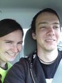
The beginning of our adventure.
Me at the precise location. I really was having that much fun.
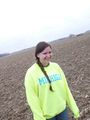
Natalie blinding us with her beauty (or maybe it's just that sweatshirt).
Diego confirms our location.
View from the location.
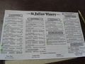
Wine list of all the stuff we tried.


Achievements
goirijo earned the Land geohash achievement
|