Difference between revisions of "2012-03-29 33 -116"
From Geohashing
imported>Jiml m (Adjust result codes) |
imported>FippeBot m (Location) |
||
| Line 58: | Line 58: | ||
[[Category:Expeditions with photos]] | [[Category:Expeditions with photos]] | ||
[[Category:Coordinates reached]] | [[Category:Coordinates reached]] | ||
| + | {{location|US|CA|SD}} | ||
Latest revision as of 03:14, 13 August 2019
| Thu 29 Mar 2012 in 33,-116: 33.0056429, -116.8173162 geohashing.info google osm bing/os kml crox |
Location
In the middle of a median on San Vincente Road, Ramona, CA
Participants
- LucasBrown dragged his
- mother,
- sister, and dog along.
Plans
Expedition
- Hi! -- LucasBrown @33.0056,-116.8173 21:10, 29 March 2012 (EDT)
Tracklog
Photos
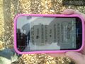
Photo of Geohash Droid showing phone's location to be 11 cm away from the target. @33.0056,-116.8173

Achievements
- Land geohash