Difference between revisions of "2012-04-14 42 -71"
imported>ChrisG (→Participants) |
imported>FippeBot m (Location) |
||
| (5 intermediate revisions by one other user not shown) | |||
| Line 18: | Line 18: | ||
== Location == | == Location == | ||
| − | Leominster, MA, | + | Leominster, MA, behind a house on Central Street |
== Participants == | == Participants == | ||
| − | * [[ChrisG]] and | + | * [[user:ChrisG|ChrisG]] and |
* WifeyGirl | * WifeyGirl | ||
| Line 65: | Line 65: | ||
<!-- Add any achievement ribbons you earned below, or remove this section --> | <!-- Add any achievement ribbons you earned below, or remove this section --> | ||
| − | + | {{land geohash | latitude = 42 | longitude = -71 | date = 2012-04-14 | name = [[user:ChrisG | ChrisG]] }} | |
| + | {{drag-along | ||
| + | | latitude = 42 | ||
| + | | longitude = -71 | ||
| + | | date = 2012-04-14 | ||
| + | | name = [[User:ChrisG | ChrisG]] | ||
| + | | partner = WifeyGirl | ||
| + | }} | ||
[[Category:Expeditions]] | [[Category:Expeditions]] | ||
| Line 72: | Line 79: | ||
[[Category:Expeditions with photos]] | [[Category:Expeditions with photos]] | ||
[[Category:Coordinates reached]] | [[Category:Coordinates reached]] | ||
| + | {{location|US|MA|WO}} | ||
Latest revision as of 03:29, 13 August 2019
| Sat 14 Apr 2012 in 42,-71: 42.5156201, -71.7562399 geohashing.info google osm bing/os kml crox |
Location
Leominster, MA, behind a house on Central Street
Participants
- ChrisG and
- WifeyGirl
Plans
Didn't really have a plan to be here today... I've been stalking easy locations in the Providence graticule, but haven't found one that works on a day when I'm free. Was planning for a non-geohash outing with WifeyGirl, when it turned into a geohash outing.
Expedition
We left the house, with our lawn chairs and a plan to head down to Galilee, RI to find a sunny spot to hang out... Me to go exploring, and WifeyGirl to read on her kindle. Stop #1 was the Newport Creamery restaurant in Cranston, RI. Over lunch, wifey saw me looking at he location of today's Providence hashpoint, and I told her it was too long a walk in the woods without a trail for me to drag her along.
Smartly, she asked if there were other points around, and I realized the Boston hash was easy... Looked to be behind a house in a reasonable area, and about 55 miles from our location. The plan was formed, and I checked google maps for a nearby park, so kindle-reading could commence afterwards. Our waitress was slooooow, and as we were leaving, I thought we'd be about 10 minutes late for the 4pm meetup.
The drive was uneventful; I don't like driving through Worcester, though it really has gotten easier than it used to be. We arrived at 4:06, which was close enough to 4pm. Nobody else present.
The hash was just at the edge of some brush behind a house, next to an Auto Zone store. The house was just kept well enough that it looked occupied, but there were no cars to make me think anyone was home. I was just taking my picture when a disembodied voice from the house asked me what I was doing... I couldn't see the guy very well, but I replied that I was on an Internet scavenger hunt, and just needed to take a picture. That turned out o be a good enough response, and the pic came out with the right location stamp - success!
I forgot to get a picture from a distance - there was a good perspective from the AutoZone parking lot (where WifeyGirl was still located). I may go back for it.
We've made our way to Barrett Park, and are enjoying the sun as I type this... Life is good.
I don't think I can claim the Ambassador achievement, but I'm definitely calling the Dragalong.
Sounds like they got there!
Tracklog
Photos

My first hashpoint @42.5156,-71.7563
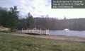
Barrett Park, Leominster, Massachusetts @42.5218,-71.7730


Achievements
ChrisG earned the Land geohash achievement
|
ChrisG earned the Drag-along achievement
|