Difference between revisions of "2012-04-16 39 116"
imported>Crox m (ETA ~ 11:30 at the hash) |
imported>Fippe (Location) |
||
| (3 intermediate revisions by 2 users not shown) | |||
| Line 7: | Line 7: | ||
__NOTOC__ | __NOTOC__ | ||
== Location == | == Location == | ||
| − | Beijing, China | + | 通州区梨园路 (Liyuan Road, [[wikipedia:Tongzhou_District,_Beijing|Tongzhou District]]), Beijing, China |
== Participants == | == Participants == | ||
*[[user:crox|Crox]] | *[[user:crox|Crox]] | ||
| + | *[[user:tingting|Ting Ting]] | ||
== Plans == | == Plans == | ||
| − | + | Crox' [[2010-10-25_39_116|last expedition in China]] was near 苹果园 (Píngguǒyuán, apple garden), near the Western end of [[wikipedia:Line_1,_Beijing_Subway|Line 1 of the Beijing Subway]]. This one is in 梨园 (Líyuán, pear garden), near the Eastern end of the same line (well, more precisely, near the Eastern end of the [[wikipedia:Batong_Line,_Beijing_Subway|Batong line]], which is like an above ground extension of Line 1)... So the plan is to take the subway there and see how it looks like. | |
| − | ( | + | Today's geohashing equipment: GPS with OSM-based map ([[2010-10-25_39_116#Google_maps_problem|Google is not that useful in China]]), camera and [[wikipedia:Yikatong|Yikatong]]. |
| − | + | == Expedition == | |
| − | + | Thanks to the [[wikipedia:Beijing_Subway|Beijing Subway]] network we got as close as a few hundred meters from the hash for a mere CNY 2 per person, which is about 30 cents in CHF or USD (there is flat fee for unlimited travel on the different lines, apart from the airport one - we travelled about 40 km to get there). | |
| − | |||
| − | + | From there we walked to the spot, found it, took a few pictures and went back to theSubway which led us to [[wikipedia:Guomao_Station_(Beijing)|Guomao]] for the next planned activities of the day. | |
| + | == Tracklog == | ||
| + | [http://maps.google.com/maps?q=http://gallery.crox.net/gh-20120416.kmz http://maps.google.com/maps?q=http://gallery.crox.net/gh-20120416.kmz] (only makes sense if you switch to satellite view, see [[2010-10-25_39_116#Google_maps_problem]]) | ||
| + | == Photos == | ||
| + | {{#vardefine:gaLines|3}} | ||
| + | {{#vardefine:gaWidth|250}} | ||
| + | {{#vardefine:gaHeight|230}} | ||
| + | {{Gallery2| | ||
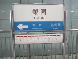
| + | {{GalleryItem | File:2012-04-16_39_116_01-ditie_IMG_1509.jpg | arriving at Liyuan Station }} | ||
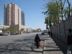
| + | {{GalleryItem | File:2012-04-16_39_116_02-liyuan_beijie_IMG_1511.jpg | 梨园北街 (líyuán běi jiè) }} | ||
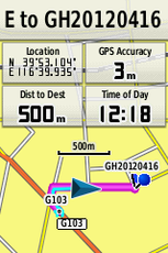
| + | {{GalleryItem | File:2012-04-16_39_116_03-gps_500m_2241.png | 500m left (you can observe that the hash street is missing from the map) }} | ||
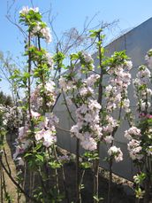
| + | {{GalleryItem | File:2012-04-16_39_116_04-blossoms_IMG_1513.jpg | Crox likes to think that these are pear trees, is however not sure about it }} | ||
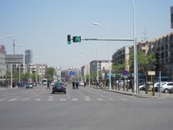
| + | {{GalleryItem | File:2012-04-16_39_116_05-traffic_light_IMG_1514.jpg | the street features the same traffic lights seen elsewhere in China which provide a convenient countdown }} | ||
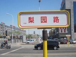
| + | {{GalleryItem | File:2012-04-16_39_116_06-liyuanlu_sign_IMG_1515.jpg | we reached the hash street }} | ||
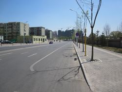
| + | {{GalleryItem | File:2012-04-16_39_116_07-liyuanlu_road_IMG_1519.jpg | 梨园路 (líyuán lù, Liyuan Road) }} | ||
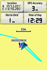
| + | {{GalleryItem | File:2012-04-16_39_116_08-gps_reached_2908.png | coordinates reached! (as you can see in this screenshot, Liyuan North Street is named incorectly after the street it's connected to) }} | ||
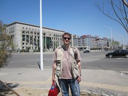
| + | {{GalleryItem | File:2012-04-16_39_116_09-crox_IMG_1518.jpg | Crox at the hash, with Ting Ting taking the picture }} | ||
| + | }} | ||
| − | [[Category: | + | == Achievements == |
| + | |||
| + | {{OpenStreetMap achievement | ||
| + | | latitude = 39 | ||
| + | | longitude = 116 | ||
| + | | date = 2012-04-16 | ||
| + | | OSMlink = 11329676 | ||
| + | | name = [[user:crox|Crox]] and [[user:tingting|Ting Ting]] | ||
| + | | image = 2012-04-16_39_116_06-liyuanlu_sign_IMG_1515.jpg | ||
| + | }} | ||
| + | |||
| + | |||
| + | [[Category:Expeditions]] | ||
| + | [[Category:Expeditions with photos]] | ||
| + | [[Category:Coordinates reached]] | ||
| + | [[Category:China]] | ||
| + | {{location|CN|BJ}} | ||
Latest revision as of 15:00, 1 June 2019
| Mon 16 Apr 2012 in 39,116: 39.8849421, 116.6713965 geohashing.info google osm bing/os kml crox |
Location
通州区梨园路 (Liyuan Road, Tongzhou District), Beijing, China
Participants
Plans
Crox' last expedition in China was near 苹果园 (Píngguǒyuán, apple garden), near the Western end of Line 1 of the Beijing Subway. This one is in 梨园 (Líyuán, pear garden), near the Eastern end of the same line (well, more precisely, near the Eastern end of the Batong line, which is like an above ground extension of Line 1)... So the plan is to take the subway there and see how it looks like.
Today's geohashing equipment: GPS with OSM-based map (Google is not that useful in China), camera and Yikatong.
Expedition
Thanks to the Beijing Subway network we got as close as a few hundred meters from the hash for a mere CNY 2 per person, which is about 30 cents in CHF or USD (there is flat fee for unlimited travel on the different lines, apart from the airport one - we travelled about 40 km to get there).
From there we walked to the spot, found it, took a few pictures and went back to theSubway which led us to Guomao for the next planned activities of the day.
Tracklog
http://maps.google.com/maps?q=http://gallery.crox.net/gh-20120416.kmz (only makes sense if you switch to satellite view, see 2010-10-25_39_116#Google_maps_problem)
Photos
|
Achievements
Crox and Ting Ting earned the OpenStreetMap achievement
|
