Difference between revisions of "2012-04-28 33 -117"
From Geohashing
imported>LucasBrown ([live picture] 99m from the hashpoint. Closer approaches require wading through poison ivy.) |
imported>FippeBot m (Location) |
||
| (2 intermediate revisions by 2 users not shown) | |||
| Line 1: | Line 1: | ||
| − | |||
| − | |||
| − | |||
| − | |||
| − | |||
{{meetup graticule | {{meetup graticule | ||
| lat=33 | | lat=33 | ||
| Line 10: | Line 5: | ||
}} | }} | ||
| − | |||
__NOTOC__ | __NOTOC__ | ||
== Location == | == Location == | ||
| − | + | ''In a wooded area north of Fallbrook, off of Sandia Creek Dr.''? | |
== Participants == | == Participants == | ||
| − | + | * [[User:LucasBrown|LucasBrown]] | |
| − | |||
== Plans == | == Plans == | ||
| − | + | ''Unknown'' | |
== Expedition == | == Expedition == | ||
| − | + | ''From photo, apparently the expedition was aborted just 99m shy of the destination'' | |
| − | |||
| − | |||
| − | |||
== Photos == | == Photos == | ||
| − | |||
| − | |||
| − | |||
<gallery perrow="5"> | <gallery perrow="5"> | ||
| Line 39: | Line 26: | ||
== Achievements == | == Achievements == | ||
{{#vardefine:ribbonwidth|800px}} | {{#vardefine:ribbonwidth|800px}} | ||
| − | |||
| − | |||
| − | |||
| − | |||
| − | |||
| − | |||
| − | |||
| − | |||
| − | |||
| − | |||
| − | |||
[[Category:Expeditions]] | [[Category:Expeditions]] | ||
| − | |||
[[Category:Expeditions with photos]] | [[Category:Expeditions with photos]] | ||
| − | |||
| − | |||
| − | |||
| − | |||
| − | |||
| − | |||
| − | |||
| − | |||
| − | |||
[[Category:Coordinates not reached]] | [[Category:Coordinates not reached]] | ||
| − | + | [[Category:Not reached - Mother Nature]] | |
| − | [[Category:Not reached - Mother Nature]] | + | {{location|US|CA|RI}} |
| − | |||
| − | |||
| − | |||
| − | |||
Latest revision as of 03:40, 13 August 2019
| Sat 28 Apr 2012 in 33,-117: 33.4519755, -117.2477861 geohashing.info google osm bing/os kml crox |
Location
In a wooded area north of Fallbrook, off of Sandia Creek Dr.?
Participants
Plans
Unknown
Expedition
From photo, apparently the expedition was aborted just 99m shy of the destination
Photos
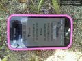
99m from the hashpoint. Closer approaches require wading through poison ivy.
