Difference between revisions of "2012-05-12 47 9"
From Geohashing
imported>Ekorren (Reached. Template only by now, more to be added later) |
imported>Ekorren (Gallery) |
||
| Line 18: | Line 18: | ||
== Gallery == | == Gallery == | ||
<gallery> | <gallery> | ||
| + | File:2012-05-12_47_9_Altshausen_train.JPG|Getting off at Altshausen | ||
| + | File:2012-05-12_47_9_Altshausen_Stellwerk.JPG|Part of the old mechanical signal tower | ||
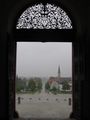
| + | File:2012-05-12_47_9_Altshausen_Schloss_1.JPG|Altshausen castle | ||
| + | File:2012-05-12_47_9_Altshausen_Schloss_2.JPG|Yes, the weather was that bad... | ||
| + | File:2012-05-12_47_9_Bf_Hosskirch.JPG|Abandoned railway station Hoßkirch-Königsegg | ||
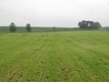
| + | File:2012-05-12_47_9_Hashfield.JPG|The hashfield | ||
| + | File:2012-05-12_47_9_Hashbird.JPG|The hashbird | ||
| + | File:2012-05-12_47_9_GPS.JPG|Coordinates reached | ||
| + | File:2012-05-12_47_9_VFH_village.JPG|View from hash | ||
| + | File:2012-05-12_47_9_VFH_fields.JPG|View from hash | ||
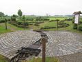
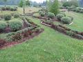
| + | File:2012-05-12_47_9_Grenzsteinmuseum_1.JPG|Model landscape | ||
| + | File:2012-05-12_47_9_Grenzsteinmuseum_2.JPG| | ||
| + | File:2012-05-12_47_9_Grenzsteinmuseum_hash.JPG|Model hash | ||
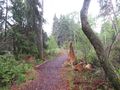
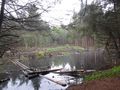
| + | File:2012-05-12_47_9_Ried_1.JPG|Impressions from the ''Pfrunger-Burgweiler Ried'' | ||
| + | File:2012-05-12_47_9_Ried_2.JPG| | ||
| + | File:2012-05-12_47_9_Ried_3.JPG| | ||
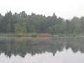
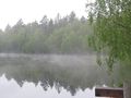
| + | File:2012-05-12_47_9_Riedsee_1.JPG| | ||
| + | File:2012-05-12_47_9_Riedsee_2.JPG| | ||
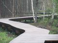
| + | File:2012-05-12_47_9_Riedweg.JPG| | ||
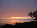
| + | File:2012-05-12_47_9_FDH_Boat.JPG|Friedrichshafen | ||
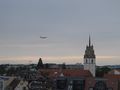
| + | File:2012-05-12_47_9_FDH_plane.JPG| | ||
| + | File:2012-05-12_47_9_FDH_Panorama.JPG| | ||
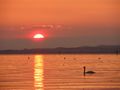
| + | File:2012-05-12_47_9_Sunset_1.JPG|Sunset at the Bodensee shore | ||
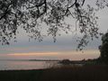
| + | File:2012-05-12_47_9_Sunset_2.JPG| | ||
| + | File:2012-05-12_47_9_Swan.JPG| | ||
| + | File:2012-05-12_47_9_Sunset_with_Swan.JPG| | ||
| + | File:2012-05-12_47_9_Sunset_Panorama.JPG| | ||
</gallery> | </gallery> | ||
Revision as of 08:11, 16 May 2012
| Sat 12 May 2012 in 47,9: 47.9260412, 9.3618228 geohashing.info google osm bing/os kml crox |
Contents
Location
Ostrach, a field
Participants
Ekorren was there. It was wet.
Expedition
Gallery
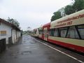
Getting off at Altshausen
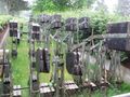
Part of the old mechanical signal tower

Altshausen castle
Yes, the weather was that bad...
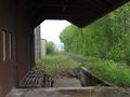
Abandoned railway station Hoßkirch-Königsegg
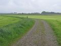
The hashfield
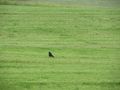
The hashbird
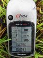
Coordinates reached
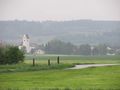
View from hash
View from hash
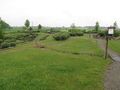
Model landscape
Model hash
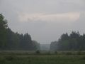
Impressions from the Pfrunger-Burgweiler Ried
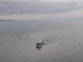
Friedrichshafen
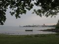
Sunset at the Bodensee shore