Difference between revisions of "2012-06-01 48 9"
From Geohashing
imported>Ekorren (Announcing plans) |
imported>FippeBot m (Location) |
||
| (2 intermediate revisions by one other user not shown) | |||
| Line 11: | Line 11: | ||
== Participants == | == Participants == | ||
| − | [[User:Ekorren|Ekorren]] | + | [[User:Ekorren|Ekorren]] was there by bike in the evening. |
== Expedition == | == Expedition == | ||
| − | + | Since this report got written not before 2014, I actually don't remember anything worth telling. There's a good chance that there hasn't happened anything as well. | |
== Gallery == | == Gallery == | ||
<gallery> | <gallery> | ||
| + | File:2012-06-01_48_9_01_bottles1.JPG|Seems the road was thirsty and claimed lots of bottled water... | ||
| + | File:2012-06-01_48_9_01_bottles2.JPG| | ||
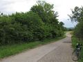
| + | File:2012-06-01_48_9_03.JPG|Along the way | ||
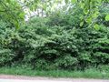
| + | File:2012-06-01_48_9_04_hashbushes.JPG|Behind these bushes the hash must be | ||
| + | File:2012-06-01_48_9_05_hashbushes.JPG| | ||
| + | File:2012-06-01_48_9_07_gps.JPG|Boordinates reached | ||
| + | File:2012-06-01_48_9_06_vfh_b27_2.JPG|View from hash. Not very idyllic | ||
| + | File:2012-06-01_48_9_09.JPG|Nicer views near hash | ||
| + | File:2012-06-01_48_9_10.JPG| | ||
</gallery> | </gallery> | ||
| − | |||
| − | |||
| − | |||
[[Category:Expeditions]] | [[Category:Expeditions]] | ||
[[Category:Expeditions with photos]] | [[Category:Expeditions with photos]] | ||
[[Category:Coordinates reached]] | [[Category:Coordinates reached]] | ||
| − | + | {{location|DE|BW|TÜ}} | |
Latest revision as of 04:20, 13 August 2019
| Fri 1 Jun 2012 in 48,9: 48.5011179, 9.1230844 geohashing.info google osm bing/os kml crox |
Contents
Location
Kusterdingen-Jettenburg, besides the B28 motorway
Participants
Ekorren was there by bike in the evening.
Expedition
Since this report got written not before 2014, I actually don't remember anything worth telling. There's a good chance that there hasn't happened anything as well.
Gallery
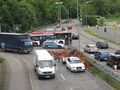
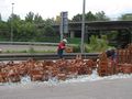
Seems the road was thirsty and claimed lots of bottled water...
Along the way
Behind these bushes the hash must be
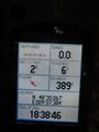
Boordinates reached
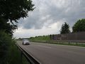
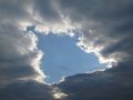
View from hash. Not very idyllic
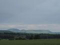
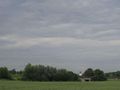
Nicer views near hash