Difference between revisions of "2012-06-04 53 4"
imported>Murfie (→Expedition) |
m (per Renaming Proposal) |
||
| (7 intermediate revisions by 4 users not shown) | |||
| Line 1: | Line 1: | ||
| − | |||
| − | |||
| − | |||
| − | |||
| − | |||
| − | |||
| − | |||
| − | |||
| − | |||
{{meetup graticule | {{meetup graticule | ||
| lat=53 | | lat=53 | ||
| Line 14: | Line 5: | ||
}} | }} | ||
| − | + | ||
__NOTOC__ | __NOTOC__ | ||
== Location == | == Location == | ||
| − | + | ||
Grass field in Den Burg, Texel | Grass field in Den Burg, Texel | ||
== Participants == | == Participants == | ||
| − | + | ||
| − | + | * [[User:Murfie|Murfie]] | |
| − | [[User:Murfie|Murfie]] | ||
== Plans == | == Plans == | ||
| − | + | ||
Doing a midnight expedition at the 2012-06-03/2012-06-04 day change. | Doing a midnight expedition at the 2012-06-03/2012-06-04 day change. | ||
== Expedition == | == Expedition == | ||
<!-- how it all turned out. your narrative goes here. --> | <!-- how it all turned out. your narrative goes here. --> | ||
| − | + | When I was examining the geohash coordinates for this weekend, a pleasant surprise | |
| + | popped up. It seemed that the geohash for Monday at 53,4 was located at a very good to reach | ||
| + | spot on land ground. I would estimate this a less than 1% chance, since for the rest this | ||
| + | graticule consists of about 95% water/sea and 4% sheep. | ||
| + | |||
| + | So after my successful geohash in Alphen aan den Rijn, I decided to go for a (short) weekend trip | ||
| + | to Texel. My plan was to arrive in the evening, find some place to sleep, hunt for the hash | ||
| + | in the midnight from Sunday on Monday and return for work early in the morning on Monday. | ||
| + | |||
| + | On Sunday afternoon I drove to Den Helder. There I took a ferry to Texel. (35 euro, ugh). | ||
| + | Normally this ferry goes once per hour (at xx:30). However during summer season, they can decide | ||
| + | to double the schedule to twice an hour. Luckily they did that this day. As I arrived at the ferry | ||
| + | around 16:55, I had to wait only a few minutes to enjoy the 20 minutes trip. | ||
| + | |||
| + | Travelling with me on the ferry were about 100 other people and the same amount of seagulls. | ||
| + | |||
| + | When I arrived in Den Burg, I found a nice apartment called 'Bos en duin' ('forest and dune'). | ||
| + | The complex was about a 10 minutes walk from the spot I had to reach at midnight. | ||
| + | |||
| + | To kill the time until midnight, I went out sightseeing and took quite some time to take typical pictures of the | ||
| + | island (sheep, grass, sheep, sheep). Also I investigated the spot where the geohash for Monday was | ||
| + | located and it was opposite of a small farm (without sheep, how is that possible?). | ||
| + | Only one wire had to be stepped over to get to the holy ground of the geohash (this wire was there to stop | ||
| + | 3 cows from reaching the nearby road). Since it was still Sunday, I didn't do this yet, | ||
| + | because it might have looked silly (or suspicious?) if somebody passing by saw me | ||
| + | entering this field. | ||
| + | |||
| + | Then I got some chinese take-away at a restaurant called 'Azie' ('Asia'). Watched | ||
| + | some tv in the apartment. Took a bath. And pulled out my laptop to use the free Wi-Fi. | ||
| − | + | At 23:45 I walked through the dark to the grass field. At 23:58 I arrived at the field. | |
| − | + | The cows were still awake. They greeted me. I climbed over the wire and got to the geohash. | |
| − | + | Since the only light source I had was my mobile phone, I couldn't see where I was | |
| + | walking and hit some old cow shit. At exactly 0:00 I took a picture of me standing | ||
| + | at the geohash. Luckily, the flashlight didn't scare the cows. | ||
| + | A few moments after that, I noticed somebody else also took a picture because I saw | ||
| + | another flashlight in the distance. But when I looked in that direction I saw it.. | ||
| + | Duh, it was a large light tower which was about 1km away in the dunes. | ||
| − | + | Then with a satisfied grin, I walked back to the apartment, setting the alarm | |
| − | + | clock to catch one of the first ferries back to Den Helder in the morning. | |
== Photos == | == Photos == | ||
| Line 45: | Line 68: | ||
--> | --> | ||
<gallery perrow="5"> | <gallery perrow="5"> | ||
| + | Image:2012-06-04 53 4 texel1.jpg | Driving up the ferry | ||
| + | Image:2012-06-04 53 4 texel2.jpg | Entrance ticket to the ferry | ||
| + | Image:2012-06-04 53 4 texel3.jpg | I dived into the sea and swam around to make this picture | ||
| + | Image:2012-06-04 53 4 texel4.jpg | View from the back of the ferry | ||
| + | Image:2012-06-04 53 4 texel5.jpg | View from the apartment | ||
| + | Image:2012-06-04 53 4 texel9.jpg | Literally everywhere you look, you see sheep (figuratively) | ||
| + | Image:2012-06-04 53 4 texel10.jpg | Wabbit season? | ||
| + | Image:2012-06-04 53 4 texel12.jpg | Street sign of the street where the hash was located | ||
| + | Image:2012-06-04 53 4 texel15.jpg | Fonteinsnol could be translated as 'Fountain slut' | ||
| + | Image:2012-06-04 53 4 texel16.jpg | My feet, standing at the geohash | ||
| + | Image:2012-06-04 53 4 texel17.jpg | Alien cow saying moo | ||
| + | |||
</gallery> | </gallery> | ||
== Achievements == | == Achievements == | ||
{{#vardefine:ribbonwidth|800px}} | {{#vardefine:ribbonwidth|800px}} | ||
| − | |||
| + | {{Graticule unlocked | latitude = 53 | longitude = 4 | date = 2012-06-04 | name = Murfie | image = }} | ||
| + | {{Midnight geohash | latitude = 53 | longitude = 4 | date = 2012-06-04 | name = Murfie | image = 2012-06-04 53 4 texel17.jpg }} | ||
| + | {{consecutive geohash | count = 2 | latitude = 52 | longitude = 4 | date = 2012-06-03 | name = Murfie }} | ||
| − | |||
| − | |||
| − | |||
| − | |||
| − | |||
| − | |||
| − | |||
| − | |||
| − | |||
[[Category:Expeditions]] | [[Category:Expeditions]] | ||
| − | |||
[[Category:Expeditions with photos]] | [[Category:Expeditions with photos]] | ||
| − | |||
| − | |||
| − | |||
| − | |||
| − | |||
[[Category:Coordinates reached]] | [[Category:Coordinates reached]] | ||
| − | + | {{location|NL|NH}} | |
| − | |||
| − | |||
| − | |||
| − | |||
| − | |||
| − | |||
| − | |||
| − | |||
| − | |||
Latest revision as of 05:36, 20 March 2024
| Mon 4 Jun 2012 in 53,4: 53.0458348, 4.7443343 geohashing.info google osm bing/os kml crox |
Location
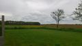
Grass field in Den Burg, Texel
Participants
Plans
Doing a midnight expedition at the 2012-06-03/2012-06-04 day change.
Expedition
When I was examining the geohash coordinates for this weekend, a pleasant surprise popped up. It seemed that the geohash for Monday at 53,4 was located at a very good to reach spot on land ground. I would estimate this a less than 1% chance, since for the rest this graticule consists of about 95% water/sea and 4% sheep.
So after my successful geohash in Alphen aan den Rijn, I decided to go for a (short) weekend trip to Texel. My plan was to arrive in the evening, find some place to sleep, hunt for the hash in the midnight from Sunday on Monday and return for work early in the morning on Monday.
On Sunday afternoon I drove to Den Helder. There I took a ferry to Texel. (35 euro, ugh). Normally this ferry goes once per hour (at xx:30). However during summer season, they can decide to double the schedule to twice an hour. Luckily they did that this day. As I arrived at the ferry around 16:55, I had to wait only a few minutes to enjoy the 20 minutes trip.
Travelling with me on the ferry were about 100 other people and the same amount of seagulls.
When I arrived in Den Burg, I found a nice apartment called 'Bos en duin' ('forest and dune'). The complex was about a 10 minutes walk from the spot I had to reach at midnight.
To kill the time until midnight, I went out sightseeing and took quite some time to take typical pictures of the island (sheep, grass, sheep, sheep). Also I investigated the spot where the geohash for Monday was located and it was opposite of a small farm (without sheep, how is that possible?). Only one wire had to be stepped over to get to the holy ground of the geohash (this wire was there to stop 3 cows from reaching the nearby road). Since it was still Sunday, I didn't do this yet, because it might have looked silly (or suspicious?) if somebody passing by saw me entering this field.
Then I got some chinese take-away at a restaurant called 'Azie' ('Asia'). Watched some tv in the apartment. Took a bath. And pulled out my laptop to use the free Wi-Fi.
At 23:45 I walked through the dark to the grass field. At 23:58 I arrived at the field. The cows were still awake. They greeted me. I climbed over the wire and got to the geohash. Since the only light source I had was my mobile phone, I couldn't see where I was walking and hit some old cow shit. At exactly 0:00 I took a picture of me standing at the geohash. Luckily, the flashlight didn't scare the cows. A few moments after that, I noticed somebody else also took a picture because I saw another flashlight in the distance. But when I looked in that direction I saw it.. Duh, it was a large light tower which was about 1km away in the dunes.
Then with a satisfied grin, I walked back to the apartment, setting the alarm clock to catch one of the first ferries back to Den Helder in the morning.
Photos
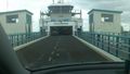
Driving up the ferry
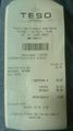
Entrance ticket to the ferry
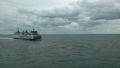
I dived into the sea and swam around to make this picture
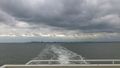
View from the back of the ferry
View from the apartment
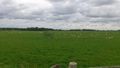
Literally everywhere you look, you see sheep (figuratively)
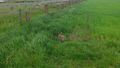
Wabbit season?
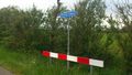
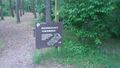
Street sign of the street where the hash was located
Fonteinsnol could be translated as 'Fountain slut'
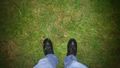
My feet, standing at the geohash
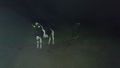
Alien cow saying moo


Achievements
Murfie earned the Graticule Unlocked Achievement
|
Murfie earned the Midnight Geohash achievement
|
Murfie earned the Consecutive geohash achievement
|