Difference between revisions of "2012-06-19 49 8"
imported>Danatar (Created page with "nothing to see here yet, move along... <!-- While I was staying at my parents' place, the hashpoint decided to fall into a hamlet belonging to the next town. So I took my brothe...") |
imported>Danatar (story) |
||
| Line 1: | Line 1: | ||
| − | + | {{meetup graticule | |
| − | + | | lat=49 | |
| + | | lon=8 | ||
| + | | date=2012-06-19 | ||
| + | | graticule_name=Mannheim | ||
| + | | graticule_link=Mannheim, Germany | ||
| + | }}__NOTOC__ | ||
| + | == Location == | ||
| + | |||
| + | Today's location is in a meadow at Muckensturm, a hamlet belonging to the municipality of Heddesheim. | ||
| + | |||
| + | Country: Germany; state: Baden-Württemberg (EU:DE:BW); administrative region: Karlsruhe; district: Rhein-Neckar-Kreis | ||
| + | |||
| + | Weather: clouded, a few tiny drops of rain | ||
| + | |||
| + | |||
| + | == Expedition== | ||
| + | ===[[User:Danatar|Danatar]]=== | ||
While I was staying at my parents' place, the hashpoint decided to fall into a hamlet belonging to the next town. So I took my brother's bike and set out. A few drops of rain were falling, but they didn't bother me. I cycled over the fields to Heddesheim. When I took a look at my GPS unit at the other side of that town, I saw "battery empty, powering down in 3... 2... 1...". With the GPS unit my plans for a tron geohash died, too, since I had no good possibility to prove it now. I continued to Muckensturm and found the hashpoint from the satellite image. It was in a large meadow, so even if I was a few metres off it wouldn't make any difference. | While I was staying at my parents' place, the hashpoint decided to fall into a hamlet belonging to the next town. So I took my brother's bike and set out. A few drops of rain were falling, but they didn't bother me. I cycled over the fields to Heddesheim. When I took a look at my GPS unit at the other side of that town, I saw "battery empty, powering down in 3... 2... 1...". With the GPS unit my plans for a tron geohash died, too, since I had no good possibility to prove it now. I continued to Muckensturm and found the hashpoint from the satellite image. It was in a large meadow, so even if I was a few metres off it wouldn't make any difference. | ||
| − | Since there was no point in continueing on my planned tron route any more, I just took the same route on my way back. | + | Since there was no point in continueing on my planned tron route any more, I just took the same route on my way back. In total I cycled 14.8 km. |
| − | |||
| + | <gallery> | ||
File:2012-06-19_49_8_muckensturm.jpg|Muckensturm hamlet | File:2012-06-19_49_8_muckensturm.jpg|Muckensturm hamlet | ||
File:2012-06-19_49_8_near.jpg|almost there | File:2012-06-19_49_8_near.jpg|almost there | ||
| Line 12: | Line 28: | ||
File:2012-06-19_49_8_hp.jpg|ambivalent grin | File:2012-06-19_49_8_hp.jpg|ambivalent grin | ||
File:2012-06-19_49_8_pano.jpg|panorama | File:2012-06-19_49_8_pano.jpg|panorama | ||
| + | File:2012-06-19_49_8_storch.jpg|stork | ||
| + | </gallery> | ||
| − | + | [[Category:Expeditions]] | |
| + | [[Category:Expeditions with photos]] | ||
| + | [[Category:Coordinates reached]] | ||
[[Category:Danatar]] | [[Category:Danatar]] | ||
| − | |||
Revision as of 14:18, 21 June 2012
| Tue 19 Jun 2012 in Mannheim: 49.5300098, 8.6209986 geohashing.info google osm bing/os kml crox |
Location
Today's location is in a meadow at Muckensturm, a hamlet belonging to the municipality of Heddesheim.
Country: Germany; state: Baden-Württemberg (EU:DE:BW); administrative region: Karlsruhe; district: Rhein-Neckar-Kreis
Weather: clouded, a few tiny drops of rain
Expedition
Danatar
While I was staying at my parents' place, the hashpoint decided to fall into a hamlet belonging to the next town. So I took my brother's bike and set out. A few drops of rain were falling, but they didn't bother me. I cycled over the fields to Heddesheim. When I took a look at my GPS unit at the other side of that town, I saw "battery empty, powering down in 3... 2... 1...". With the GPS unit my plans for a tron geohash died, too, since I had no good possibility to prove it now. I continued to Muckensturm and found the hashpoint from the satellite image. It was in a large meadow, so even if I was a few metres off it wouldn't make any difference.
Since there was no point in continueing on my planned tron route any more, I just took the same route on my way back. In total I cycled 14.8 km.
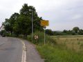
Muckensturm hamlet
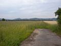
almost there
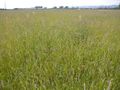
the hashpoint

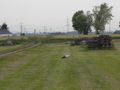
ambivalent grin

panorama
stork


