Difference between revisions of "2012-07-21 50 20"
From Geohashing
imported>Mkoniecz (Created page with "{{subst:Expedition |lat = 50 |lon = 20 |date = 2012-07-21 }}") |
m (per Renaming Proposal) |
||
| (12 intermediate revisions by 3 users not shown) | |||
| Line 1: | Line 1: | ||
| − | |||
| − | |||
| − | |||
| − | |||
| − | |||
| − | |||
| − | |||
| − | |||
| − | |||
| − | |||
{{meetup graticule | {{meetup graticule | ||
| lat=50 | | lat=50 | ||
| Line 15: | Line 5: | ||
}} | }} | ||
| − | |||
__NOTOC__ | __NOTOC__ | ||
== Location == | == Location == | ||
| − | + | In the Niepołomice Forest. | |
== Participants == | == Participants == | ||
| − | + | *[[User:mkoniecz]] | |
| − | |||
| − | |||
| − | |||
| − | |||
== Expedition == | == Expedition == | ||
| − | |||
| − | |||
| − | |||
| − | |||
| − | |||
| − | |||
| − | |||
| − | |||
| − | |||
<gallery perrow="5"> | <gallery perrow="5"> | ||
| + | File:Nowa Huta.JPG|On the route, between Kraków and Niepołomice - view toward Nowa Huta (N) | ||
| + | File:Random house.jpg|And random house (S) | ||
| + | File:Grabie - Kościół.jpg|Church in Grabie | ||
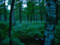
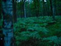
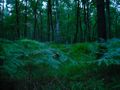
| + | File:Road in Niepołomice Forest.jpg|In Niepołomice Forest | ||
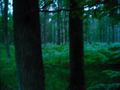
| + | File:Sunset in Niepołomice Forest.jpg|Sunset in Niepołomice Forest | ||
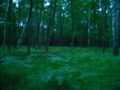
| + | File:Hashpoint -1.jpg|Hashpoint was here | ||
| + | File:Hashpoint -2.jpg|...or maybe here | ||
| + | File:Hashpoint -3.jpg|...or here... | ||
| + | File:Hashpoint -4.jpg|...or here... | ||
| + | File:Hashpoint -5.jpg|...or here. | ||
| + | File:Hashpoint -6.jpg|...or here. | ||
| + | File:Wawel.jpg|Return trip, near midnight - Wawel Castle in Kraków | ||
</gallery> | </gallery> | ||
== Achievements == | == Achievements == | ||
{{#vardefine:ribbonwidth|800px}} | {{#vardefine:ribbonwidth|800px}} | ||
| − | + | {{Bicycle geohash | |
| − | + | | latitude = 50 | |
| − | + | | longitude = 20 | |
| − | + | | date = 2012-07-21 | |
| − | + | | name = [[User:mkoniecz|mkoniecz]] | |
| − | [[ | + | | distance = 80 km |
| + | }} | ||
| + | {{Graticule unlocked | ||
| + | | latitude = 50 | ||
| + | | longitude = 20 | ||
| + | | date = 2012-07-21 | ||
| + | | name = [[User:mkoniecz|mkoniecz]] | ||
| + | }} | ||
| + | {{No_batteries_geohash | ||
| + | | latitude = 50 | ||
| + | | longitude = 20 | ||
| + | | date = 2012-07-21 | ||
| + | | name = [[User:mkoniecz|mkoniecz]] | ||
| + | }} | ||
| − | |||
| − | |||
| − | |||
| − | |||
| − | |||
[[Category:Expeditions]] | [[Category:Expeditions]] | ||
| − | |||
[[Category:Expeditions with photos]] | [[Category:Expeditions with photos]] | ||
| − | |||
[[Category:Expedition without GPS]] | [[Category:Expedition without GPS]] | ||
| − | |||
| − | |||
| − | |||
[[Category:Coordinates reached]] | [[Category:Coordinates reached]] | ||
| − | + | {{location|PL|K|BC}} | |
| − | |||
| − | |||
| − | |||
| − | |||
| − | |||
| − | |||
| − | |||
| − | |||
| − | |||
| − | |||
| − | |||
| − | |||
| − | |||
| − | |||
| − | |||
| − | |||
| − | |||
Latest revision as of 05:35, 20 March 2024
| Sat 21 Jul 2012 in 50,20: 50.0420860, 20.4041931 geohashing.info google osm bing/os kml crox |
Location
In the Niepołomice Forest.
Participants
Expedition
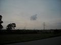
On the route, between Kraków and Niepołomice - view toward Nowa Huta (N)
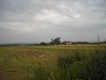
And random house (S)
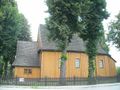
Church in Grabie
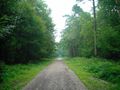
In Niepołomice Forest
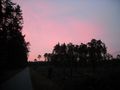
Sunset in Niepołomice Forest
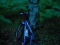
Hashpoint was here
...or maybe here
...or here...
...or here...
...or here.
...or here.
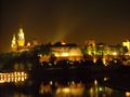
Return trip, near midnight - Wawel Castle in Kraków


Achievements
mkoniecz earned the Bicycle geohash achievement
|
mkoniecz earned the Graticule Unlocked Achievement
|
mkoniecz earned the No Batteries Geohash Achievement
|